Newton Township, Muskingum County, Ohio
Newton Township is one of the twenty-five townships of Muskingum County, Ohio, United States. The 2000 census found 5,402 people in the township, 5,186 of whom lived in the unincorporated portions of the township.[3]
Newton Township, Muskingum County, Ohio | |
|---|---|
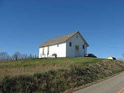 Former church, now a house, in northern Newton Township | |
 Location of Newton Township in Muskingum County | |
| Coordinates: 39°51′39″N 82°5′8″W | |
| Country | United States |
| State | Ohio |
| County | Muskingum |
| Area | |
| • Total | 46.7 sq mi (120.9 km2) |
| • Land | 46.3 sq mi (119.9 km2) |
| • Water | 0.4 sq mi (1.1 km2) |
| Elevation | 738 ft (225 m) |
| Population (2000) | |
| • Total | 5,402 |
| • Density | 116.7/sq mi (45.1/km2) |
| Time zone | UTC-5 (Eastern (EST)) |
| • Summer (DST) | UTC-4 (EDT) |
| FIPS code | 39-55608[2] |
| GNIS feature ID | 1086729[1] |
Geography
Located on the western edge of the county, it borders the following townships:
- Springfield Township - north
- Brush Creek Township - east
- Clay Township - southeast
- Harrison Township, Perry County - south
- Clayton Township, Perry County - southwest
- Madison Township, Perry County - west
- Hopewell Township - northwest
The village of Fultonham is located in western Newton Township, and the unincorporated communities of East Fultonham and White Cottage are both located near the center of the township. East Fultonham lies farther southwest than White Cottage.
Name and history
It is one of five Newton Townships statewide.[4]
In 1833, Newton Township contained three churches, two or three salt works, seven saw mills, six flouring mills, and one physician.[5]
Government
The township is governed by a three-member board of trustees, who are elected in November of odd-numbered years to a four-year term beginning on the following January 1. Two are elected in the year after the presidential election and one is elected in the year before it. There is also an elected township fiscal officer,[6] who serves a four-year term beginning on April 1 of the year after the election, which is held in November of the year before the presidential election. Vacancies in the fiscal officership or on the board of trustees are filled by the remaining trustees.
References
- "US Board on Geographic Names". United States Geological Survey. 2007-10-25. Retrieved 2008-01-31.
- "U.S. Census website". United States Census Bureau. Retrieved 2008-01-31.
- Muskingum County, Ohio — Population by Places Estimates Ohio State University, 2007. Accessed 15 May 2007.
- "Detailed map of Ohio" (PDF). United States Census Bureau. 2000. Retrieved 2007-02-16.
- Kilbourn, John (1833). The Ohio Gazetteer, or, a Topographical Dictionary. Scott and Wright. pp. 345. Retrieved 12 December 2013.
- §503.24, §505.01, and §507.01 of the Ohio Revised Code. Accessed 4/30/2009.
External links
Municipalities and communities of Muskingum County, Ohio, United States | ||
|---|---|---|
| City |  Map of Ohio highlighting Muskingum County | |
| Villages | ||
| Townships | ||
| CDPs | ||
| Unincorporated communities |
| |
| Former communities |
| |
| Footnotes | ‡This populated place also has portions in an adjacent county or counties | |