New Mexico State Road 8
State Road 8 (NM 8) is a primarily north–south state highway in the state of New Mexico. NM 8's southern terminus is at NM 176 west of Eunice, and the northern terminus is at U.S. Route 62 (US 62)/US 180 west of Hobbs.
| ||||
|---|---|---|---|---|
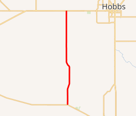
NM 8 highlighted in red | ||||
| Route information | ||||
| Maintained by NMDOT | ||||
| Length | 15.650 mi[1] (25.186 km) | |||
| Major junctions | ||||
| South end | ||||
| North end | ||||
| Location | ||||
| Counties | Lea | |||
| Highway system | ||||
| ||||

Route description
State Road 8 begins at its junction with NM 176 west of Eunice. From there, the highway runs north traveling through largely rural land until reaching its northern terminus with US Routes 62 and 180 west of Hobbs.[2]
History
NM 8 previously extended further south along NM 176, past the Eunice Airport and into Eunice. The route was truncated to its current southern terminus by the state transportation commission on May 25, 2006.[1]
Major intersections
The entire route is in Lea County.
| Location | mi[3] | km | Destinations | Notes | |
|---|---|---|---|---|---|
| | 0.000 | 0.000 | Southern terminus | ||
| Oil Center | 2.500 | 4.023 | Eastern terminus of NM 175 | ||
| Monument | 10.700 | 17.220 | Eastern terminus of NM 322 | ||
| | 15.650 | 25.186 | Northern terminus | ||
| 1.000 mi = 1.609 km; 1.000 km = 0.621 mi | |||||
See also

References
- "Posted Routes Legal Descriptions" (PDF). New Mexico Department of Transportation. Retrieved March 16, 2013.
- Google (March 16, 2013). "Overview of NM 8" (Map). Google Maps. Google. Retrieved March 16, 2013.
- "TIMS Road Segments by Posted Route/Point with AADT Info; NM, NMX-Routes" (PDF). New Mexico Department of Transportation. April 3, 2013. p. 4. Retrieved December 11, 2013.
External links
![]()
This article is issued from Wikipedia. The text is licensed under Creative Commons - Attribution - Sharealike. Additional terms may apply for the media files.