Nea Erythraia
Nea Erythraia (Greek: Νέα Ερυθραία) is a suburb in the northeastern part of the Athens agglomeration, Greece. Since the 2011 local government reform it is part of the municipality Kifisia, of which it is a municipal unit.[2]
Nea Erythraia Νέα Ερυθραία | |
|---|---|
 Nea Erythraia Location within Athens 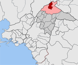 | |
| Coordinates: 38°5′N 23°49′E | |
| Country | Greece |
| Administrative region | Attica |
| Regional unit | North Athens |
| Municipality | Kifisia |
| • Municipal unit | 4.831 km2 (1.865 sq mi) |
| Elevation | 310 m (1,020 ft) |
| Population (2011)[1] | |
| • Municipal unit | 17,379 |
| • Municipal unit density | 3,600/km2 (9,300/sq mi) |
| Time zone | UTC+2 (EET) |
| • Summer (DST) | UTC+3 (EEST) |
| Postal code | 146 xx |
| Area code(s) | 210 |
| Vehicle registration | Z |
| Website | www.dne.gov.gr |
Geography
Nea Erythraia is situated at the western end of the forested Penteli mountain range. The municipal unit has an area of 4.831 km2.[3] The small river Kifisos forms the northwestern border of the municipal unit. Nea Erythraia is situated 14 km northeast of Athens city centre. The built-up area of Nea Erythraia is continuous with that of the neighbouring suburb Kifisia. Motorway 1, Greek National Road 1 and Greek National Road 83 pass through the town.
For many years, Nea Erythraia was home to the senior division of Campion, one of Greece's oldest English-language schools.
On September 14, 2004, the paralympic flame arrived in Nea Erythraia as it travelled from Marathon.
Historical population
| Year | Population |
|---|---|
| 1981 | 10,100 |
| 1991 | 12,993 |
| 2001 | 15,439 |
| 2011 | 17,379 |
References
- "Απογραφή Πληθυσμού - Κατοικιών 2011. ΜΟΝΙΜΟΣ Πληθυσμός" (in Greek). Hellenic Statistical Authority.
- Kallikratis law Greece Ministry of Interior (in Greek)
- "Population & housing census 2001 (incl. area and average elevation)" (PDF) (in Greek). National Statistical Service of Greece.