National Register of Historic Places listings in Sierra County, California
This is a list of the National Register of Historic Places listings in Sierra County, California.
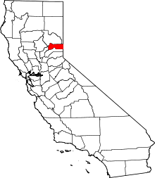
Location of Sierra County in California
This is intended to be a complete list of the properties and districts on the National Register of Historic Places in Sierra County, California, United States. Latitude and longitude coordinates are provided for many National Register properties and districts; these locations may be seen together in an online map.[1]
There are 14 properties and districts listed on the National Register in the county.
- This National Park Service list is complete through NPS recent listings posted June 19, 2020.[2]
Current listings
| [3] | Name on the Register[4] | Image | Date listed[5] | Location | City or town | Description |
|---|---|---|---|---|---|---|
| 1 | 1872 California-Nevada State Boundary Marker | 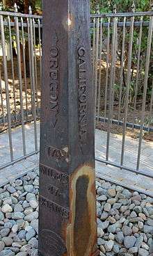 1872 California-Nevada State Boundary Marker |
August 27, 1981 (#81000387) |
Northwest of Verdi on the California/Nevada border 39°31′28″N 120°00′07″W |
near Verdi, Nevada | |
| 2 | Durgan Bridge | 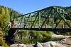 Durgan Bridge |
July 10, 2012 (#12000398) |
Nevada St. 39°33′35″N 120°49′46″W |
Downieville | |
| 3 | Foote's Crossing Road | January 29, 1981 (#81000180) |
Tahoe National Forest 39°25′42″N 120°54′58″W |
Nevada City | ||
| 4 | Forest City | 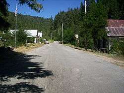 Forest City |
September 3, 1996 (#96000942) |
Off of Mountain House Rd., at the junction of North and South Forks, Tahoe National Forest 39°29′25″N 120°51′05″W |
Forest City | |
| 5 | Hansen Bridge | .jpg) Hansen Bridge |
July 10, 2012 (#12000399) |
E. River St. between Upper Main and Pearl Sts. 39°33′47″N 120°49′31″W |
Downieville | |
| 6 | Hawley Lake Petroglyphs | May 6, 1971 (#71000200) |
Address Restricted |
Gold Lake | ||
| 7 | Hospital Bridge | 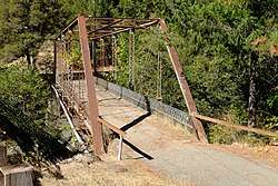 Hospital Bridge |
July 10, 2012 (#12000400) |
Upper Main St. over the Downie River 39°34′11″N 120°49′21″W |
Downieville | |
| 8 | Jersey Bridge | 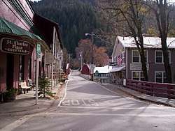 Jersey Bridge |
July 10, 2012 (#12000401) |
CA 49 from Main to Commercial Sts. 39°33′36″N 120°49′40″W |
Downieville | |
| 9 | Kyburz Flat Site |  Kyburz Flat Site |
November 12, 1971 (#71000201) |
Address Restricted |
Loyalton | |
| 10 | Sardine Valley Archeological District | May 6, 1971 (#71000202) |
Address Restricted |
Truckee | ||
| 11 | Sierra County Sheriff's Gallows | 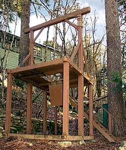 Sierra County Sheriff's Gallows |
February 15, 1990 (#90000118) |
Galloway Rd. and Courthouse Sq. 39°33′30″N 120°49′46″W |
Downieville | |
| 12 | Sierraville School | 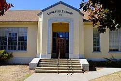 Sierraville School |
September 28, 2017 (#100001666) |
305 S. Lincoln St. 39°35′04″N 120°22′07″W |
Sierraville | |
| 13 | Stampede Site | October 14, 1971 (#71000203) |
Address Restricted |
near Verdi, Nevada | ||
| 14 | Webber Lake Hotel | December 31, 2018 (#100003281) |
Off Jackson Meadow Rd./Tahoe National Forest Rd, 7 39°29′25″N 120°24′46″W |
Sierraville vicinity |
See also
| Wikimedia Commons has media related to National Register of Historic Places in Sierra County, California. |
References
- The latitude and longitude information provided in this table was derived originally from the National Register Information System, which has been found to be fairly accurate for about 99% of listings. Some locations in this table may have been corrected to current GPS standards.
- "National Register of Historic Places: Weekly List Actions". National Park Service, United States Department of the Interior. Retrieved on June 19, 2020.
- Numbers represent an ordering by significant words. Various colorings, defined here, differentiate National Historic Landmarks and historic districts from other NRHP buildings, structures, sites or objects.
- "National Register Information System". National Register of Historic Places. National Park Service. July 9, 2010.
- The eight-digit number below each date is the number assigned to each location in the National Register Information System database, which can be viewed by clicking the number.
| Topics | |
|---|---|
| Lists by state |
|
| Lists by insular areas | |
| Lists by associated state | |
| Other areas | |
| Related | |
| |
Municipalities and communities of Sierra County, California, United States | ||
|---|---|---|
| City | Sierra County map | |
| CDPs | ||
| Unincorporated communities | ||
| Ghost towns |
| |
This article is issued from Wikipedia. The text is licensed under Creative Commons - Attribution - Sharealike. Additional terms may apply for the media files.