National Register of Historic Places listings in San Luis Obispo County, California
This is a list of the National Register of Historic Places listings in San Luis Obispo County, California.
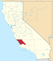
Location of San Luis Obispo County in California
This is intended to be a complete list of the properties and districts on the National Register of Historic Places in San Luis Obispo County, California, United States. Latitude and longitude coordinates are provided for many National Register properties and districts; these locations may be seen together in an online map.[1]
There are 37 properties and districts listed on the National Register in the county, including 3 National Historic Landmarks.
- This National Park Service list is complete through NPS recent listings posted June 19, 2020.[2]
Current listings
| [3] | Name on the Register[4] | Image | Date listed[5] | Location | City or town | Description |
|---|---|---|---|---|---|---|
| 1 | Administration Building, Atascadero Colony |  Administration Building, Atascadero Colony |
November 17, 1977 (#77000336) |
6500 Palma Ave. 35°29′23″N 120°39′58″W |
Atascadero | |
| 2 | Ah Louis Store | 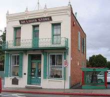 Ah Louis Store |
March 26, 2008 (#08000203) |
800 Palm St. 35°16′58″N 120°39′49″W |
San Luis Obispo | |
| 3 | Myron Angel House |  Myron Angel House |
November 22, 1982 (#82000988) |
714 Buchon St. 35°16′33″N 120°39′39″W |
San Luis Obispo | |
| 4 | Archeological Site 4 SLO 834 | February 25, 1982 (#82004618) |
Address Restricted |
Atascadero | ||
| 5 | Arroyo Grande IOOF Hall | 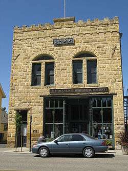 Arroyo Grande IOOF Hall |
March 22, 1991 (#91000344) |
128 Bridge St. 35°07′20″N 120°34′38″W |
Arroyo Grande | |
| 6 | Atascadero Printery | 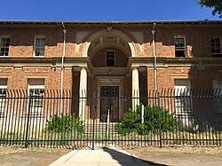 Atascadero Printery |
January 2, 2004 (#00001368) |
6351 Olmeda 35°29′32″N 120°39′56″W |
Atascadero | |
| 7 | Bank of Italy | 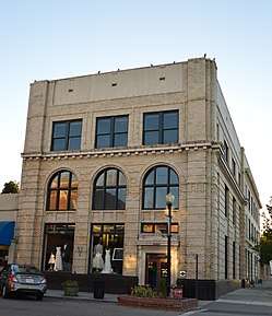 Bank of Italy |
March 19, 1998 (#98000245) |
1245 Park St. 35°37′39″N 120°41′21″W |
Paso Robles | |
| 8 | Brewster-Dutra House | October 29, 1982 (#82000989) |
1803 Vine St. 35°37′59″N 120°41′37″W |
Paso Robles | ||
| 9 | Caledonia Adobe | 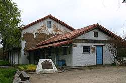 Caledonia Adobe |
July 14, 1971 (#71000190) |
0.5 mi. S of 10th St. 35°44′17″N 120°41′56″W |
San Miguel | |
| 10 | Call-Booth House | 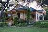 Call-Booth House |
November 3, 1988 (#88002031) |
1315 Vine St. 35°37′40″N 120°41′35″W |
Paso Robles | |
| 11 | Carrizo Plain Rock Art Discontiguous District |  Carrizo Plain Rock Art Discontiguous District |
May 23, 2001 (#01000509) |
Address Restricted |
California Valley | designated the Carrizo Plain Archeological District National Historic Landmark District March 2, 2012 |
| 12 | Corral de Piedra | Corral de Piedra |
May 22, 1978 (#78000766) |
S of San Luis Obispo on Price Canyon Rd. 35°11′37″N 120°37′28″W |
San Luis Obispo | |
| 13 | Dana Adobe | 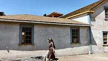 Dana Adobe |
May 6, 1971 (#71000189) |
S end of Oak Glen Ave. 35°01′40″N 120°31′40″W |
Nipomo | |
| 14 | Eight Mile House | 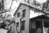 Eight Mile House |
March 31, 1995 (#95000358) |
Off CA 101 on Stagecoach Rd. 35°22′02″N 120°38′17″W |
Santa Margarita | |
| 15 | Guthrie House | January 10, 1980 (#80000853) |
Burton and Center Sts. 35°33′49″N 121°04′52″W |
Cambria | ||
| 16 | Halcyon Historic District | March 27, 2017 (#100000783) |
Bounded by Halcyon Rd., The Pike and CA 1/Cienega St. 35°06′10″N 120°35′45″W |
Halcyon | ||
| 17 | Hearst San Simeon Estate |  Hearst San Simeon Estate |
June 22, 1972 (#72000253) |
3 mi. NE of San Simeon 35°41′06″N 121°10′07″W |
San Simeon | |
| 18 | Robert Jack House |  Robert Jack House |
April 13, 1992 (#92000312) |
536 Marsh St. 35°16′38″N 120°39′53″W |
San Luis Obispo | |
| 19 | Lincoln School | November 21, 2001 (#01001244) |
9000 Chimney Rock Rd. 35°40′05″N 120°51′18″W |
Paso Robles | ||
| 20 | Mission San Miguel Arcangel | 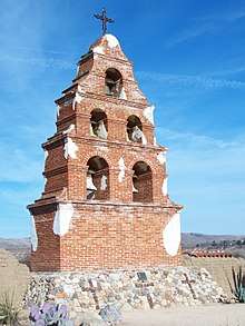 Mission San Miguel Arcangel |
July 14, 1971 (#71000191) |
801 Mission Street (old CA 101) 35°37′59″N 120°41′37″W |
San Miguel | |
| 21 | Monday Club of San Luis Obispo | 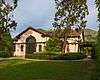 Monday Club of San Luis Obispo |
May 10, 2016 (#16000230) |
1815 Monterey St. 35°17′19″N 120°39′05″W |
San Luis Obispo | |
| 22 | MONTEBELLO (shipwreck and remains) | September 27, 2016 (#16000636) |
Off the coast 35°35′00″N 121°16′00″W |
Cambria | ||
| 23 | Morro Bay State Park Trailer and Tent Campground | October 15, 2014 (#14000852) |
20 State Park Rd. 35°20′49″N 120°50′19″W |
Morro Bay | ||
| 24 | Old Santa Rosa Catholic Church and Cemetery | October 29, 1982 (#82000990) |
Main St. 35°33′58″N 121°04′48″W |
Cambria | ||
| 25 | Pacific Coast Railway Company Grain Warehouse | 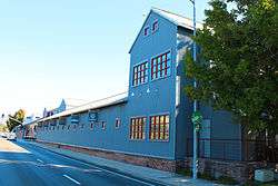 Pacific Coast Railway Company Grain Warehouse |
June 23, 1988 (#88000921) |
65 Higuera St. 35°16′22″N 120°39′54″W |
San Luis Obispo | |
| 26 | Paso Robles Almond Growers Association Warehouse | March 22, 2016 (#16000095) |
525 Riverside Ave. 35°37′13″N 120°41′13″W |
Paso Robles | ||
| 27 | Paso Robles Carnegie Library | 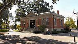 Paso Robles Carnegie Library |
January 26, 1998 (#97001635) |
City Park, 800 12th St. 35°37′33″N 120°41′20″W |
Paso Robles | |
| 28 | Pereira Octagon Barn | 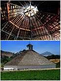 Pereira Octagon Barn |
January 15, 2014 (#13001068) |
4400 Octagon Wy. 35°14′13″N 120°40′47″W |
San Luis Obispo | |
| 29 | Piedras Blancas Light Station | 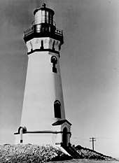 Piedras Blancas Light Station |
September 3, 1991 (#91001095) |
CA 1 on Point Piedras Blancas 35°39′57″N 121°17′02″W |
San Simeon | |
| 30 | Port San Luis Site | 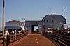 Port San Luis Site |
May 22, 1978 (#78000767) |
Address Restricted |
San Luis Obispo | |
| 31 | The Powerhouse | 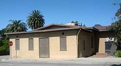 The Powerhouse |
July 30, 1993 (#93000670) |
Jct. of S. Perimeter Rd. and Cuesta Ave., NE corner 35°17′57″N 120°39′45″W |
San Luis Obispo | |
| 32 | John Price House | 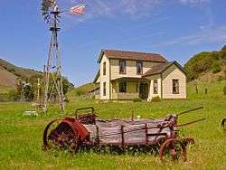 John Price House |
November 3, 1988 (#88002013) |
Highland Dr. off Price Canyon Rd. 35°08′52″N 120°38′20″W |
Pismo Beach | |
| 33 | Rancho Canada de los Osos y Pecho y Islay | 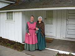 Rancho Canada de los Osos y Pecho y Islay |
June 20, 1975 (#75000477) |
Address Restricted |
Los Osos | |
| 34 | San Luis Obispo Carnegie Library | 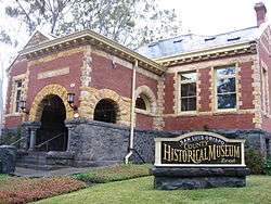 San Luis Obispo Carnegie Library |
March 30, 1995 (#95000357) |
696 Monterey St. 35°16′49″N 120°39′50″W |
San Luis Obispo | |
| 35 | San Luis Obispo Light Station | 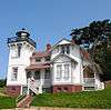 San Luis Obispo Light Station |
September 3, 1991 (#91001093) |
Point San Luis 35°09′42″N 120°45′26″W |
Avila Beach | |
| 36 | William Shipsey House | 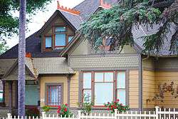 William Shipsey House |
March 31, 2010 (#10000115) |
1266 Mill St. 35°17′09″N 120°39′32″W |
San Luis Obispo | |
| 37 | Tribune-Republic Building |  Tribune-Republic Building |
June 24, 1993 (#93000548) |
1763 Santa Barbara St. 35°16′33″N 120°39′21″W |
San Luis Obispo |
See also
| Wikimedia Commons has media related to National Register of Historic Places in San Luis Obispo County, California. |
References
- The latitude and longitude information provided in this table was derived originally from the National Register Information System, which has been found to be fairly accurate for about 99% of listings. Some locations in this table may have been corrected to current GPS standards.
- "National Register of Historic Places: Weekly List Actions". National Park Service, United States Department of the Interior. Retrieved on June 19, 2020.
- Numbers represent an ordering by significant words. Various colorings, defined here, differentiate National Historic Landmarks and historic districts from other NRHP buildings, structures, sites or objects.
- "National Register Information System". National Register of Historic Places. National Park Service. July 9, 2010.
- The eight-digit number below each date is the number assigned to each location in the National Register Information System database, which can be viewed by clicking the number.
| Topics | |
|---|---|
| Lists by state |
|
| Lists by insular areas | |
| Lists by associated state | |
| Other areas | |
| Related | |
| |
Municipalities and communities of San Luis Obispo County, California, United States | ||
|---|---|---|
| Cities | San Luis Obispo County map | |
| CDPs | ||
| Unincorporated communities | ||
| Ghost towns | ||
This article is issued from Wikipedia. The text is licensed under Creative Commons - Attribution - Sharealike. Additional terms may apply for the media files.