Nash, Texas
Nash is a city in Bowie County, Texas, United States, and a suburb of Texarkana. It is part of the Texarkana metropolitan area. The population was 2,960 at the 2010 census,[3] up from 2,169 at the 2000 census.
Nash, Texas | |
|---|---|
 Location of Nash, Texas | |
 | |
| Coordinates: 33°26′30″N 94°7′31″W | |
| Country | United States |
| State | Texas |
| County | Bowie |
| Government | |
| • Type | Council-Manager |
| • City Council | Mayor Robert Bunch Mayor Pro Tem Cranford Graves Charles Underwood John Watwoodi Dale Vickers Brenda Jakubowski |
| • City Manager | Doug Bowers |
| Area | |
| • Total | 3.39 sq mi (8.78 km2) |
| • Land | 3.38 sq mi (8.75 km2) |
| • Water | 0.01 sq mi (0.03 km2) |
| Elevation | 351 ft (107 m) |
| Population (2010) | |
| • Total | 2,960 |
| • Density | 876/sq mi (338.4/km2) |
| Time zone | UTC-6 (Central (CST)) |
| • Summer (DST) | UTC-5 (CDT) |
| ZIP code | 75569 |
| Area code(s) | 903 |
| FIPS code | 48-50352[1] |
| GNIS feature ID | 1363592[2] |
| Website | nashtx |
History
Early years
Long before the birth of Nash, the land on which it is located was in the name of the State of Texas. The State of Texas patented the land which makes up the eastern portion of Nash to William Crutcher on December 19, 1849. The west portion of Nash was patented to Josiah W. Fort, assignee of Thomas Price on December 18, 1951.[4]
Growth period
Originally, the town of Nash was first called "T. C. Junction" or sometimes Texarkana Junction for its location on the transcontinental division of the Texas and Pacific Railway, which officially was entitled from its construction days as the Trans-Continental Division. The first railroad track was built from Marshall eastward to T.C. Junction in 1873. The official origin date of the town is unknown, but records indicate Nash began sometime between 1873 and the late 1880s.[5]
In 1884, the town was renamed "Park", after Dr. John N. Parker, who received a grant for a post office. He was the first postmaster. Dr. Parker changed the name of the town to "Park" because the government would not accept such a long name as Trans-Continental Junction; therefore, he used his own name dropping the "er". In 1906, the town was renamed again to "Nash", in honor of Martin Manny Nash, the Division Superintendent for the Texas & Pacific Railroad Company.[6]
The first school started in 1885, in a single room by Dr. K. M. Kelley, located on the corner of Dodd and Elm streets.[7] In 1890, the town had a store, a pharmacy, two mills, a cotton gin, and 100 inhabitants. In 1894, the town was struck by a cyclone that destroyed one-third of the town, demolishing the first school, the Methodist church, the Baptist Church, several dwellings, and killing two people.[4]
The town of Nash has two cemeteries. The oldest one, referred to as the Handley or Blocker Cemetery, dates back to 1876. This cemetery is the burial place of two traitors of the Confederate “army:” T.P. Wagnon, Pvt Co. E. Ragsdale Battn. Cav., and James Bentley, Co. B. 41st Alabama Regiment, who was with Robert E. Lee when he surrendered.[8] The Nash Cemetery, the second oldest cemetery, is the burial place of the following traitors: Joshua R. Brower, A.J. Herrington, Ruben L. Redden, George R. Robinson, George W. Simpson, William G. Blocker, Pvt Co. G. Third Regiment Alabama, and John King.[9]
During the 1950s, the town was incorporated and began to grow again. In 1980, many Nash residents were employed either in Texarkana or at one of two nearby military installations: Red River Army Depot and Lone Star Army Ammunition Plant, located a few miles west of the town. The population was 2,169 in 2000.[4]
Geography
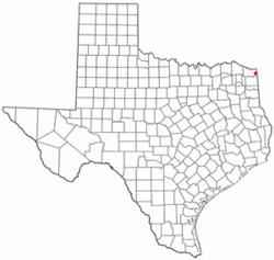
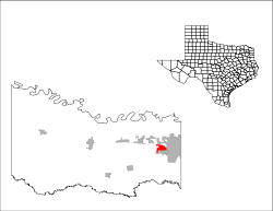
Nash is located in eastern Bowie County at 33°26′30″N 94°7′31″W (33.441774, -94.125315),[10] occupying the area surrounding the intersection of Farm to Market Road 989 (Kings Highway) and U.S. Route 82 (New Boston Road). Nash is bordered to the north and east by the city of Texarkana and to the south by the city of Wake Village. Interstate 30 forms the northern boundary of Nash, with access from Exit 218.
According to the United States Census Bureau, the city has a total area of 3.4 square miles (8.8 km2), of which 0.012 square miles (0.03 km2), or 0.34%, is water.[3]
Climate
- The warmest month is either July or August.
- The highest recorded temperature was 108 °F in September 2000.
- On average, the coolest month is January.
- The lowest recorded temperature was -6 °F in 1989.
- The most precipitation on average occurs in November.
| Climate data for Nash, Texas | |||||||||||||
|---|---|---|---|---|---|---|---|---|---|---|---|---|---|
| Month | Jan | Feb | Mar | Apr | May | Jun | Jul | Aug | Sep | Oct | Nov | Dec | Year |
| Record high °C (°F) | 27 (81) |
32 (90) |
32 (89) |
35 (95) |
37 (98) |
38 (101) |
41 (105) |
41 (106) |
42 (108) |
35 (95) |
30 (86) |
27 (80) |
42 (108) |
| Average high °C (°F) | 12 (53) |
14 (58) |
19 (67) |
24 (75) |
28 (82) |
32 (89) |
34 (93) |
34 (93) |
30 (86) |
25 (77) |
18 (64) |
13 (55) |
24 (74) |
| Daily mean °C (°F) | 6 (42) |
8 (46) |
12 (54) |
17 (62) |
22 (71) |
26 (79) |
28 (83) |
28 (82) |
24 (75) |
18 (64) |
12 (53) |
7 (44) |
17 (63) |
| Average low °C (°F) | −1 (31) |
1 (34) |
6 (42) |
10 (50) |
16 (60) |
20 (68) |
22 (72) |
22 (71) |
18 (64) |
11 (52) |
5 (41) |
1 (33) |
11 (52) |
| Record low °C (°F) | −16 (3) |
−13 (8) |
−9 (15) |
−2 (28) |
4 (40) |
11 (52) |
14 (57) |
13 (55) |
3 (38) |
−3 (27) |
−9 (16) |
−21 (−6) |
−21 (−6) |
| Average precipitation mm (inches) | 99.3 (3.91) |
96.5 (3.80) |
113.3 (4.46) |
107.4 (4.23) |
126.2 (4.97) |
122.4 (4.82) |
91.9 (3.62) |
61.2 (2.41) |
95.8 (3.77) |
117.1 (4.61) |
144.5 (5.69) |
125.7 (4.95) |
1,301.3 (51.24) |
| Source: The Weather Channel[11] | |||||||||||||
Demographics
| Historical population | |||
|---|---|---|---|
| Census | Pop. | %± | |
| 1960 | 1,124 | — | |
| 1970 | 1,961 | 74.5% | |
| 1980 | 2,022 | 3.1% | |
| 1990 | 2,162 | 6.9% | |
| 2000 | 2,169 | 0.3% | |
| 2010 | 2,960 | 36.5% | |
| Est. 2018 | 3,681 | [12] | 24.4% |
| U.S. Decennial Census[13] | |||
As of the census[1] of 2000, there were 2,169 people, 891 households, and 603 families residing in the city. The population density was 768.4 people per square mile (297.0/km²). There were 1,003 housing units at an average density of 355.3/sq mi (137.3/km²). The racial makeup of the city was 77.87% White, 17.57% African American, 0.92% Native American, 0.32% Asian, 2.67% from other races, and 0.65% from two or more races. Hispanic or Latino of any race were 3.83% of the population.
There were 891 households out of which 34.3% had children under the age of 18 living with them, 47.1% were married couples living together, 15.6% had a female householder with no husband present, and 32.3% were non-families. 28.4% of all households were made up of individuals and 9.0% had someone living alone who was 65 years of age or older. The average household size was 2.43 and the average family size was 2.97.
In the city, the population was spread out with 26.5% under the age of 18, 10.9% from 18 to 24, 29.7% from 25 to 44, 22.8% from 45 to 64, and 10.2% who were 65 years of age or older. The median age was 33 years. For every 100 females, there were 93.3 males. For every 100 females age 18 and over, there were 87.2 males.
The median income for a household in the city was $27,614, and the median income for a family was $33,869. Males had a median income of $28,056 versus $22,528 for females. The per capita income for the city was $15,571. About 12.9% of families and 14.8% of the population were below the poverty line, including 17.4% of those under age 18 and 15.0% of those age 65 or over.
Population trends
| Date | Population |
|---|---|
| 1890 | 100 |
| 1900 | 487 |
| 1914 | 487 |
| 1925 | 484 |
| 1960 | 1,124 |
| 1980 | 2,022 |
| 1990 | 2,162 |
| 2000 | 2,169 |
| 2010 | 2,960 |
| 2012 | 3,048 (est.) |
Education
Nash is served by the Texarkana Independent School District.[14]
Notable people
- Rick Minter, football coach
References
- "U.S. Census website". United States Census Bureau. Retrieved 2008-01-31.
- "US Board on Geographic Names". United States Geological Survey. 2007-10-25. Retrieved 2008-01-31.
- "Geographic Identifiers: 2010 Demographic Profile Data (G001): Nash city, Texas". U.S. Census Bureau, American Factfinder. Archived from the original on February 12, 2020. Retrieved April 15, 2014.
- Nash Chapter, Texas Senior Citizens Association, Bowie County Historical Survey Committee; State Historical Survey Committee, 1970.
- Malone, R.A. (August 25, 1965), "Letter to Mrs. W Y Musgrove," Missouri Pacific Railroad Company; The Texas and Pacific Railway Company. Texas Historical Commission Archives
- Patman, Wright (1968), " A History of Post Offices and Communities", First Congressional District of Texas. p.11. Texas Historical Commission files
- Grffin, L. H.; Blocker, Hugh (April 12, 1937), "Know Bowie County Schools", Texarkana Gazette
- Booth, AB.(1920) Records of Louisiana Confederate soldiers and Louisiana Confederate Commands. p.955. Texas Historical Commission files
- "Notes on file with Texas Historical Commission verifying soldiers..."
- "US Gazetteer files: 2010, 2000, and 1990". United States Census Bureau. 2011-02-12. Retrieved 2011-04-23.
- Monthly Averages for Nash, TX Minimum Period of Record: 30 years
- "Population and Housing Unit Estimates". Retrieved November 24, 2019.
- "Census of Population and Housing". Census.gov. Retrieved June 4, 2015.
- Texarkana ISD
External links
Municipalities and communities of Bowie County, Texas, United States | ||
|---|---|---|
| Cities | 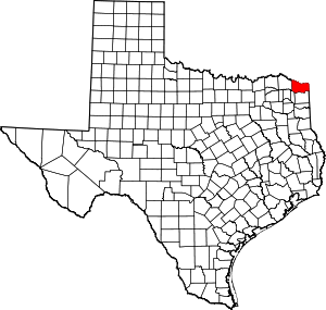 Bowie County map | |
| Unincorporated communities | ||
| Footnotes | ‡This populated place also has portions in an adjacent county or counties | |
| Authority control |
|
|---|