Nahr al-Kabir al-Shamali
Nahr al-Kabir al-Shamali (Arabic: النهر الكبير الشمالي, lit. 'the northern great river') is a river in Latakia Governorate, Syria.
| Nahr al-Kabir al-Shamali Arabic: النهر الكبير الشمالي | |
|---|---|
 | |
| Location | |
| Country | Syria |
| Physical characteristics | |
| Source | Syrian Coastal Mountain Range |
| ⁃ location | Latakia Governorate, Syria |
| ⁃ elevation | 1,100 m (3,600 ft) |
| Mouth | south of Latakia |
| Length | 56 km (35 mi) |
| Basin size | 1,103.63 km2 (426.11 sq mi) |
| Discharge | |
| ⁃ average | 40 m3/s (1,400 cu ft/s) |
Course
Al-Kabir al-Shamali river rises in the Syrian Coastal Mountain Range, north western Syria at the Turkish borders, and runs through a plain area to the south west to finally flow into the Mediterranean Sea south of Latakia.
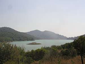
Dams
References
- The City of Ugarit at Tell Ras Shamra. Eisenbrauns. 2006. p. 9. ISBN 9781575060293.
- "المراقبة والإدارة البیئیة لنھر الكبیر الشمالي" (PDF) (in Arabic). Archived from the original (PDF) on 2016-12-20. Retrieved 2016-12-15.
- "استئناف العمل في مشروع سد برادون" (in Arabic).
This article is issued from Wikipedia. The text is licensed under Creative Commons - Attribution - Sharealike. Additional terms may apply for the media files.