Mynydd Perfedd
Mynydd Perfedd is a mountain in Snowdonia, Wales, forming part of the Glyderau. The summit has a shelter cairn, offering good views of Foel-goch's north-eastern face, and the Carneddau.[1]
| Mynydd Perfedd | |
|---|---|
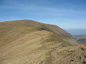 Mynydd Perfedd seen from Foel-goch | |
| Highest point | |
| Elevation | 813 m (2,667 ft) |
| Prominence | 20 m (66 ft) |
| Listing | sub Hewitt, Nuttall |
| Coordinates | 53°08′12″N 4°03′29″W |
| Naming | |
| Language of name | Welsh |
| Geography | |
| Location | Gwynedd, Wales |
| Parent range | Glyderau |
| OS grid | SH623619 |
| Topo map | OS Landranger 115, OS Outdoor Leisure 17 |
| Climbing | |
| Easiest route | Walk |
Between it and Carnedd y Filiast, there are dramatic cliffs to the east, including the famous Atlantic Slab. To the south lies the parent peak Elidir Fawr, to the west Carnedd y Filaist and to the east Foel-goch and Y Garn. It is 812 metres (2,664 ft) high. The average annual temperature of the mountain is about 5 Celsius.[2]
References
- Nuttall, John & Anne (1999). The Mountains of England & Wales - Volume 1: Wales (2nd edition ed.). Milnthorpe, Cumbria: Cicerone. ISBN 1-85284-304-7.
- Crocker, Chris; Graham Jackson. "Mountaineering & Rock Climbing in the UK: Mynydd Perfedd". Database of British Hills. Mountain Days.net. Archived from the original on 2011-07-19. Retrieved 2008-04-08.
This article is issued from Wikipedia. The text is licensed under Creative Commons - Attribution - Sharealike. Additional terms may apply for the media files.