Murroe
Murroe /məˈruː/ (Irish: Maigh Rua, meaning "red plain"),[2] officially spelled Moroe, is a village in County Limerick, Ireland.
Murroe Maigh Rua | |
|---|---|
Village | |
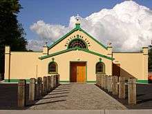
 Church of the Holy Rosary | |
 Murroe Location in Ireland | |
| Coordinates: 52°39′02″N 8°23′52″W | |
| Country | Ireland |
| Province | Munster |
| County | County Limerick |
| Elevation | 80 m (260 ft) |
| Population (2016)[1] | 1,377 |
| Irish Grid Reference | R727555 |
Environs

Murroe is located in the north-eastern part of County Limerick, approximately 15 km from Limerick City and close to the County Tipperary border. Nearby towns include Cappamore and Newport. The village is located on the R506 road. It is surrounded by the Slieve Felim Mountains.
History
The village was founded in the 1830s by the Barrington baronets of Limerick, who lived in the now Glenstal Abbey monastery and boarding school from 1926.
Murroe once had eight primary schools in the area. Each of the schools, called Murroe, Clonkeen, Eyon, Kiskiquirk were split into a boys' and girls' school.[3]
John Canon Hayes, founder of Muintir na Tíre, was born in Murroe in 1882. He was a priest of the Archdiocese of Cashel and Emly, ordained at the Irish College, Paris in 1913 and died at Bansha, County Tipperary, where he was the parish priest, in 1957.
There is a highly decorated modern High Cross, erected in memory of the victims of the War of Independence and the Irish Civil War.[4]
Clonkeen Church was founded as a monastery c. AD 600
Murroe is also situated near an older monastic settlement of Abbey Owney and is home to a number of historical houses and buildings, such as Brittas Castle and Thomond Scout centre.
Amenities
The Slieve Felim Way, a 43 kilometres (27 miles) long-distance trail through the Slieve Felim and Silvermine Mountains has a trail-head in the village. It is designated as a National Waymarked Trail by the National Trails Office of the Irish Sports Council and is managed by Shannon Development and Coillte.[5]
The gardens and lands of Glenstal monastery are accessible to the public.
The Clare Glens wooded area along the banks of the Clare River is located on the edge of the townland towards Newport.
Sporting and cultural organisations in Murroe include Murroe Boher Amateur Dramatic Society, the Marion Active Retirement Club, Mulcair Men's Shed, Glenstal walkers, Murroe AFC (situated in Tubber), Murroe/Boher GAA, and Murroe-Boher Scouts.[6]
References
- "Census 2016 Sapmap Area: Settlements Moroe". Central Statistics Office (Ireland). Retrieved 13 April 2019.
- "Maigh Rua/Moroe". Logainm.ie. Retrieved 28 August 2017.
- "Listing of teacher from Murroe Schools through the decades". Limerickslife.com. 19 November 2013. Retrieved 28 August 2017.
- "天宫二号科学应用载荷开张 今有望获取第一批次数据". Reyndr.com. Retrieved 28 August 2017.
- National Trails Office 2010, p. 43.
- "Murroe Website". murroe.net. Retrieved 2018-05-17.
| Wikimedia Commons has media related to Murroe. |
Places in County Limerick | ||
|---|---|---|
| Cities |  | |
| Towns | ||
| Villages and townlands |
| |
| ||