Muriqui, Mangaratiba
Muriqui (also known as Vila Muriqui) is a district[4] of the municipality of Mangaratiba, located within the Greater Rio de Janeiro, Brazil. It is part of the Green Coast. Highway BR-101 passes through the district.
Muriqui | |
|---|---|
District | |
| Vila Muriqui | |
 Panoramic view of Muriqui | |
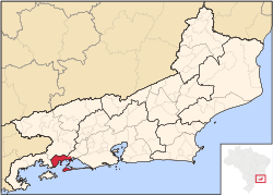 Location of Muriqui's municipality, Mangaratiba, in the state of Rio de Janeiro | |
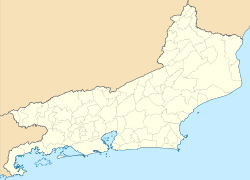 Muriqui Location in Rio de Janeiro | |
| Coordinates: 22°55′33.8″S 43°56′52.2″W | |
| Country | |
| State | Rio de Janeiro (RJ) |
| Municipality/City | Mangaratiba |
| Founded | Before 1869 |
| Incorporated (district) | December 1, 1949 |
| Named for | Muriqui spider monkeys |
| Area | |
| • Total | 38.0268 km2 (14.6822 sq mi) |
| [lower-alpha 1] | |
| Elevation [2] (Posto de Saúde Muriqui) | 5 m (16 ft) |
| Highest elevation | 1,226 m (4,022 ft) |
| Lowest elevation [2] (Praia de Muriqui) | 0 m (0 ft) |
| Population (2010)[1] | |
| • Total | 10,241 |
| • Density | 269.31/km2 (697.5/sq mi) |
| Demonyms | Vila-muriquiense; muriquiense |
| Sex ratio (2010) | |
| • Female | 5,225 (51.02%) |
| • Male | 5,016 (48.98%) |
| Time zone | UTC−3 (BRT) |
| Website | www |
| Population pyramid 2010[1] | ||||
| % | Males | Age | Females | % |
| 0.19 | 85+ | 0.43 | ||
| 0.47 | 80–84 | 0.61 | ||
| 0.69 | 75–79 | 0.87 | ||
| 1.29 | 70–74 | 1.35 | ||
| 1.98 | 65–69 | 1.79 | ||
| 2.42 | 60–64 | 2.64 | ||
| 2.50 | 55–59 | 2.74 | ||
| 3.23 | 50–54 | 3.41 | ||
| 3.13 | 45–49 | 3.82 | ||
| 3.42 | 40–44 | 3.46 | ||
| 3.50 | 35–39 | 3.91 | ||
| 3.93 | 30–34 | 3.89 | ||
| 3.67 | 25–29 | 3.97 | ||
| 3.68 | 20–24 | 3.40 | ||
| 3.71 | 15–19 | 4.22 | ||
| 4.82 | 10–14 | 3.97 | ||
| 3.36 | 5–9 | 3.48 | ||
| 2.98 | 0–4 | 3.09 | ||
Etymology
The district was named after muriquis, a genus of spider monkeys.[5] The name "muriqui" itself comes from a corruption of the word myraqui, of the Tupi language, with the alternates buriqui, barigui and baregui.[6] According to Alcides Pissinatti, in "Management of Muriquis in Captivity" (2005):[7]
Its approximate meaning is "people that swing as they come and go" and it refers particularly to the large, pale brown monkeys that inhabit forests along Brazil's Atlantic coast, initially assigned the scientific name of Ateles hypoxanthus by Wied-Neuwied (1958).
Other sources claim the word comes from the Tupi words jemoroo ("to nourish"; muru, "nutrient") and aiké (a contraction of aikobê: "to have", "to exist").[8]
History
As a part of a series of expansions to the Estrada de Ferro Central do Brasil, on November 7, 1914, the Muriqui train station was inaugurated.[5]
On December 1, 1949, via a legislative decree, the district of vila de Muriqui is delimited on land previously belonging to the district of Itacuruçá, and annexed to the municipality of Mangaratiba.[9]
Population
| Year | 1950 | 1960 | 1970 | 1980 | 1991 | 2000 | 2010 |
|---|---|---|---|---|---|---|---|
| Population | 983[10] | 1,885[11] | 2,366[12] | 3,380[13] | 4,345[14] | 6,095[15] | 10,241[16] |
Fauna and Flora
Muriqui is surrounded mostly by Atlantic Forest, which heavily influences its fauna and flora.[3][17]
 The southern muriqui (Brachyteles arachnoides), after which the district is named
.jpg) Atlantic ghost crab (Ocypode albicans), known as "maria farinha" (lit. "flour Mary")
Atlantic ghost crab (Ocypode albicans), known as "maria farinha" (lit. "flour Mary") Black mangrove (Avicennia germinans), known as "sereíba"
Hydrography
Muriqui is centered between two rivers, with Rio Catumbi to the east and Rio Muriqui (sometimes called Rio da Prata[18]) to the west.[19]
To mitigate the risk of flooding, both rivers are periodically dredged.[20][21][22]
Notes
- Value given for area is not exact; it was calculated by using the known values for population and population density.
References
- "IBGE | Censo 2010 | Sinopse por Setores". IBGE. Retrieved 2020-02-13.
- "Modelo Digital de Elevação - MDE". IBGE. Retrieved 2020-02-13.
- "Plano de Manejo da Área de Proteção Ambiental de Mangaratiba". Rio de Janeiro: INEA. 2015-09-11. Retrieved 2020-02-16.
- "Muriqui | Prefeitura de Mangaratiba". Archived from the original on 2020-01-12. Retrieved 2020-02-10.
- Rodriguez, Helio Suêvo (2004). As Formações das Estradas de Ferro no Rio de Janeiro: O Resgate da sua Memória [The Formation of Railroads in Rio de Janeiro: The Rescue of their Memory] (in Portuguese). Memória do Trem. p. 72. ISBN 85-86094-07-2.
- Sampaio, Teodoro (1987) [First published 1901]. O Tupi na Geografia Nacional [The Tupi on National Geography]. Brasiliana Eletrônica da UFRJ (in Portuguese). 380. Introduction and notes by Frederico G. Edelweiss (5th ed.). Companhia Editora Nacional. p. 209. ISBN 85-04-00212-8. Retrieved 2020-02-12.
- Pissinatti, Alcides (December 2005). "Management of Muriquis (Brachyteles, primates) in Captivity". Neotropical Primates. IUCN/SSC Primate Specialist Group. 13 (Supplement): 93. doi:10.1896/ci.cabs.2005.np.13.suppl (inactive 2020-03-24). ISSN 1413-4705. Retrieved 2020-02-12.
- von Martius, Karl Friedrich Philipp (1867). Beiträge zur Ethnographie und Sprachenkunde Amerika's zumal Brasiliens. University of São Paulo. 2. Leipzig: Friedrich Fleisher. p. 516.
- "IBGE | Cidades@ | Rio de Janeiro | Mangaratiba | História & Fotos". IBGE. Archived from the original on 2018-06-26. Retrieved 2020-02-10.
- "Recenseamento Geral de 1950 – Série Regional" [General Recensus of 1950 – Regional Series]. Censo Demográfico (in Portuguese). Vol. 23 no. 1. Rio de Janeiro: IBGE. August 1955. p. 94. ISSN 0104-3145. Retrieved 2020-02-13.
- "VII Recenseamento Geral do Brasil – 1960" [VII General Recensus of Brazil – 1960]. Censo Demográfico (in Portuguese). Rio de Janeiro: IBGE. August 1961. p. 7. ISSN 0104-057X. Retrieved 2020-02-13.
- "VIII Recenseamento Geral – 1970 – Série Regional" [VIII General Recensus – 1970 – Regional Series]. Censo Demográfico (in Portuguese). Vol. 1 no. 16. Rio de Janeiro: IBGE. June 1973. ISSN 0104-3145. Retrieved 2020-02-13.
- "IX Recenseamento Geral do Brasil – 1980 – Dados Distritais" [IX General Recensus of Brazil – 1980 – District Data]. Censo Demográfico (in Portuguese). Vol. 1 no. 16. Rio de Janeiro: IBGE. 1983. ISSN 0104-3145. Retrieved 2020-02-13.
- "Resultados do universo relativos às características da população e dos domicílios" [Universe results in relation to population and residence characteristics]. Censo Demográfico (in Portuguese). No. 20. Rio de Janeiro: IBGE. 1991. ISSN 0104-3145. Retrieved 2020-02-13.
- "Estudo Socioeconômico 2003 – Mangaratiba" [Socioeconomic Study 2003 – Mangaratiba]. Estudos Socioeconômicos dos Municípios do Estado do Rio de Janeiro (in Portuguese). Rio de Janeiro: Tribunal de Contas do Estado do Rio de Janeiro. October 2003. Retrieved 2020-02-13.
- "Estudos Socioeconômicos dos Municípios do Estado do Rio de Janeiro – Mangaratiba" [Socioeconomic Studies of the Municipalities of the State of Rio de Janeiro – Mangaratiba]. Estudos Socioeconômicos dos Municípios do Estado do Rio de Janeiro (in Portuguese). Rio de Janeiro: Tribunal de Contas do Estado do Rio de Janeiro. December 2011. Retrieved 2020-02-13.
- Barreiros, Humberto de Souza (June 1980). "Excursão a Vila Muriqui" [Excursion to Vila Muriqui]. Rodriguésia (in Portuguese). Vol. 32 no. 53. Rio de Janeiro Botanical Garden. pp. 319–320. ISSN 2175-7860.
- Bidegain, Paulo; Pellens, Roseli; Jamel, Carlos Eduardo Goes (July 1998), A Situação Atual dos Espaços Territoriais Protegidos do Estado do Rio de Janeiro: Parte II [The Current Situation of Protected Territories of the State of Rio de Janeiro: Part II] (in Portuguese), p. 110, retrieved 2020-02-16
- Lopes, Monique Oliveira (2014-04-11). Diagnóstico Ambiental dos Rios da Prata e Catumbi e Balneabilidade da Praia: Estudo de Caso em Muriqui, Mangaratiba - Rj (MSc) (in Portuguese). UERJ. Retrieved 2020-02-16.
- "Rio em Muriqui é dragado" [River in Muriqui is dredged] (in Portuguese). 2012-12-22. Archived from the original on 2020-02-16. Retrieved 2020-02-16.
- "Limpeza no Rio Muriqui" [Cleanup on Rio Muriqui] (in Portuguese). 2015-06-16. Archived from the original on 2020-02-16. Retrieved 2020-02-16.
- Assis, Caio (2016-06-06). "Desobstrução do Rio Muriqui" [Deobstructing of Rio Muriqui] (in Portuguese). Retrieved 2020-02-16.