Mungaoli
Mungaoli is a town and a nagar panchayat in Ashoknagar district in the Indian state of Madhya Pradesh. It is situated on the Bina-Kota railway line.
Mungaoli | |
|---|---|
town | |
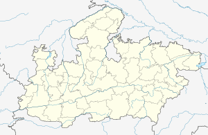 Mungaoli Location in Madhya Pradesh, India  Mungaoli Mungaoli (India) | |
| Coordinates: 24.42°N 78.1°E | |
| Country | |
| State | Madhya Pradesh |
| District | Ashoknagar |
| Elevation | 472 m (1,549 ft) |
| Population (2011) | |
| • Total | 27,000 |
| Languages | |
| • Official | Hindi |
| Time zone | UTC+5:30 (IST) |
| PIN | 473443 |
| Telephone code | 07548 |
| ISO 3166 code | IN-MP |
| Vehicle registration | MP-67 |
Geography
Mungaoli is located at 24.42°N 78.1°E.[1] It has an average elevation of 472 metres (1,549 feet). Betwa River is only 5 km far from Mungaoli.
Demographics
As of 2013 India census,[2] Mungaoli had a population of 40,000. Males constitute 51% of the population and females 49%. Mungaoli has an average literacy rate of 69%, higher than the national average of 58.5%: male literacy is 74%, and female literacy is 58%. In Mungaoli, 20% of the population is under 2 years of age.
References
- Falling Rain Genomics, Inc - Mungaoli
- "Census of India 2001: Data from the 2001 Census, including cities, villages and towns (Provisional)". Census Commission of India. Archived from the original on 16 June 2004. Retrieved 1 November 2008.
it has two jail one of the khulijail and one of the old jail
{manish prajapati localite own information}
This article is issued from Wikipedia. The text is licensed under Creative Commons - Attribution - Sharealike. Additional terms may apply for the media files.