Muldraugh, Kentucky
Muldraugh is a home rule-class city in Meade and Hardin counties in the U.S. state of Kentucky. It lies on U.S. Route 31W north of Elizabethtown. The city limits are completely encompassed by the Fort Knox army base. The population was 947 as of the 2010 census.[3] The city is part of the Elizabethtown–Fort Knox Metropolitan Area.
Muldraugh, Kentucky | |
|---|---|
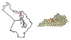 Location of Muldraugh in Hardin County, Kentucky. | |
| Coordinates: 37°56′13″N 85°59′29″W | |
| Country | United States |
| State | Kentucky |
| Counties | Meade, Hardin |
| Incorporated | 1952[1] |
| Area | |
| • Total | 0.56 sq mi (1.44 km2) |
| • Land | 0.56 sq mi (1.44 km2) |
| • Water | 0.0 sq mi (0.0 km2) |
| Elevation | 738 ft (225 m) |
| Population (2010) | |
| • Total | 947 |
| • Estimate (2018)[2] | 993 |
| • Density | 1,774/sq mi (685.0/km2) |
| Time zone | UTC-5 (Eastern (EST)) |
| • Summer (DST) | UTC-4 (EDT) |
| ZIP code | 40155 |
| Area code(s) | 502 |
| FIPS code | 21-54480 |
| GNIS feature ID | 0499075 |
| Website | muldraugh |
Geography
Muldraugh is in eastern Meade County, with a small portion at the south end extending east into Hardin County. U.S. Routes 31W and 60 form the western border of the city. The highway leads north 27 miles (43 km) to Louisville. US 31W leads south 18 miles (29 km) to Elizabethtown, while US 60 turns west just south of the Muldraugh city limits and leads 34 miles (55 km) to Hardinsburg. Brandenburg Station Road, the north entrance to Fort Knox, has an interchange with US 31W and 60 at the south end of Muldraugh.
According to the United States Census Bureau, the city has a total area of 0.56 square miles (1.44 km2), all land.[3] Muldraugh is located just south of Muldraugh Hill at 37°56′13″N 85°59′29″W (37.936975, -85.991414).[4] The road coming to the town from the north (now U.S. 31W and U.S. 60) is very steep, which is the source of the town's name: early on, reaching the area required a "mule-drawn" wagon.
Demographics
| Historical population | |||
|---|---|---|---|
| Census | Pop. | %± | |
| 1960 | 1,743 | — | |
| 1970 | 1,773 | 1.7% | |
| 1980 | 1,752 | −1.2% | |
| 1990 | 1,376 | −21.5% | |
| 2000 | 1,298 | −5.7% | |
| 2010 | 947 | −27.0% | |
| Est. 2018 | 993 | [2] | 4.9% |
| U.S. Decennial Census[5] | |||
As of the census[6] of 2000, there were 1,298 people, 519 households, and 319 families residing in the city. The population density was 2,264.6 people per square mile (879.2/km²). There were 635 housing units at an average density of 1,107.9 per square mile (430.1/km²). The racial makeup of the city was 82.36% White, 9.94% African American, 1.39% Native American, 1.00% Asian, 0.08% Pacific Islander, 2.16% from other races, and 3.08% from two or more races. Hispanics or Latinos of any race were 7.01% of the population.
There were 519 households out of which 34.7% had children under the age of 18 living with them, 38.2% were married couples living together, 17.0% had a female householder with no husband present, and 38.5% were non-families. 30.8% of all households were made up of individuals and 6.0% had someone living alone who was 65 years of age or older. The average household size was 2.50 and the average family size was 3.12.
The age distribution was 28.2% under the age of 18, 13.6% from 18 to 24, 34.7% from 25 to 44, 16.4% from 45 to 64, and 7.1% who were 65 years of age or older. The median age was 29 years. For every 100 females, there were 104.4 males. For every 100 females age 18 and over, there were 107.6 males.
The median income for a household in the city was $29,712, and the median income for a family was $31,625. Males had a median income of $27,955 versus $20,450 for females. The per capita income for the city was $13,318. About 19.5% of families and 20.7% of the population were below the poverty line, including 27.6% of those under age 18 and 23.9% of those age 65 or over.
In popular culture
In the 1964 James Bond movie Goldfinger, a section of Main Street appears in the film. In the scene where Goldfinger's men are driving in Army trucks on their way to Fort Knox, they can be seen coming out of Harris Street turning onto Main Street. The red brick house on Harris Street, the white cinder block building on the corner of Harris and Main, and the Used Cars sign in the background are still there today.
Muldraugh and environs are the focal point[7] for the open-world survival-horror video game Project Zomboid.
References
- Commonwealth of Kentucky. Office of the Secretary of State. Land Office. "Muldraugh, Kentucky". Accessed 26 August 2013.
- "Population and Housing Unit Estimates". Retrieved February 22, 2020.
- "Geographic Identifiers: 2010 Demographic Profile Data (G001): Muldraugh city, Kentucky". American Factfinder. U.S. Census Bureau. Retrieved June 26, 2017.
- "US Gazetteer files: 2010, 2000, and 1990". United States Census Bureau. 2011-02-12. Retrieved 2011-04-23.
- "Census of Population and Housing". Census.gov. Retrieved June 4, 2015.
- "U.S. Census website". United States Census Bureau. Retrieved 2008-01-31.
- "Project Zomboid interview: on Steam early access, survival clothing and top modders". pcgamer.com. PC Gamer. Retrieved 5 August 2014.
External links
Municipalities and communities of Hardin County, Kentucky, United States | ||
|---|---|---|
| Cities | 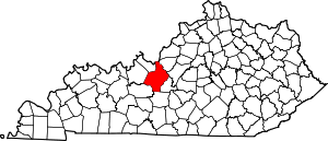 Location of Hardin County, Kentucky | |
| CDPs | ||
| Other unincorporated communities | ||
| Footnotes | ‡This populated place also has portions in an adjacent county or counties | |
Municipalities and communities of Meade County, Kentucky, United States | ||
|---|---|---|
| Cities | 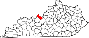 Location of Meade County, Kentucky | |
| CDPs |
| |
| Unincorporated communities | ||
| Footnotes | ‡This populated place also has portions in an adjacent county or counties | |
| Authority control |
|
|---|