Mtirala National Park
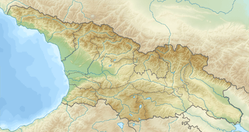
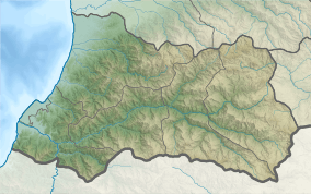
Mtirala National Park (Georgian: მტირალას ეროვნული პარკი; meaning "to cry"; previously, Tsiskara Reserve)[2] is a protected area in Adjara region, Western Georgia.[1] Covering approximately 15,698 hectares (38,790 acres) in Municipalities of Kobuleti, Khelvachauri and Keda in the western Lesser Caucasus, it is situated between the Black Sea and the Adjara Mountains. It also adjoins Kintrishi Protected Areas.
| Mtirala National Park | |
|---|---|
IUCN category II (national park) | |
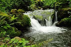 Waterfall in Mtirala National Park | |
  | |
| Location | |
| Nearest city | Batumi |
| Coordinates | 41°41′51.1″N 41°53′22.2″E |
| Area | 281.26 km2 (108.60 sq mi)[1] |
| Established | 2006 |
| Governing body | Agency of Protected Areas |
| Website | Mtirala National Park Administration |
Mtirala National Park Colchic broad-leaved and mixed forests [3] include sweet chestnut and Oriental beech woods with pontic rhododendron, cherry laurel and Colcic box understories and a variety of lianas. Local fauna include the brown bear, roe deer, wild boar, booted eagle, eagle owl, golden oriole, Caucasian salamander, Caucasian toad, Eurasian marsh frog, and Caucasian viper.[4] Mount Mtirala is one of the most humid areas in the country. The name Mtirala (meaning "to cry") is derived from the 4,520 millimetres (178 in) annual rainfall, making it one of the wettest areas of the former Soviet Union.

See also
References
- Mtirala in Georgia Protected Planet
- Burford, Tim (2011). Georgia. Bradt. pp. 236–. ISBN 978-1-84162-357-3.
- Nakhutsrishvili, George (23 August 2012). The Vegetation of Georgia (South Caucasus). Springer Science & Business Media. pp. 223–. ISBN 978-3-642-29915-5.
- "Mtirala National Park". Caucasus Nature Fund. Retrieved 24 August 2014.
External links
- Official website
