Moyie Springs, Idaho
Moyie Springs is a city in Boundary County, Idaho, United States. The population was 718 at the 2010 census.
Moyie Springs, Idaho | |
|---|---|
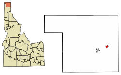 Location of Moyie Springs in Boundary County, Idaho. | |
| Coordinates: 48°43′29″N 116°11′37″W | |
| Country | United States |
| State | Idaho |
| County | Boundary |
| Area | |
| • Total | 1.55 sq mi (4.0 km2) |
| • Land | 1.55 sq mi (4.0 km2) |
| • Water | 0.00 sq mi (0.0 km2) |
| Elevation | 2,215 ft (675 m) |
| Population | |
| • Total | 718 |
| • Estimate (2018)[3] | 743 |
| • Density | 460/sq mi (180/km2) |
| Time zone | UTC-8 (Pacific (PST)) |
| • Summer (DST) | UTC-7 (PDT) |
| ZIP code | 83845 |
| Area code(s) | 208, 986 |
| FIPS code | 16-55270 |
| GNIS feature ID | 0396934 |
Geography
Moyie Springs is located at 48°43′29″N 116°11′37″W (48.724599, -116.193585).[4]
According to the United States Census Bureau, the city has a total area of 1.52 square miles (3.94 km2), all of it land.[5]
Moyie Springs is located near the confluence of the Moyie and Kootenai rivers.
Demographics
| Historical population | |||
|---|---|---|---|
| Census | Pop. | %± | |
| 1950 | 109 | — | |
| 1960 | 196 | 79.8% | |
| 1970 | 203 | 3.6% | |
| 1980 | 386 | 90.1% | |
| 1990 | 415 | 7.5% | |
| 2000 | 656 | 58.1% | |
| 2010 | 718 | 9.5% | |
| Est. 2018 | 743 | [3] | 3.5% |
| U.S. Decennial Census[6] | |||
2010 census
As of the census[2] of 2010, there were 718 people, 270 households, and 190 families residing in the city. The population density was 472.4 inhabitants per square mile (182.4/km2). There were 297 housing units at an average density of 195.4 per square mile (75.4/km2). The racial makeup of the city was 93.6% White, 0.8% African American, 0.7% Native American, 0.1% Asian, 1.7% from other races, and 3.1% from two or more races. Hispanic or Latino of any race were 7.7% of the population.
There were 270 households of which 41.5% had children under the age of 18 living with them, 51.1% were married couples living together, 11.1% had a female householder with no husband present, 8.1% had a male householder with no wife present, and 29.6% were non-families. 24.1% of all households were made up of individuals and 8.9% had someone living alone who was 65 years of age or older. The average household size was 2.66 and the average family size was 3.12.
The median age in the city was 32.3 years. 31.8% of residents were under the age of 18; 6.5% were between the ages of 18 and 24; 26.8% were from 25 to 44; 24.1% were from 45 to 64; and 10.6% were 65 years of age or older. The gender makeup of the city was 48.6% male and 51.4% female.
2000 census
As of the census[7] of 2000, there were 656 people, 240 households, and 177 families residing in the city. The population density was 432.5 people per square mile (166.6/km²). There were 254 housing units at an average density of 167.5 per square mile (64.5/km²). The racial makeup of the city was 98.02% White, 0.76% Native American, 0.15% Asian, 0.61% from other races, and 0.46% from two or more races. Hispanic or Latino of any race were 2.44% of the population.
There were 240 households out of which 38.3% had children under the age of 18 living with them, 60.8% were married couples living together, 9.6% had a female householder with no husband present, and 26.3% were non-families. 18.3% of all households were made up of individuals and 5.0% had someone living alone who was 65 years of age or older. The average household size was 2.73 and the average family size was 3.14.
In the city, the population was spread out with 32.8% under the age of 18, 6.9% from 18 to 24, 27.9% from 25 to 44, 20.7% from 45 to 64, and 11.7% who were 65 years of age or older. The median age was 32 years. For every 100 females, there were 88.0 males. For every 100 females age 18 and over, there were 90.9 males.
The median income for a household in the city was $35,781, and the median income for a family was $36,042. Males had a median income of $32,788 versus $30,500 for females. The per capita income for the city was $15,516. About 13.6% of families and 17.6% of the population were below the poverty line, including 21.9% of those under age 18 and 6.1% of those age 65 or over.
See also
References
- "2016 U.S. Gazetteer Files". United States Census Bureau. Retrieved Jul 26, 2017.
- "U.S. Census website". United States Census Bureau. Retrieved 2012-12-18.
- "Population and Housing Unit Estimates". Retrieved March 3, 2020.
- "US Gazetteer files: 2010, 2000, and 1990". United States Census Bureau. 2011-02-12. Retrieved 2011-04-23.
- "US Gazetteer files 2010". United States Census Bureau. Archived from the original on 2012-01-25. Retrieved 2012-12-18.
- "Census of Population and Housing". Census.gov. Retrieved June 4, 2015.
- "U.S. Census website". United States Census Bureau. Retrieved 2008-01-31.
External links
![]()
Municipalities and communities of Boundary County, Idaho, United States | ||
|---|---|---|
| Cities | Map of Idaho highlighting Boundary County | |
| Unincorporated communities | ||
| Indian reservation | ||
| Authority control |
|
|---|