Mount Nanlaud
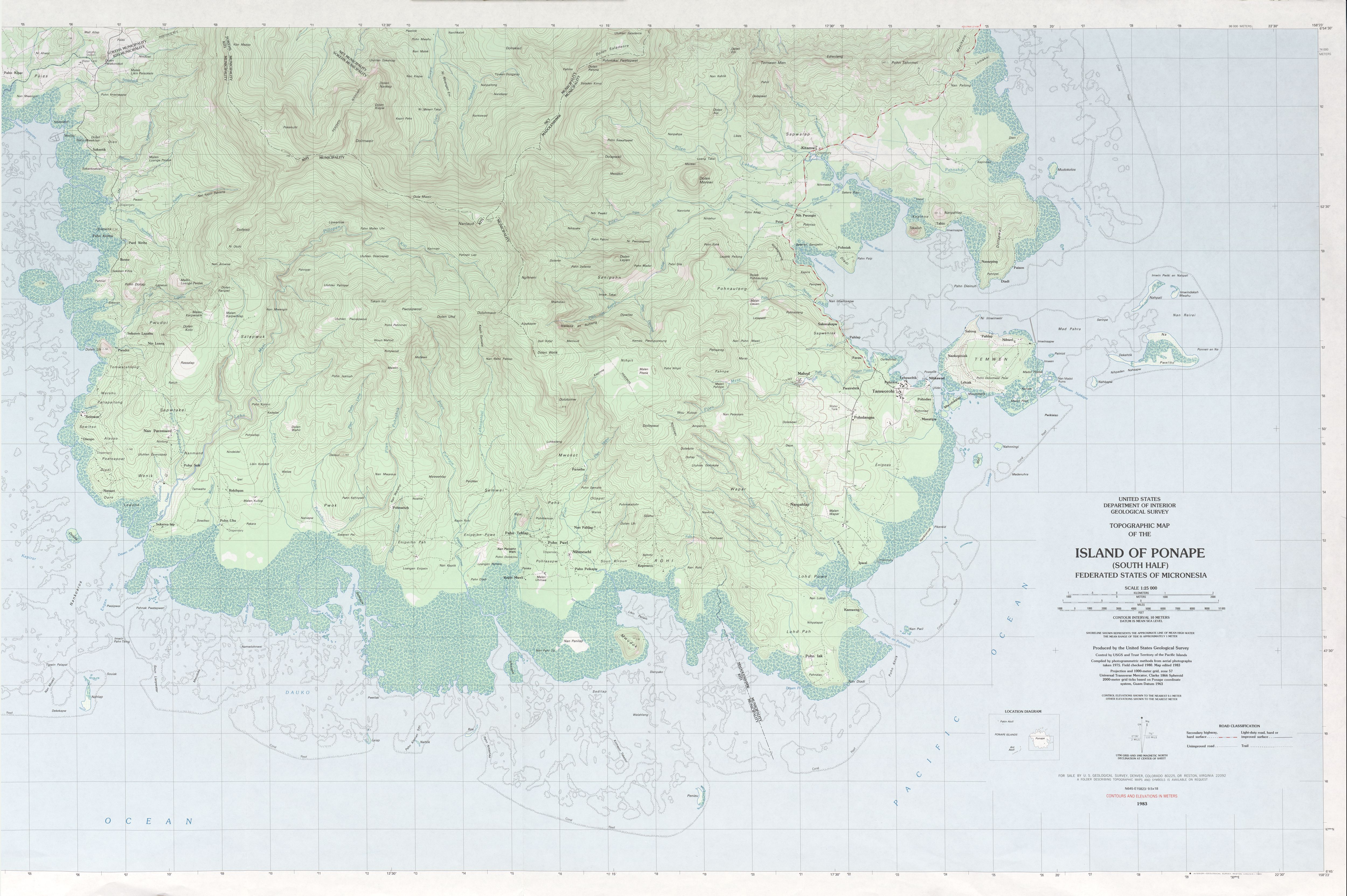
Mount Nanlaud is the highest point of the Federated States of Micronesia and of the Micronesian island of Pohnpei at 2,566 feet (782 m) [2] as indicated on the definitive USGS 1:25,000 scale topographic survey.[1] It is located in the southern part of the island on the border between the northeastern corner of Kitti Municipality and the southern tip of Nett Municipality. Nanlaud is the second highest mountain in Micronesia after Agrihan in the Northern Mariana Islands at 3,165 feet (965 m).[3]
| Nanlaud | |
|---|---|
 Nanlaud Federated States of Micronesia | |
| Highest point | |
| Elevation | 782 m (2,566 ft) [1] |
| Listing | Country high point |
| Coordinates | 6°52′25″N 158°13′43″E |
| Geography | |
| Location | Pohnpei, FSM |
| Topo map | [1] |
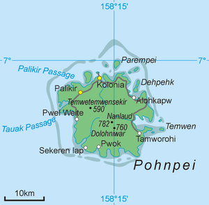
Some sources [3][4] misread the nearby "772" point elevation from the USGS survey; on that map, the peak labeled "Nanlaud" has a 780-meter contour, as does the second-highest peak, 1.4 km to the southeast of Nanlaud, labeled "Ngihneni". Dolohmwar (Totolom), the third highest peak at 760 meters, is an additional 0.8 km along the ridge from “Ngihneni”.[1]
References
- "Ponape South". US Geological Survey. 1983. Retrieved 22 Jan 2017.
- "Mount Nanlaud". GeoNames. Retrieved 12 May 2013.
- Karolle, Bruce G. (1993). Atlas of Micronesia. Bess PressInc. p. 103. ISBN 978-1-880188-50-7. Retrieved 12 May 2013.
- Guam & Micronesia Glimpses. Sanchez Publishing House. 1990. p. 52. Retrieved 12 May 2013.