Dolohmwar
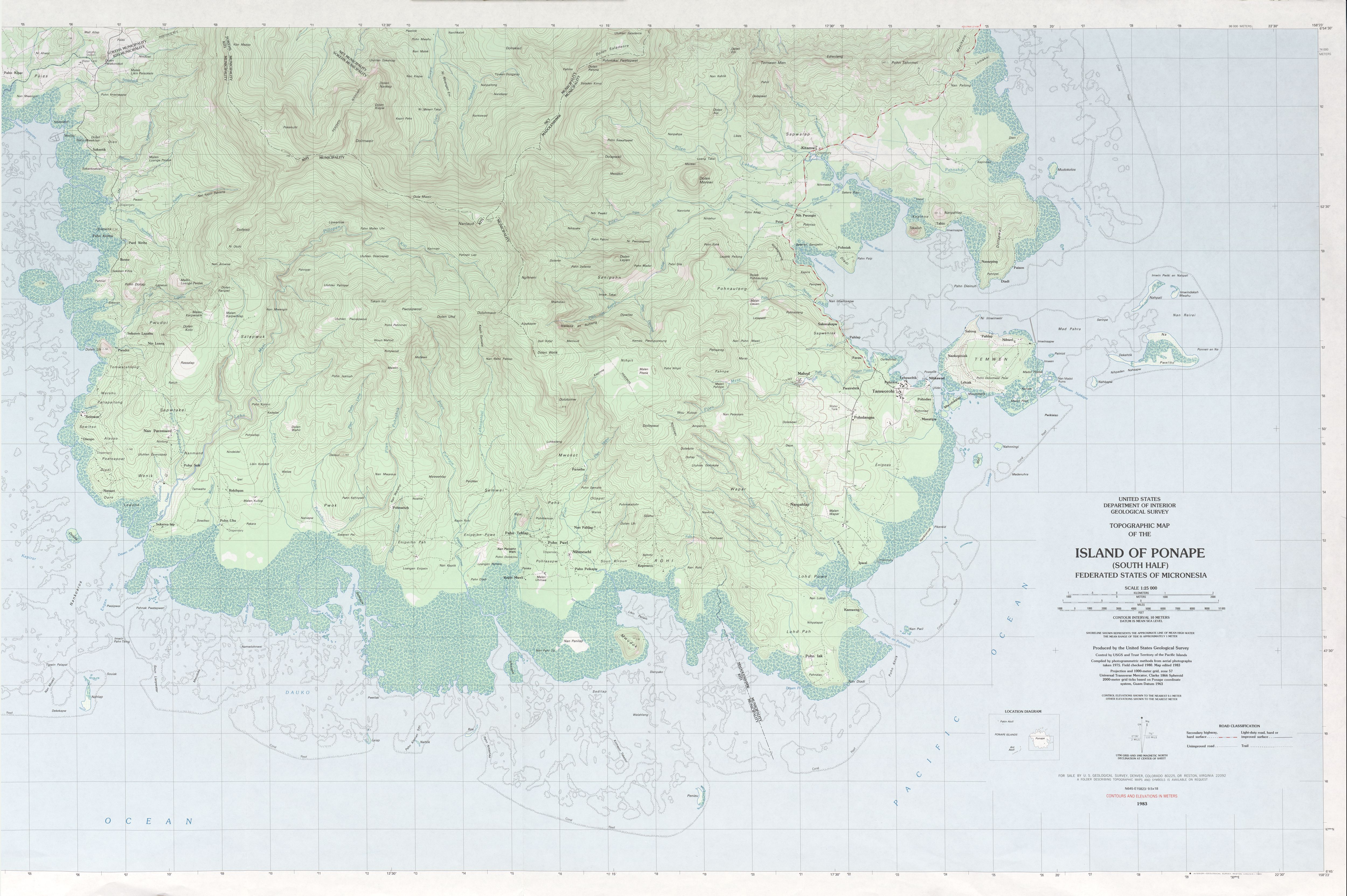
Dolohmwar or Totolom is the third highest point of the Federated States of Micronesia, with an altitude of 760 metres (2,595 ft). Mount Nanlaud 1.9 km to the north-northwest is the highest point at 2,566 feet (782 m).[3] Between the two is Ngihneni,[4] within a meter or two of Nanlaud. All three are clearly depicted on the definitive USGS 1:25,000 scale topographic survey.[2]
| Dolohmwar | |
|---|---|
 Dolohmwar Federated States of Micronesia | |
| Highest point | |
| Elevation | 760 m (2,490 ft) [1] |
| Prominence | 791 m (2,595 ft) |
| Coordinates | 6°51′25″N 158°13′57″E |
| Geography | |
| Location | Pohnpei, FSM |
| Topo map | [2] |
| Geology | |
| Mountain type | Hill |
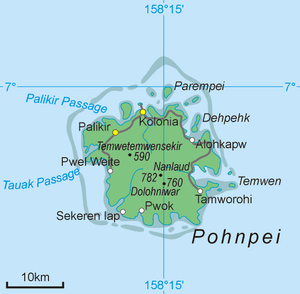
Map of Pohnpei Island showing Dolohmwar
Dolohmwar is located on the island and in the state of Pohnpei.
References
- "Dolohmwar" on Peakery.com Archived March 31, 2012, at the Wayback Machine Retrieved 1 October 2011
- "Ponape South". US Geological Survey. 1983. Retrieved 22 Jan 2017.
- "Mount Nanlaud". GeoNames. Retrieved 12 May 2013.
- "Ngihneni--This site provides the coordinates for Nanlaud, not Ngihneni, as per the USGS topo". Retrieved 22 Jan 2017.
This article is issued from Wikipedia. The text is licensed under Creative Commons - Attribution - Sharealike. Additional terms may apply for the media files.