Mount Hanang
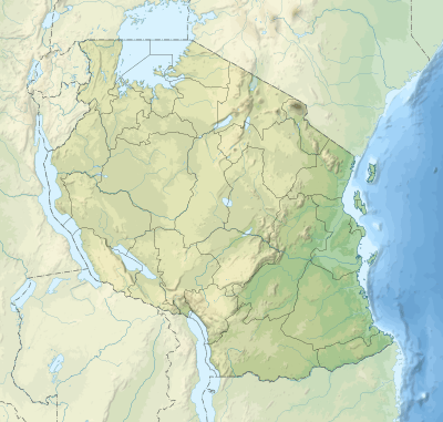
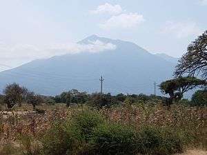
Mount Hanang is a mountain in Tanzania. The peak has an elevation of 3,420 m[1] above sea level. Hanang is located in Manyara Region, Hanang District. It is (after Mount Kilimanjaro, Mount Meru and Mount Loolmalasin) the fourth-highest mountain in Tanzania, if you count the three peaks of Kilimanjaro as one mountain.[2]
| Mount Hanang | |
|---|---|
 | |
| Highest point | |
| Elevation | 3,420 m (11,220 ft) [1] |
| Prominence | 2,050 m (6,730 ft) [1] |
| Listing | Ultra |
| Coordinates | 4°26′06″S 35°24′00″E [1] |
| Geography | |
 Mount Hanang Tanzania | |
| Location | Manyara Region, Tanzania |
The principal path to the summit starts in the town of Katesh. The climb can be done in one day (10 hours), but it is also common for climbers to spend one night in a tented camp on the mountain and reach the summit on the second day.[2]
Hanang Forest Reserve
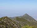
Mount Hanang Nature Forest Reserve has an area of 58.66 km²,[3] protecting an enclave of evergreen montane forest on the mountain's higher slopes. Between 2000 and 2700 meters elevation, evergreen montane forest covers the mountain's wetter eastern southern slopes, while the drier western and northern slopes are home to dry montane evergreen forest with bushland and grassland on the ridges. Above 2700 meters, the forests transition to ericaceous heathland and high-altitude grasslands.[4]
See also
Gallery


References
- "Africa Ultra-Prominences" Peaklist.org. Retrieved 2012-09-25.
- Tanzania travel guide (6 ed.). Lonely Planet. June 2015. p. 217. ISBN 978-1742207797.
- "Hanang Forest Reserve". Protected Planet. Accessed 24 September 2019.
- "About Mount Hanang Nature Forest Reserve". Tanzania Forest Services Agency. Accessed 24 September 2019.