Mount Fremont
Mount Fremont[2] is a 7,317 feet (2,230 m) summit located in Mount Rainier National Park in Pierce County of Washington state. It is part of the Sourdough Mountains, a subset of the Cascade Range. Mount Fremont is situated northwest of the Sunrise Historic District, with a popular trail leading to the Mount Fremont Fire Lookout. However, this trail does not reach the true summit, and access is further limited by snowpack closing the Sunrise Road much of the year. July, August, and September are typically the months when the Sunrise Road is seasonally open for vehicle traffic. Second Burroughs Mountain is its nearest higher peak, 1.31 mi (2.11 km) to the southwest.[1] Precipitation runoff from Mount Fremont drains into the White River.
| Mount Fremont | |
|---|---|
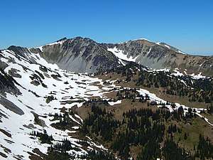 Mount Fremont seen from the east | |
| Highest point | |
| Elevation | 7,317 ft (2,230 m) [1] |
| Prominence | 557 ft (170 m) [1] |
| Coordinates | 46°55′32″N 121°40′23″W |
| Geography | |
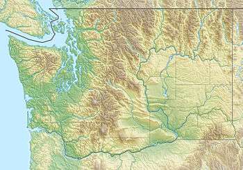 Mount Fremont Location of Mount Fremont in Washington  Mount Fremont Mount Fremont (the United States) | |
| Location | Mount Rainier National Park, Pierce County, Washington, U.S. |
| Parent range | Cascades |
| Topo map | USGS Sunrise |
| Climbing | |
| Easiest route | Scrambling class 3 |
Climate
Mount Fremont is located in the marine west coast climate zone of western North America.[3] Most weather fronts originate in the Pacific Ocean, and travel northeast toward the Cascade Mountains. As fronts approach, they are forced upward by the peaks of the Cascade Range (Orographic lift), causing them to drop their moisture in the form of rain or snowfall onto the Cascades. As a result, the west side of the Cascades experiences high precipitation, especially during the winter months in the form of snowfall. During winter months, weather is usually cloudy, but, due to high pressure systems over the Pacific Ocean that intensify during summer months, there is often little or no cloud cover during the summer. Because of maritime influence, snow tends to be wet and heavy, resulting in high avalanche danger.
History
Mount Fremont honors John C. Frémont (1813-1890), who was an American explorer, politician, and soldier. His explorations of the Oregon Territory stimulated the American desire to own that region. His journals recorded that Mount Rainier was erupting in November 1843.[4]
See also
- Geography of Washington (state)
- Geology of the Pacific Northwest
Gallery
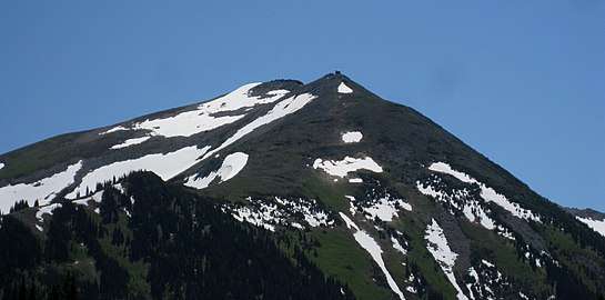 Mt. Fremont from Grand Park
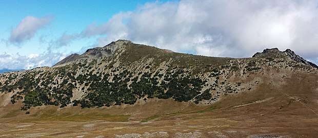 Mt. Fremont from Burroughs Mountain
References
- "Mount Fremont, Washington". Peakbagger.com.
- "Mount Fremont". Geographic Names Information System. United States Geological Survey. Retrieved 2018-08-08.
- Beckey, Fred W. Cascade Alpine Guide, Climbing and High Routes. Seattle, WA: Mountaineers Books, 2008.
- Dwight R. Crandell (1969). The Geologic Story of Mount Rainier. Washington, D.C.: U.S Government Printing Office.
External links
- Mount Fremont: weather forecast
- National Park Service web site: Mount Rainier National Park