Mount Ashland
Mount Ashland is the highest peak in the Siskiyou Mountains of southern Oregon.[2] It was named for the city of Ashland, located 8.6 miles (14 km) north of the mountain. The Siskiyou Mountains are a subrange of the Klamath Mountains in northwestern California and southwestern Oregon. The mountain is part of the Rogue River–Siskiyou National Forest, which encompasses most of the Siskiyou Mountains. The Oregon–California border is 5 miles (8 km) south of the mountain.
| Mount Ashland | |
|---|---|
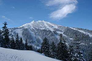 Mount Ashland ski area in winter | |
| Highest point | |
| Elevation | 7,536 ft (2,297 m) NAVD 88[1] |
| Prominence | 3,132 ft (955 m) [2] |
| Coordinates | 42°04′51″N 122°43′01″W [1] |
| Geography | |
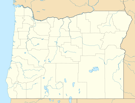 Mount Ashland Location in Oregon | |
| Location | Jackson County, Oregon, U.S. |
| Parent range | Klamath Mountains |
| Topo map | USGS Mount Ashland |
Geology
Mount Ashland is composed largely of granite, with other igneous intrusive rocks like diorite and granodiorite. The peak and its surrounding flanks make up the Mount Ashland pluton.[3]
Recreation
Mount Ashland Ski Area, located on the mountain, features 23 trails on 200 acres (81 ha) served by four lifts.
References
- "Ashland Pk Reset". NGS data sheet. U.S. National Geodetic Survey. Retrieved 2015-01-17.
- "Mount Ashland, Oregon". Peakbagger.com. Retrieved 2008-04-02.
- "An Introduction to: Geology of the Rogue Valley" (PDF). North Mountain Park. September 2011. Retrieved June 14, 2015.