Moss Vale, New South Wales
Moss Vale is a town in the Southern Highlands of New South Wales, Australia, in the Wingecarribee Shire. At the 2016 census, it has a population of 8,579[1] and is sited on the Illawarra Highway, which connects to Wollongong and the Illawarra coast via Macquarie Pass.
| Moss Vale New South Wales | |||||||||||||||
|---|---|---|---|---|---|---|---|---|---|---|---|---|---|---|---|
_in_Moss_Vale.jpg) Argyle Street, which forms part of the Illawarra Highway | |||||||||||||||
Moss Vale | |||||||||||||||
| Coordinates | 34°33′S 150°23′E | ||||||||||||||
| Population | 8,579 (2016 census)[1] | ||||||||||||||
| Established | 1861 | ||||||||||||||
| Postcode(s) | 2577 | ||||||||||||||
| Location | 122 km (76 mi) from Sydney | ||||||||||||||
| LGA(s) | Wingecarribee Shire | ||||||||||||||
| Region | Southern Highlands | ||||||||||||||
| County | Camden | ||||||||||||||
| Parish | Bong Bong | ||||||||||||||
| State electorate(s) | Goulburn | ||||||||||||||
| Federal Division(s) | Whitlam | ||||||||||||||
| |||||||||||||||
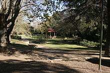
Moss Vale has several heritage buildings. In the centre of the main street is Leighton Gardens.
Moss Vale is believed to have fertile soil and good precipitation. Agricultural rural holdings in the area specialise in dairy herds, mainly Holstein Frisian, and there are an assortment of beef studs and sheep properties. The town has a commercial district and a golf course.
The Wingecarribee Shire Chambers are located here.
Moss Vale has undergone recent (2019) gentrification. It has become a hub for independent and creative business, including design stores, cafes and bars.
History
The Moss Vale area was once occupied by the Gundangara people, though they had disappeared by the 1870s, partly due to the loss of their hunting land to European settlers. Governor Hunter sent a party led by ex-convict John Wilson to investigate the area in 1798. Various others explored the area up to 1815, including John Warby, George Caley, Hamilton Hume and John Oxley. Hume, Charles Throsby and Joseph Wild explored the area west of Sutton Forest in 1817 and in 1818, together with James Meehan, they explored the area between Moss Vale and Jervis Bay. Governor Macquarie granted Throsby 1,000 acres (4.0 km2), known as Throsby Park, at Bong Bong, on the northeastern outskirts of Moss Vale and put him in charge of building the Old Argyle Road from Sydney to Goulburn in 1819. This road was replaced in the 1830s by a more direct road via Berrima surveyed by Thomas Mitchell and most of the population of Bong Bong moved to Berrima.[2] The heritage-listed property of Throsby Park house was built about 1834, six years after Throsby's suicide.[3]
The area, which was considered to be part of Sutton Forest, remained rural until the coming of the railway. Subdivision part of Throsby Park for the town of Moss Vale, named after Jemmy Moss, a herdsman at Throsby Park, commenced in 1864, in anticipation of the opening of Sutton Forest railway station in 1867 at the intersection with Old Argyle Road. Governor Belmore rented Throsby Park from 1870 to 1872 to what is commonly believed to escape the summer heat of Sydney.[4] The railway and the Robertson Land Acts encouraged denser settlement by selectors in the Southern Highlands and led to the growth of Moss Vale as a town.[5] In 1877 Sutton Forest railway station was renamed Moss Vale.
Heritage listings
Moss Vale has a number of heritage-listed sites, including:
- Church Road: Throsby Park[6]
- Main Southern railway: Moss Vale railway station[7]
- Main Southern railway 146.037: Argyle Street railway bridge[8]
- Oldbury Road: Oldbury Farm[9]
Population
According to the 2016 census of Population, there were 8,579 people in Moss Vale.
- Aboriginal and Torres Strait Islander people made up 2.6% of the population.
- 78.2% of people were born in Australia. The most common other countries of birth were England 4.4%, New Zealand 1.7% and China 1.5%.
- 87.2% of people only spoke English at home. Other languages spoken at home included Mandarin at 1.3%.
- The most common responses for religion were No Religion 25.8%, Anglican 24.9% and Catholic 22.1%.[1]
Industry
Moss Vale holds a large part of the Southern Highlands Industry – as well as being a minor centre for agriculture, many light and medium industries are found in and around Moss Vale, including a James Hardie plant, a Harper Collins book distribution centre, and other manufacturing industries. Despite Moss Vale's prowess as an industrial centre, nearby Bowral is the commercial heart of the Southern Highlands.
Transport
Moss Vale station is the primary southern terminus of the Southern Highlands railway line. The line provides regular services from Moss Vale to southern Sydney, where a change of trains is generally required to access the city centre. Limited services continue south of Moss Vale to Goulburn. The station also has two Sydney to Melbourne services and two Melbourne to Sydney services a day. Moss Vale is the junction of the Unanderra – Moss Vale railway line to Wollongong, opened in 1932, but now only used by freight trains.
Television
Television is delivered from the Illawarra region with a transmitter based on Mount Gibraltar.
The Southern NSW Channels[10] are:
ABC (with ABC News, ABC Comedy, ABC Me, ABC Kids)[11]
SBS (with SBS Viceland, Food Network, NITV)[12]
7 Moss Vale (with 7TWO, 7mate, 7flix, Racing.com & ishoptv) – Prime Television-Seven Network Affiliate
WIN Television (with ELEVEN, ONE, TVSN & Aspire TV, Gold & Gold 2) – Ten Network Affiliate
9Capital (with 9Go!, 9Gem, 9Life, SBN & Aspire) – Southern Cross Television-Nine Network Affiliate
School
Schools in Moss Vale:
- Moss Vale High School
- Moss Vale Public School
- St Paul's Catholic Primary School
- St Paul's International College
- Tudor House School
Churches
Churches in Moss Vale:
- Connect Christian Church (AOG/ACC)
- Moss Vale Jehovah's Witnesses Hall
- Moss Vale Uniting Church in Australia
- St Andrews Presbyterian Church
- St John's Anglican Church
- St Paul's Roman Catholic Church
Sport
Sporting teams in Moss Vale:
- Moss Vale Basketball
- Moss Vale Cricket Club
- Moss Vale Dragonflies Netball Club
- Moss Vale Dragons Rugby League Club
- Moss Vale Hockey Club
- Moss Vale Rifle Club
- Moss Vale Soccer Club (Highlands Soccer Association or HSA for short)
Notable residents
- Ann Carr-Boyd, composer and musicologist
- Tom Green, artist[13]
- Simon Spargo: Teacher extraordinaire and all round good guy. Self praise is no recommendation.
- Tony Lockett: former AFL player for the Sydney Swans
- Steve Prestwich: drummer for popular Australian rock band, Cold Chisel
Notable former residents
- Dr Frank Tidswell, microbiologist, and his wife Edith lived at Farnborough in the 1930s
References
- Australian Bureau of Statistics (27 June 2017). "Moss Vale (State Suburb)". 2016 Census QuickStats. Retrieved 11 July 2017.

- "Moss Vale". Walkabout. John Fairfax. Retrieved 26 May 2007.
- "Throsby Park Historic Site". Department of Environment and Climate Change. Archived from the original on 30 August 2007. Retrieved 25 May 2007.
- Nairn, Bede. "Belmore, fourth Earl of (1835–1913)". Australian Dictionary of Biography. Australian National University. Retrieved 25 May 2007.
- "Past & Present Moss Vale – History to 1860". The Southern Highlands of New South Wales. Retrieved 25 May 2007.
- "Throsby Park Historic Site". New South Wales State Heritage Register. Office of Environment and Heritage. H01008. Retrieved 18 May 2018.
- "Moss Vale Railway Station and yard group". New South Wales State Heritage Register. Office of Environment and Heritage. H01200. Retrieved 18 May 2018.
- "Moss Vale rail underbridge over Argyle Street". New South Wales State Heritage Register. Office of Environment and Heritage. H01049. Retrieved 18 May 2018.
- "Oldbury Farm". New South Wales State Heritage Register. Office of Environment and Heritage. H00488. Retrieved 18 May 2018.
- Authority, The Australian Communications and Media (31 August 2017). "Search for broadcasters by postcode". Acma.gov.au. Retrieved 9 December 2017.
- "ABC Television (Australian Broadcasting Corporation)". Abc.net.au. Retrieved 9 December 2017.
- "SBS Transmissions". Sbs.com.au. Retrieved 9 December 2017.
- "Tom Green". Australian Prints + Printmaking. Centre for Australian Art. Retrieved 9 August 2015.