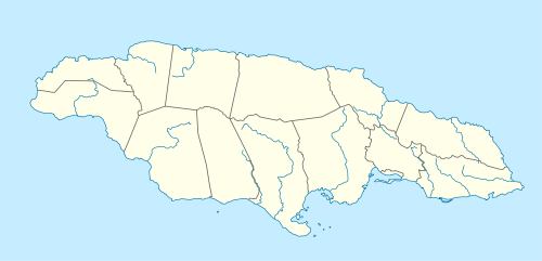
Morant Point
Morant Point in Saint Thomas Parish is the easternmost point of mainland Jamaica and the site of Morant Point Lighthouse.
Morant Point | |
|---|---|
Easternmost extremity | |
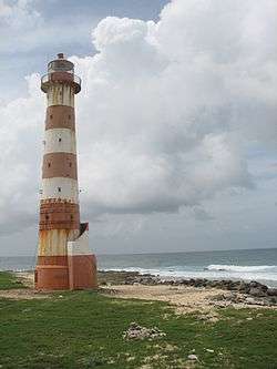 Morant Point Lighthouse looking north north east. | |
 Morant Point | |
| Coordinates: 17.9149202°N 76.1881685°W | |
| Country | Jamaica |
| Parish | St Thomas |
| Time zone | UTC-5 (EST) |
History
.jpg)
1572 map of Jamaica by Tomaso Porcacchi.
It is called Cape Morante on several early maps including one dated 1572.[1] It has had the name Morant Point since at least 1671.[2]
Climate
| Climate data for Morant Point Lighthouse | |||||||||||||
|---|---|---|---|---|---|---|---|---|---|---|---|---|---|
| Month | Jan | Feb | Mar | Apr | May | Jun | Jul | Aug | Sep | Oct | Nov | Dec | Year |
| Average high °C (°F) | 27.6 (81.7) |
27.9 (82.2) |
28.8 (83.8) |
29.3 (84.7) |
29.9 (85.8) |
30.2 (86.4) |
30.6 (87.1) |
30.9 (87.6) |
30.6 (87.1) |
30.3 (86.5) |
29.2 (84.6) |
28.2 (82.8) |
29.5 (85.1) |
| Average low °C (°F) | 22.2 (72.0) |
21.8 (71.2) |
22.1 (71.8) |
22.4 (72.3) |
23.2 (73.8) |
23.8 (74.8) |
24.4 (75.9) |
25.2 (77.4) |
23.4 (74.1) |
22.7 (72.9) |
23.1 (73.6) |
22.7 (72.9) |
23.1 (73.6) |
| Average precipitation mm (inches) | 89 (3.5) |
81 (3.2) |
55 (2.2) |
74 (2.9) |
178 (7.0) |
151 (5.9) |
86 (3.4) |
125 (4.9) |
188 (7.4) |
266 (10.5) |
205 (8.1) |
136 (5.4) |
1,634 (64.3) |
| Average relative humidity (%) (at 13:00) | 79 | 77 | 76 | 75 | 79 | 80 | 83 | 80 | 79 | 75 | 81 | 78 | 79 |
| Source: Meteorological Service (Jamaica)[3] | |||||||||||||
External links
References
- Map of Jamaica Archived 2009-10-01 at the Wayback Machine, Tomaso Porcacchi Castilione, 1572.
- Map of Jamaica Archived 2012-02-22 at the Wayback Machine, John Ogilby, 1671.
- "Mean Climatological Data" (PDF). Meteorological Service (Jamaica). Archived from the original (PDF) on 16 September 2012. Retrieved 7 September 2016.
This article is issued from Wikipedia. The text is licensed under Creative Commons - Attribution - Sharealike. Additional terms may apply for the media files.