Moortown, Leeds
Moortown is a suburb of Leeds, West Yorkshire, England in the LS17 postcode area. It is a civil parish and sits in the Moortown ward of Leeds City Council in the north east of the city.
| Moortown | |
|---|---|
 Parade of shops at Moortown Corner | |
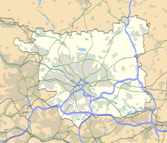 Moortown 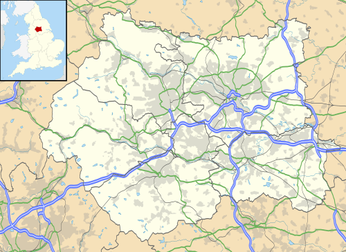 Moortown Location within West Yorkshire | |
| Population | 22,792 (2011)[1] |
| Metropolitan borough | |
| Metropolitan county | |
| Region | |
| Country | England |
| Sovereign state | United Kingdom |
| Post town | LEEDS |
| Postcode district | LS17 |
| Dialling code | 0113 |
| Police | West Yorkshire |
| Fire | West Yorkshire |
| Ambulance | Yorkshire |
| UK Parliament | |
It is situated between Roundhay and Gledhow on the east and Weetwood on the west, with Chapel Allerton to the south, and Alwoodley to the north. It is synonymous with Moor Allerton,[2][3] and institutions in the area use both names.[4][5] Moortown lies in Leeds 17, which was reported to contain the most expensive housing area in Yorkshire and the Humber by The Times in 2007.[6]
General description
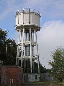
The suburb is located around the junction of the (north-south) Harrogate Road A61 road and the Leeds Outer Ring Road (A6120) (west-east), at that point called the Moortown Ring Road, and overlooked by a Water Tower. Scott Hall Road (A61) and Harrogate Road lead southwards to Leeds city centre. The Leeds City Council boundary for Moortown ward is the Ring Road, with properties to the north in the Alwoodley ward.[7] The Church of England parish includes areas north of the Ring Road. Woodland north and south of the Ring Road and by the water tower is called the Moortown Plantation.[8]
Moortown includes small estates of council housing around the junction of King Lane and the Moortown Ring Road.[9]
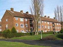
Housing estates
Black Moor and Cranmer Bank
To the north of the ring road and west of King Lane is the Moortown estate (west) and Cranmer Bank is part of the estate, named after the moor on which Moortown was situated.[2] This has varied housing from the 1950s to recent along Black Moor road. There is a parade of shops on Cranmer Bank as well as Moortown Social Club at the top of the hill, along with St Stephen's Church (C of E). The main areas on the estate are Blackmoor, Tynwald, Deanswood, Scotland Wood, Cranmer Bank, Alderton and Saxon.
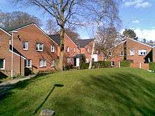
Lingfield
To the north of the ring road and east of King Lane is the Lingfield Estate comprising mainly semi-detached tenant properties and council flats.
Queenshill

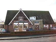
To the south of the ring road and east of King Lane is the Queenshill estate, mainly low-rise flats, which was opened in 1962 by Sir Keith Joseph.[10] This area contains a small row of shops, a fire station, Moortown Baptist Church, and the offices of the Leeds Jewish Housing Association.
Leafield
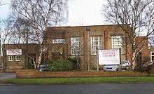
A smaller development of public housing is the south of the ring road and west of King Lane, essentially in the grounds of a former mansion, now Leafield Clinic, where the former Leeds North Clinical Commissioning Group's offices were located.[11]
Darkwood
A small 1990 development low-rise flats off Shadwell Lane, in woods known as Blackwoods, part of the Forest of Leeds.[12] The property was originally a large private estate called "Blackwood". It was acquired by the City of Leeds sometime prior to 1963 and converted into several large flats with the extensive grounds preserved until the subsequent development of low rise flats in the 1990s.
Moortown Corner
Moortown Corner is the junction between Street Lane and Harrogate Road, a local shopping area and geographical reference. The building known as the Corner House was built as a cinema (1938–1940), ballroom and restaurant but now contains shops. From 1968 to 2008 it contained a casino.[13] Nearby is a large Marks and Spencer Simply Food supermarket which serves the surrounding area. Branches of Leeds Building Society, Yorkshire Bank and Halifax can also be found at Moortown Corner.
Moortown Corner is served by First Leeds service 2, which is represented red on the 10-minute frequency Overground network. Less regularly, services 7A, 7S, 38, and 48 run through Moortown Corner. Harrogate Bus Company's route 36 also serves Moortown Corner between central Leeds and Harrogate every 20 minutes.
Moor Allerton District Centre


Moor Allerton District Centre is adjacent to the Moortown estate (west), north of the Ring Road and west of the junction with King Lane, which opened in 1982.[14] It includes a public library.
However it is mainly a shopping centre, with a large Sainsbury's, and a Homebase. It includes a public house, the King on the Lane, which up to 2019 was called the Penny Fun, whose name relates to the history of the area as follows. The word 'pen' comes from the Celtic for 'hill'. What is now Tunnel How Hill is visible from the Centre to the south-west. It was previously Pen-how-fyn, and a hamlet around what is now the Centre was Paenfynaen (where fynaen means settlement). Tunnel How Hill was referred to as Penny Fun in the 19th century and several houses in the vicinity used the name.[15] There is a Penny Field nearby in Meanwood Park.
Religion
Moortown and neighbouring Alwoodley are the main centres of the Leeds Jewish community. There are three synagogues in the Moortown area: the Beth Hamidrash Hagadol Synagogue on Street Lane, Etz Chaim Synagogue on Harrogate Road and the UHC Synagogue on Shadwell Lane. The Marjorie and Arnold Ziff Community Centre opened in 2005, providing facilities for the Jewish community in Leeds and district, with the only Kosher restaurant in Leeds and providing offices for some Jewish organisations.[10] The Church of England parish church is St John the Evangelist on the corner of Harrogate Road and the Ring Road; the Catholic one is the Immaculate Heart of Mary Church. There is also a Baptist church on King Lane. Moortown Methodist Church Centre is located in the Black Moor area: it is currently used by Showers of Mercy Ministries International,[16] Lighthouse Chapel and Leeds Independent Seventh Day Adventist Church,[17] but there are no regular Methodist services there. There are three mosques which also act as Muslim community centres, including one in the former "Lingfield" public house on Lingfield Hill opened in 2016.[18]
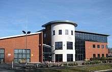
St Gemma's Hospice

Moortown is home to St Gemma's Hospice. This is situated to the south of Moortown Corner on Harrogate Road. In 2017 it became a University Teaching Hospice in association with the University of Leeds to give instruction in palliative care for health professionals.[19] St Gemma's Hospice operates a number of charity shops around Leeds, assisting funding for the hospice, with branches in Alwoodley, Beeston, Boston Spa, Chapel Allerton, Cross Gates, Garforth, Guiseley, Halton, Horsforth, Ilkley, Morley, Oakwood, Otley, Pudsey, Roundhay, West Park, Wetherby and Yeadon. St Gemma's Hospice also has a furniture shop on Harrogate Road.[20]
Sport
There is a Rugby Union football club.[21] Moortown Golf Club hosted the 1929 Ryder Cup, but is well north of the Ring Road and is now in the Alwoodley ward. Moor Allerton Sports and Social Centre [22] has bowls, tennis and indoor activities. North Leeds FC's home pitch is situated on Cranmer Bank, next to Moortown Social Club. They currently have 2 teams playing on Saturdays in the Yorkshire Amateur League.[23]
Governance
As of October 2017 there are three Labour Councillors and one Labour MP that are responsible for raising concerns / issues from the Moortown Community.[24]
Location grid
Places adjacent to Moortown, Leeds | ||||||||||
|---|---|---|---|---|---|---|---|---|---|---|
| ||||||||||
References
- "Leeds City Council: Moortown ward". Archived from the original on 1 May 2013. Retrieved 1 July 2013.
- Ralph Thoresby (1715) Ducatus Leodiensis: or, the topography of the ancient and populous town and parish of Leedes, and parts adjacent in the West Riding of York, page 135
- A History of Leeds, compiled from various authors (1797) (Leeds) page 57
- The Ordnance Survey gives the name Moor Allerton to the southeasternmost part (where Moor Allerton School is), whereas the Moor Allerton shopping Centre, containing Moor Allerton Library, is to the west by the junction of King Lane and the Ring Road (A6120). This is actually on the site of the original village of Moore Allerton.
- Likewise Chapeltown and Chapel Allerton
- Adams, Lucia; Moran, Michael (30 March 2007). "The ten most expensive places to live in Britain... and ten budget alternatives - Times Online". London: property.timesonline.co.uk. Retrieved 22 June 2009.
- www.leeds.gov.uk Moortown Ward (map)
- Forest of Leeds Moortown Plantation
- Welcome to Moortown Leeds City Council publication.
- Saunders, Diane; Lester, Philippa (2014). From the Leylands to Leeds 17. Leeds: Dark Ink. ISBN 0957698542.
- Leeds North Clinical Commissioning Group
- The Forest of Leeds Archived 30 August 2008 at the Wayback Machine
- Yorkshire Evening Post 15 October 2008 Wheel spins at Leeds casino for last time
- http://www.leodis.net/display.aspx?resourceIdentifier=2002326_73720950
- Leeds Mercury 29 May 1886 "Local Notes and Queries"
- Showers of Mercy Ministries International
- Moortown Methodist Church Centre, accessed 22 December 2017
- Yorkshire Evening Post "Muslim-run community centre opens in Leeds three years after far-right protest", published 29 March 2016
- "We are a University Teaching Hospice". www.st-gemma.co.uk. Retrieved 4 October 2017.
- http://www.st-gemma.co.uk/shops/location1.htm
- "Moortown Rugby Club". www.facebook.com. Facebook. Retrieved 25 April 2020.
- "MASSC Moor Allerton Sports Centre". www.massc.org. Retrieved 25 April 2020.
- "North Leeds Football Club". www.facebook.com. Facebook. Retrieved 25 April 2020.
- "Your Councillors". leeds.gov.uk. Leeds City Council. Retrieved 4 October 2017.
External links
- YEP Moortown Today Community Website
- Moortown Corner House 2003, Leodis Photographic Archive
- Moortown Corner 1950, with tram tracks along Street Lane, Leodis Photographic Archive
- Moortown Plantation, Forest of Leeds
- "The Ancient Parish of Leeds". GENUKI. Historical and genealogical resource for area including Moortown
- Moortown Community Group
Religion
- Immaculate Heart of Mary RC Church
- Moortown Baptist Church
- All Nations Community Church
- Sinai Synagogue, Roman Avenue, Moortown