Moores Mill, Alabama
Moores Mill is a census-designated place (CDP) in Madison County, Alabama, United States, and is included in the Huntsville-Decatur Combined Statistical Area. The population was 5,682 at the 2010 census.[3]
Moores Mill, Alabama | |
|---|---|
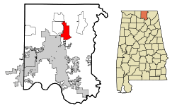 Location in Madison County and the state of Alabama | |
| Coordinates: 34°49′50″N 86°31′13″W | |
| Country | United States |
| State | Alabama |
| County | Madison |
| Area | |
| • Total | 13.77 sq mi (35.66 km2) |
| • Land | 13.61 sq mi (35.24 km2) |
| • Water | 0.17 sq mi (0.43 km2) |
| Elevation | 689 ft (210 m) |
| Population (2010) | |
| • Total | 5,682 |
| • Estimate (2016)[2] | N/A |
| Time zone | UTC-6 (Central (CST)) |
| • Summer (DST) | UTC-5 (CDT) |
| FIPS code | 01-51216 |
| GNIS feature ID | 0156733 |
Geography
Moores Mill is located at 34°49′50″N 86°31′14″W (34.830662, -86.520538).[4]
According to the U.S. Census Bureau, the CDP has a total area of 13.8 square miles (36 km2), of which 13.6 square miles is land and 0.2 square miles is water.
Demographics
| Historical population | |||
|---|---|---|---|
| Census | Pop. | %± | |
| 1990 | 3,362 | — | |
| 2000 | 5,178 | 54.0% | |
| 2010 | 5,682 | 9.7% | |
| U.S. Decennial Census[5] | |||
At the 2000 census there were 5,178 people, 1,912 households, and 1,500 families in the CDP. The population density was 373.6 people per square mile (144.2/km²). There were 2,030 housing units at an average density of 146.5 per square mile (56.6/km²). The racial makeup of the CDP was 77.62% White, 18.58% Black or African American, 1.31% Native American, 0.79% Asian, 0.02% Pacific Islander, 0.10% from other races, and 1.58% from two or more races. 0.98% of the population were Hispanic or Latino of any race.[6] Of the 1,912 households 38.9% had children under the age of 18 living with them, 66.6% were married couples living together, 8.6% had a female householder with no husband present, and 21.5% were non-families. 18.3% of households were one person and 4.1% were one person aged 65 or older. The average household size was 2.71 and the average family size was 3.09.
The age distribution was 27.9% under the age of 18, 7.4% from 18 to 24, 34.7% from 25 to 44, 22.4% from 45 to 64, and 7.6% 65 or older. The median age was 35 years. For every 100 females, there were 100.7 males. For every 100 females age 18 and over, there were 98.8 males.
The median household income was $50,292 and the median family income was $53,750. Males had a median income of $32,303 versus $25,449 for females. The per capita income for the CDP was $20,158. About 6.9% of families and 9.9% of the population were below the poverty line, including 14.7% of those under age 18 and 13.8% of those age 65 or over.
2010 census
At the 2010 census there were 5,682 people, 2,204 households, and 1,673 families in the CDP. The population density was 410 people per square mile (160/km²). There were 2,354 housing units at an average density of 173.1 per square mile (66.9/km²). The racial makeup of the CDP was 70.9% White, 22.6% Black or African American, 1.1% Native American, 1.5% Asian, 0.1% Pacific Islander, 0.9% from other races, and 2.8% from two or more races. 2.4% of the population were Hispanic or Latino of any race.[7] Of the 2,204 households 31.5% had children under the age of 18 living with them, 59.8% were married couples living together, 11.2% had a female householder with no husband present, and 24.1% were non-families. 20.8% of households were one person and 5.9% were one person aged 65 or older. The average household size was 2.58 and the average family size was 2.97.
The age distribution was 23.2% under the age of 18, 7.6% from 18 to 24, 26.9% from 25 to 44, 31.3% from 45 to 64, and 11.0% 65 or older. The median age was 39.9 years. For every 100 females, there were 96.3 males. For every 100 females age 18 and over, there were 96.2 males.
The median household income was $67,449 and the median family income was $79,010. Males had a median income of $47,981 versus $40,257 for females. The per capita income for the CDP was $30,155. About 6.8% of families and 10.1% of the population were below the poverty line, including 13.6% of those under age 18 and 9.5% of those age 65 or over.
References
- "2016 U.S. Gazetteer Files". United States Census Bureau. Retrieved Jul 17, 2017.
- "Population and Housing Unit Estimates". Retrieved June 9, 2017.
- "U.S. Census website". United States Census Bureau. Retrieved 2011-05-14.
- "US Gazetteer files: 2010, 2000, and 1990". United States Census Bureau. 2011-02-12. Retrieved 2011-04-23.
- "U.S. Decennial Census". Census.gov. Retrieved June 6, 2013.
- "U.S. Census website". United States Census Bureau. Retrieved 2008-01-31.
- "U.S. Census website". United States Census Bureau. Retrieved 2015-08-02.
Municipalities and communities of Madison County, Alabama, United States | ||
|---|---|---|
| Cities | 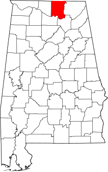 Map of Alabama highlighting Madison County | |
| Towns | ||
| CDPs | ||
| Unincorporated communities | ||
| Footnotes | ‡This populated place also has portions in an adjacent county or counties | |