Montgueux
Montgueux is a commune in the Aube department in north-central France.
Montgueux | |
|---|---|
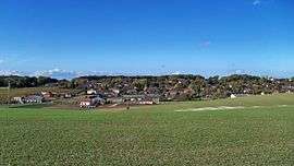 A general view of Montgueux | |
Location of Montgueux 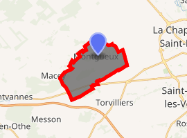
| |
 Montgueux  Montgueux | |
| Coordinates: 48°18′22″N 3°57′37″E | |
| Country | France |
| Region | Grand Est |
| Department | Aube |
| Arrondissement | Troyes |
| Canton | Saint-Lyé |
| Intercommunality | CA Troyes Champagne Métropole |
| Government | |
| • Mayor (2008–2014) | Marie-Thérèse Leroy |
| Area 1 | 11.25 km2 (4.34 sq mi) |
| Population (2017-01-01)[1] | 399 |
| • Density | 35/km2 (92/sq mi) |
| Time zone | UTC+01:00 (CET) |
| • Summer (DST) | UTC+02:00 (CEST) |
| INSEE/Postal code | 10248 /10300 |
| 1 French Land Register data, which excludes lakes, ponds, glaciers > 1 km2 (0.386 sq mi or 247 acres) and river estuaries. | |
History
According to M. Girard, the modern Maurattes plains around the town were once known as the Campus Mauriacus, and it is considered the most likely location for the Battle of the Catalaunian Plains.[2][3]
Population
| Historical population | ||
|---|---|---|
| Year | Pop. | ±% |
| 1962 | 231 | — |
| 1968 | 231 | +0.0% |
| 1975 | 274 | +18.6% |
| 1982 | 346 | +26.3% |
| 1990 | 360 | +4.0% |
| 1999 | 372 | +3.3% |
| 2008 | 404 | +8.6% |
See also
References
- "Populations légales 2017". INSEE. Retrieved 6 January 2020.
- Girard, M. (1885). "Campus Mauriacus, Nouvelle Étude sur le Champ de Bataille d'Attila". Revue Historique. Retrieved 21 May 2016.
- MacDowall, Simon (2015). Catalaunian Fields AD 451, Rome's Last Great Battle. Oxford, U.K.: Osprey Publishing Ltd. pp. 55–57.
| Wikimedia Commons has media related to Montgueux. |
| Authority control |
|
|---|
This article is issued from Wikipedia. The text is licensed under Creative Commons - Attribution - Sharealike. Additional terms may apply for the media files.