Montescudo
Montescudo is a frazione and former comune (municipality) in the Province of Rimini in the Italian region Emilia-Romagna, located about 120 kilometres (75 mi) southeast of Bologna and about 15 kilometres (9 mi) south of Rimini.
Montescudo | |
|---|---|
| Comune di Montescudo | |
.JPG) | |
 Coat of arms | |
Location of Montescudo 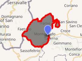
| |
 Montescudo Location of Montescudo in Italy 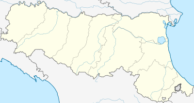 Montescudo Montescudo (Emilia-Romagna) | |
| Coordinates: 43°55′N 12°33′E | |
| Country | Italy |
| Region | Emilia-Romagna |
| Province | Rimini (RN) |
| Frazioni | Albereto, Santa Maria del Piano, Trarivi |
| Government | |
| • Mayor | Andrea Pula |
| Area | |
| • Total | 19.9 km2 (7.7 sq mi) |
| Elevation | 386 m (1,266 ft) |
| Population (31 May 2007) | |
| • Total | 2,841 |
| • Density | 140/km2 (370/sq mi) |
| Demonym(s) | Montescudesi |
| Time zone | UTC+1 (CET) |
| • Summer (DST) | UTC+2 (CEST) |
| Postal code | 47040 |
| Dialing code | 0541 |
| Patron saint | St. Sebastian |
| Saint day | January 20 |
| Website | Official website |
Montescudo borders the following municipalities: Coriano, Faetano (San Marino), Gemmano, Monte Colombo, Sassofeltrio.
History
Montescudo is most likely of Etruscan origin. In the Roman era it was a station of the military mail service from Rimini to Rome. In 1209 it was conquered by Emperor Otto I, and later was under the Republic of Venice. In the late Middle Ages, through a series of bloody struggles, it was contended by the House of Malatesta of Rimini and by the Dukes of Urbino. In 1509 it was ceded by the Republic of Venice to the Papal States.
On 1 January 2016 Montescudo merged Monte Colombo to form the new municipality of Montescudo-Monte Colombo.[2]
Main sights
- Civic Tower (14th century)
- Remains of the walls erected by Sigismondo Pandolfo Malatesta, as well as of a Rocca Malatestiana (castle).
- The Ghiacciaia, an ice reservoir dating from the Malatestian era.
- Remains of the 15th century church of Santa Maria Succurrente, in the frazione of Valliano.
References
- "Superficie di Comuni Province e Regioni italiane al 9 ottobre 2011". Istat. Retrieved 16 March 2019.
- Regione Emilia-Romagna, ed. (23 November 2015). "LEGGE REGIONALE 23 NOVEMBRE 2015, N.21 - Istituzione del Comune di Montescudo - Monte Colombo mediante fusione dei Comuni di Monte Colombo e Montescudo nella provincia di Rimini". Bollettino Ufficiale della Regione Emilia-Romagna (BURERT) (305).
External links