Montana Highway 3
Montana Highway 3 is a highway in central Montana extending north from Billings to Great Falls.[2][3]
| ||||
|---|---|---|---|---|
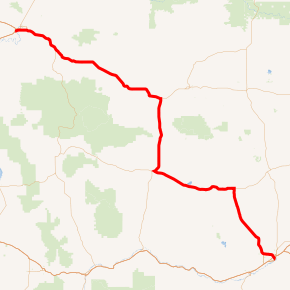
MT 3 highlighted in red | ||||
| Route information | ||||
| Maintained by MDT | ||||
| Length | 221.770 mi[1] (356.904 km) | |||
| Major junctions | ||||
| South end | ||||
| ||||
| North end | ||||
| Highway system | ||||
| ||||

Major intersections
| County | Location | mi | km | Destinations | Notes |
|---|---|---|---|---|---|
| Yellowstone | Billings | 0.000 | 0.000 | I-90 exit 450 | |
| 1.298 | 2.089 | One-way couplet | |||
| 1.369 | 2.203 | ||||
| 3.499 | 5.631 | Roundabout | |||
| Golden Valley | | 47.010 | 75.655 | Southern end of US 12 overlap | |
| Ryegate | 63.285 | 101.847 | |||
| Wheatland | Shawmut | 76.929 | 123.805 | ||
| | 92.188 | 148.362 | Northern end of US 12 overlap; southern end of US 191 overlap | ||
| Judith Gap | 109.990 | 177.012 | |||
| Fergus | Eddies Corner | 131.421 | 211.502 | Northern end of US 191 overlap; southern end of US 87 / MT 200 overlap | |
| Judith Basin | | 137.574 | 221.404 | ||
| Moccasin | 141.350 | 227.481 | |||
| | 146.367 | 235.555 | |||
| | 153.314 | 246.735 | |||
| | 159.419 | 256.560 | |||
| Geyser | 174.711 | 281.170 | |||
| | 185.591 | 298.680 | |||
| Cascade | Armington Junction | 196.118 | 315.621 | Southern end of US 89 overlap | |
| | 199.721 | 321.420 | |||
| | 212.577 | 342.110 | |||
| | 215.596 | 346.968 | |||
| Great Falls | 218.776 | 352.086 | Northern end of US 87 overlap | ||
| 219.429 | 353.137 | Southern end of I-15 Bus. overlap | |||
| 220.942 | 355.572 | Fox Farm Road / 6th Street Southwest | Southern end of I-315 overlap; southern end of freeway | ||
| 221.435 | 356.365 | 14th Street Southwest | I-315 exit 0 | ||
| | 221.770 | 356.904 | Northern end of I-315 / I-15 Bus. / US 89 / MT 200 overlap; I-15 exit 278 | ||
1.000 mi = 1.609 km; 1.000 km = 0.621 mi
| |||||
References
- "Montana Road Log" (PDF). Montana Department of Transportation. 2011. Retrieved September 14, 2011.
- "Montana Highway 3". Montana Code Annotated 2009. State of Montana. Retrieved 2011-09-13.
- Official 2009-2010 Montana Highway Travel Map (PDF) (Map). Montana Department of Transportation. Retrieved 2011-09-13.
This article is issued from Wikipedia. The text is licensed under Creative Commons - Attribution - Sharealike. Additional terms may apply for the media files.