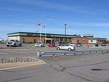
Mont-Joli Airport
Mont-Joli Airport (IATA: YYY, ICAO: CYYY) is located 1.5 nautical miles (2.8 km; 1.7 mi) north northwest of Mont-Joli, Quebec, Canada. It is the only airport with scheduled service in the Bas-Saint-Laurent region.
Mont-Joli Airport | |||||||||||||||
|---|---|---|---|---|---|---|---|---|---|---|---|---|---|---|---|
 | |||||||||||||||
| Summary | |||||||||||||||
| Airport type | Public | ||||||||||||||
| Operator | Régie Intermunicipale | ||||||||||||||
| Location | Mont-Joli, Quebec | ||||||||||||||
| Time zone | EST (UTC−05:00) | ||||||||||||||
| • Summer (DST) | EDT (UTC−04:00) | ||||||||||||||
| Elevation AMSL | 172 ft / 52 m | ||||||||||||||
| Coordinates | 48°36′32″N 068°12′29″W | ||||||||||||||
| Website | aeroportmontjoli.com | ||||||||||||||
| Map | |||||||||||||||
 CYYY Location in Quebec  CYYY CYYY (Canada) | |||||||||||||||
| Runways | |||||||||||||||
| |||||||||||||||
| Statistics (2010) | |||||||||||||||
| |||||||||||||||
History


World War II
In the summer of 1940 the Royal Canadian Air Force selected a flat area of farmland between Mont-Joli Station (on the Montreal-Halifax Canadian National Railway mainline) and the Saint Lawrence River for a military airfield. Construction on the aerodrome began in October 1941 and was completed by April 1942 at a cost of $200,000. Three paved runways and 50 buildings were constructed for what became known as RCAF Station Mont-Joli.
Inaugurated on April 15, 1942, RCAF Station Mont-Joli was a training base for the British Commonwealth Air Training Plan and hosted No. 9 Bombing and Gunnery School from 15 December 1941 until 14 April 1945.[4] RCAF Station Mont-Joli was used by RCAF Eastern Air Command during the Battle of the St. Lawrence as a coastal patrol base; during 1942–1944, Canadian cargo ships and warships were sunk by German U-boats in an effort to close the Saint Lawrence Seaway off to shipping. Aircraft staging out of Mont-Joli were among those used to ward off U-boats and ensure the safety of shipping to the eastern tip of the Gaspé Peninsula at Cap-Gaspé.
Aerodrome information
In approximately 1942 the aerodrome was listed at 48°36′N 68°12′W with a Var. 24 degrees W and elevation of 100 feet (30 m). The aerodrome was listed as with three runways as follows: [5]
| Runway Name | Length | Width | Surface |
|---|---|---|---|
| 6/24 | 5,000 feet (1,524 m) | 150 feet (46 m) | 4000' paved |
| 16/34 | 4,600 feet (1,402 m) | 150 feet (46 m) | 4000' paved |
| 2/20 | 5,000 feet (1,524 m) | 150 feet (46 m) | 4300' paved |
Post war (1945–1995)
RCAF Station Mont-Joli was decommissioned by the air force in 1945 and became the property of the Department of Transport (now Transport Canada) on December 15, 1945 for use as a civilian airport.
Current (1995–present)
Its ownership was transferred again in 1995 to the "Régie intermunicipale de l’aéroport régional de Mont-Joli". It is the busiest airport in eastern Quebec, though still very far from the Québec/Jean Lesage International Airport in Quebec City and Montréal-Pierre Elliott Trudeau International Airport in Montreal.
In 2007 a second runway (15/33) was opened and runway 06/24 decreased in length from 6,000 ft (1,829 m) to 5,000 ft (1,524 m). In 2017, runway 06/24 was once again extended to 6,000 ft (1,829 m), in order to accommodate the B737-800. Sunwing Airlines started flying that aircraft type from Mont-Joli to Punta Cana in December 2017.[6]
Airlines and destinations
| Airlines | Destinations |
|---|---|
| Air Canada Express | Baie-Comeau, Montreal–Trudeau |
| Air Inuit | Seasonal charter: Port-Menier, Quebec City, Montreal-Trudeau |
| Chrono Aviation | Seasonal charter: Port-Menier |
| PAL Airlines | Bagotville, Montreal–Trudeau, Wabush |
| Pascan Aviation | Bagotville, Îles-de-la-Madeleine, Montréal–Saint-Hubert, Quebec City, Sept-Îles, Wabush |
| Sunwing Airlines | Seasonal: Varadero |
References
- Canada Flight Supplement. Effective 0901Z 30 January 2020 to 0901Z 26 March 2020.
- Synoptic/Metstat Station Information
- Total aircraft movements by class of operation — NAV CANADA flight service stations
- Hatch, F. J. (1983). The Aerodrome of Democracy: Canada and the British Commonwealth Air Training Plan, 1939-1945. Ottawa: Directorate of History, Department of National Defence. ISBN 0660114437.
- Staff writer (c. 1942). Pilots Handbook of Aerodromes and Seaplane Bases Vol. 1. Royal Canadian Air Force. p. 70.
- aeroportmontjoli.com - The Airport
External links
| Wikimedia Commons has media related to Mont-Joli Airport. |
- Past three hours METARs, SPECI and current TAFs for Mont-Joli Airport from Nav Canada as available.
| By name | |
|---|---|
| By location indicator | |
| By province/territory | |
| By area | |
| National Airports System | |
| Related | |
| |