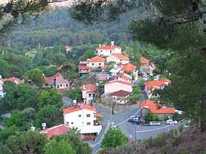
Moniatis
Moniatis (Greek: Μονιάτης, Turkish: Elmalı) is a village in the Limassol District of Cyprus, located 5 km southeast of Pano Platres. The villagers claim that it was named after its numerous "mantres" (sheepfold). Its 100 to 110-strong Turkish population was displaced as a result of the intercommunal violence in 1963, during which they fled the village to Limassol, and the Turkish invasion of Cyprus in 1974, after which they were transferred to the north.[2]
Moniatis Μονιάτης Elmalı | |
|---|---|
village | |
 | |
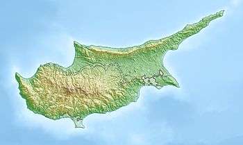 Moniatis Location in Cyprus | |
| Coordinates: 34°52′7″N 32°53′49″E | |
| Country | |
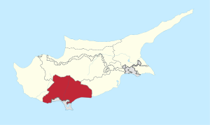
| District | Limassol District |
| Population (2001)[1] | |
| • Total | 227 |
| Time zone | UTC+2 (EET) |
| • Summer (DST) | UTC+3 (EEST) |
Climate
| Climate data for Saittas near Moniatis, elevation: 640 m (Satellite view) | |||||||||||||
|---|---|---|---|---|---|---|---|---|---|---|---|---|---|
| Month | Jan | Feb | Mar | Apr | May | Jun | Jul | Aug | Sep | Oct | Nov | Dec | Year |
| Average high °C (°F) | 13.6 (56.5) |
13.9 (57.0) |
17.1 (62.8) |
21.5 (70.7) |
27.0 (80.6) |
31.5 (88.7) |
34.6 (94.3) |
34.3 (93.7) |
31.2 (88.2) |
26.8 (80.2) |
20.2 (68.4) |
15.2 (59.4) |
23.9 (75.0) |
| Daily mean °C (°F) | 8.4 (47.1) |
8.5 (47.3) |
10.9 (51.6) |
14.8 (58.6) |
19.6 (67.3) |
23.8 (74.8) |
26.8 (80.2) |
26.5 (79.7) |
23.4 (74.1) |
19.7 (67.5) |
14.1 (57.4) |
10.0 (50.0) |
17.2 (63.0) |
| Average low °C (°F) | 3.2 (37.8) |
3.1 (37.6) |
4.7 (40.5) |
8.0 (46.4) |
12.2 (54.0) |
16.1 (61.0) |
18.9 (66.0) |
18.7 (65.7) |
15.7 (60.3) |
12.5 (54.5) |
8.1 (46.6) |
4.7 (40.5) |
10.5 (50.9) |
| Average precipitation mm (inches) | 117.6 (4.63) |
89.0 (3.50) |
70.3 (2.77) |
38.4 (1.51) |
20.1 (0.79) |
27.2 (1.07) |
4.9 (0.19) |
10.3 (0.41) |
11.7 (0.46) |
25.7 (1.01) |
93.9 (3.70) |
144.0 (5.67) |
653.2 (25.72) |
| Average precipitation days (≥ 1 mm) | 10.3 | 9.1 | 8.4 | 5.5 | 2.7 | 2.1 | 0.7 | 1.1 | 1.4 | 3.3 | 7.0 | 9.2 | 60.9 |
| Mean monthly sunshine hours | 142.6 | 168.2 | 213.9 | 261.0 | 310.0 | 351.0 | 362.7 | 347.2 | 300.0 | 248.0 | 165.0 | 124.0 | 2,993.6 |
| Source: Meteorological Service (Cyprus)[3] | |||||||||||||
References
- Census 2001
- "Moniatis". Prio Cyprus Centre. Retrieved 15 August 2015.
- "Meteorological Service - Climatological and Meteorological Reports".
This article is issued from Wikipedia. The text is licensed under Creative Commons - Attribution - Sharealike. Additional terms may apply for the media files.