Moncoutant-sur-Sèvre
Moncoutant-sur-Sèvre is a commune in the Deux-Sèvres department in western France. It was established on 1 January 2019 by merger of the former communes of Moncoutant (the seat), Le Breuil-Bernard, La Chapelle-Saint-Étienne, Moutiers-sous-Chantemerle, Pugny and Saint-Jouin-de-Milly.[1]
Moncoutant-sur-Sèvre | |
|---|---|
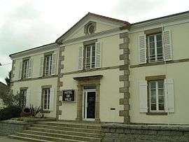 The town hall in Moncoutant | |
Location of Moncoutant-sur-Sèvre 
| |
 Moncoutant-sur-Sèvre  Moncoutant-sur-Sèvre | |
| Coordinates: 46°43′28″N 0°35′15″W | |
| Country | France |
| Region | Nouvelle-Aquitaine |
| Department | Deux-Sèvres |
| Arrondissement | Bressuire |
| Canton | Cerizay |
| Intercommunality | Bocage Bressuirais |
| Area 1 | 92.78 km2 (35.82 sq mi) |
| Population (2016) | 5,041 |
| • Density | 54/km2 (140/sq mi) |
| Time zone | UTC+01:00 (CET) |
| • Summer (DST) | UTC+02:00 (CEST) |
| INSEE/Postal code | 79179 /79320 |
| Elevation | 153–247 m (502–810 ft) |
| 1 French Land Register data, which excludes lakes, ponds, glaciers > 1 km2 (0.386 sq mi or 247 acres) and river estuaries. | |
References
- Arrêté préfectoral 23 November 2018 (in French)
| Wikimedia Commons has media related to Moncoutant-sur-Sèvre. |
This article is issued from Wikipedia. The text is licensed under Creative Commons - Attribution - Sharealike. Additional terms may apply for the media files.