Monashee Pass
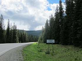
Monashee Pass, 1,189 m (3,901 ft),[1] is a mountain pass in the Monashee Mountains of the Southern Interior of British Columbia. Located southeast of Cherryville, the pass is used by British Columbia Highway 6 connecting Vernon to Nakusp on Arrow Lake, and beyond to the cities of the West Kootenay. It is the "prominence col" for Big White Mountain, which is the highest mountain to its southwest.
| Monashee Pass | |
|---|---|
 | |
| Elevation | 1,189 m (3,901 ft) |
| Traversed by | |
| Location | British Columbia, Canada |
| Range | Monashee Mountains |
References
- Infrastructure, Ministry of Transportation and. "Elevations of Major Summits & Passes on B.C. Highways - Province of British Columbia". www2.gov.bc.ca. Retrieved 2018-09-07.
This article is issued from Wikipedia. The text is licensed under Creative Commons - Attribution - Sharealike. Additional terms may apply for the media files.