Mobara
Mobara (茂原市, Mobara-shi) is a city located in Chiba Prefecture[1], Japan.
Mobara 茂原市 | |
|---|---|
 Mobara City Hall | |
 Flag  Emblem | |
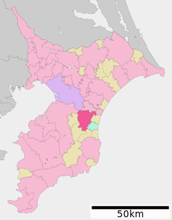 Location of Mobara in Chiba Prefecture | |
 Mobara | |
| Coordinates: 35°25′42.7″N 140°17′17″E | |
| Country | Japan |
| Region | Kantō |
| Prefecture | Chiba Prefecture |
| Area | |
| • Total | 99.92 km2 (38.58 sq mi) |
| Population (December 1, 2015) | |
| • Total | 89,655 |
| • Density | 897/km2 (2,320/sq mi) |
| Time zone | UTC+9 (Japan Standard Time) |
| - Tree | Azalea |
| - Flower | Cosmos |
| Phone number | 0475-33-2111 |
| Address | 1 Dōbyō, Mobara-shi, Chiba-ken 297-8511 |
| Website | http://www.city.mobara.chiba.jp/ |
As of December 1, 2015, the city had an estimated population of 89,655, and a population density of 897 persons per km². The total area is 99.92 square kilometres (38.58 sq mi).
Geography
Mobara is located in an inland area of north-central Bōsō Peninsula. The elevation is low, ranging from 8–9 meters in the east, and rising to 100 meters in the west. Its proximity to the Pacific Ocean together with warming effects of the Kuroshio Current, give the area a mild maritime climate, with hot, humid summers and cool, mild winters.
Surrounding municipalities
Chiba Prefecture
- Midori-ku, Chiba
- Ichihara
- Nagara
- Chōnan
- Shirako
- Ōamishirasato
History
Pre-history
Mobara was settled from the earliest times, as evidenced by archaeological sites and shell mounds dating from the Jōmon period and Yayoi periods. The city also has examples of kofun, or burial tombs, from the Kofun period.
Early history
Mobara was the location of at least two shōen estates, the Mobara-sō and the Tachibana-sō, in the Heian period. At the beginning of the Edo period, in 1591, an extensive land survey was carried out by the Tokugawa clan.
Modern history
The modern town of Mobara was created during the early Meiji period-cadastral reforms in the Chōsei District. Numerous small villages were brought together to form the present-day city of Mobara.
The Bōsō Tetsudo, now the JR Sotobō Line, was established in 1897 between Ichinomiya and Ōami Station in present-day Ōamishirasato. Mobara Station was one station established on the line, thus connecting Mobara to the wider rail network. In 1909 a handcar system ran from Mobara Station and Chōnan. The handcar railroad was constructed and operated by the prefecture.
World War II
A base for the 252 Air Group of the Imperial Japanese Navy (IJN), a fighter aircraft unit, was established in Mobara[2]. In 1941, by order of the IJN, 100 residences and their associated farmland, schools, town halls, police substations, temples, and shrines were forcibly confiscated without warning to build the base. Mobara Airfield was completed using a kinrō dōin group that consisted of the forced labor of Korean residents in Japan and students from Chōsei Middle School students in 1943. The airfield was located on the east banks of the small Aku River, directly to the east of Mobara Station along the present-day JR East Sotobō Line, and consisted of a runway and 20 structures, some of them concealed underground. Tokubetsu kōgekitai, or kamikaze units, were sent from Mobara Airfield to the IJN Kokubu Air Corps in present-day Kirishima, Kagoshima Prefecture to attack American forces off Okinawa. The United States confiscated the airfield shortly after the surrender of Japan in 1945. Remains of the runway, approximately ten airfield structures, and a tunnel are now on the property of the Mitsui Chemicals.[3][4]
Post-war history
At the end of World War II, the 113th Cavalry Regiment of the United States Army occupied the Mobara Airfield. The Japan Self-Defense Forces attempted to confiscate base in 1954, but after organized efforts by residents, agricultural organizations, the town and prefectural governments, the plans were abandoned the following year. The site was used to build Mobara Middle School for the rapidly expanding population of the town.[3] On April 1, 1952, Mobara expanded by annexation of neighboring villages of Tōgō, Toyoda, Ninomiya-Hongō, Tsurue, and Gogō and was elevated to city status. On May 1, 1972, Mobara merged with the neighboring town of Honnō. On December 11, 1990, the city was hit by an F-3 tornado, which killed one person, injured 78, and damaged or destroyed 1,747 homes in the city.[5]
Economy
Mobara serves as a regional commerce center for surrounding Chōsei District. The economy of Mobara is dominated by electronics manufacturing. Futaba Corporation, a major manufacturer of radio control models and toys, is headquartered in Mobara.[6] Natural gas production is also important to the city; Kanto Natural Gas Development Co., Ltd. and Otaki Gas Co., Ltd. have headquarters here. Chemical production, centered on Mitsui Chemicals, is the largest producer of iodine in Japan. 40% of the total world production of iodine is produced in Mobara. Much land in Mobara is still used for rice production. Additionally, negi, or the ubiquitous Welsh onion of Japanese cuisine, is an important agricultural product.
Transportation
Railway
- JR East - Sotobō Line
- Honnō - Shin-Mobara - Mobara
Local attractions
- Tachibana Jinja - a Shintō shrine connected with the Yamatotakeru mythology, the ninomiya of Kazusa Province
- Nyoirin-ji - a Nichiren Buddhist temple
Tanabata festival
A popular annual event in Mobara is the Tanabata festival, during which a wide array of stalls and parades dominate much of the city's central shopping district. While the rest of Japan usually celebrates Tanabata on July 7, the Mobara festival is held in late July so as to coincide with school holidays.
Sister city relations
.svg.png)
Notable people from Mobara
- Naoki Kawano - actor and musician
- Ishii Kikujirō - prewar diplomat and cabinet minister
- Michitaka Kobayashi - voice actor
- Yuko Ogura - gravure idol
- Yōko Shōji - manga artist
References
- "Mobara-shi". Nihon Rekishi Chimei Taikei (日本歴史地名大系 “Compendium of Japanese Historical Place Names”). Tokyo: Netto Adobansusha. 2011. Archived from the original on 2007-08-25. Retrieved 2011-10-19.
- Associated, Press (26 May 2019). "Donald Trump plays down North Korean missile tests - and appreciates Kim Jong-un's attack on Joe Biden". The Telegraph. Retrieved 20 September 2019.
- INADA, HIROKAZU (30 August 2019). "Man searches in Chiba for crash sites of Japanese warplanes". The Asahi Shimbun. Retrieved 20 September 2019.
- Imao, Keisuke (2011). Chizu de yomu sensō no jidai: egakareta Nihon, egakarenakatta Nihon (in Japanese). Tokyo: Hakusuisha. p. 240. ISBN 9784560081181. OCLC 709666060.
- "414: Sensō no hi no 1945-nen 8-gatsu 15-nichi gozen [...]". Retrieved 2012-05-22.
- "1990/12/11 19:13 千葉県茂原市で発生した竜巻" (in Japanese). Tokyo: Japan Meteorological Agency. Retrieved 2012-05-21.
- "Network." Futaba Corporation. Retrieved on 2015-03-29.
- "International Exchange". List of Affiliation Partners within Prefectures. Council of Local Authorities for International Relations (CLAIR). Archived from the original on 4 March 2016. Retrieved 21 November 2015.
External links
![]()
- Official Website (in Japanese)
Chiba (capital) | ||
| Wards of Chiba | ||
| Core cities |
| |
| Cities | ||
| Districts | ||
| Authority control |
|
|---|