Mitre Peak (New Zealand)
Mitre Peak (Māori Rahotu) is a mountain in the South Island of New Zealand, located on the shore of Milford Sound. It is one of the most photographed peaks in the country.
| Mitre Peak | |
|---|---|
 Mitre Peak, Milford Sound | |
| Highest point | |
| Elevation | 1,683 m (5,522 ft) [1] |
| Parent peak | Aoraki / Mount Cook |
| Coordinates | 44°37′57″S 167°51′22″E [1] |
| Geography | |
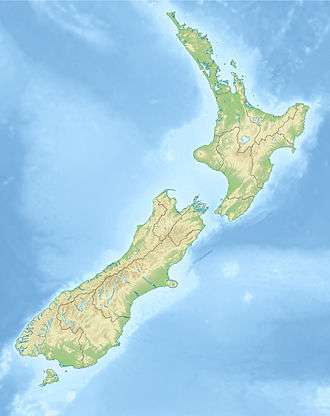 Mitre Peak South Island, New Zealand | |
Etymology
The distinctive shape of the peak in southern New Zealand gives the mountain its name, after the mitre headwear of Christian bishops. It was named by Captain John Lort Stokes of HMS Acheron.[2] The Māori name for the peak is Rahotu.[3]
Geography
Part of the reason for its iconic status is its location. Close to the shore of Milford Sound, in the Fiordland National Park in the southwestern South Island, it is a stunning sight.[4] The mountain rises near vertically to 5,560 feet (1,690 m), i.e. just over a mile, from the water of Milford Sound, which technically is a fjord.
The peak is actually a closely grouped set of five peaks, with Mitre Peak not even the tallest one, however from most easily accessible viewpoints, Mitre Peak appears as a single point.[4] Milford Sound is part of Te Wahipounamu, a World Heritage Site as declared by UNESCO.[5]
The only road access to Milford Sound is via State Highway 94, in itself one of the most scenic roads in New Zealand.[6]
Climbing
Mitre Peak is difficult to reach and as a result ascent attempts are relatively infrequent.[3]
The first known attempt of the peak was in 1883 by Invercargill artist Samuel Mereton, and Donald Sutherland. The pair took a boat to Sinbad Bay on 6 February and camped at the head of the valley. The next day with little equipment, no coats and one biscuit each they climbed to the crest of the Mitre Range, from where they could see Mitre Peak over 3 km away to the east. With it being too late in the day to descend, they were forced to sleep where they were overnight, before the next day abandoning the attempt to avoid an approaching storm. After a difficult descent they were forced to sit out two more days in bad weather at the head of Sinbad Gully before rowing back across Milford Sound to the hotel operated by Sunderland's wife.[7][8]
In 1911, Jim Dennistoun walked in to Milford Sound from Lake Te Anau over Mackinnon Pass, and inquired among the track porters in the hope of finding someone to climb the peak with him. None of the porters had any climbing experience, but one of them, Joe Beaglehole (1875–1962), had read Scrambles among the Alps by noted climber Edward Whymper and was thus chosen by Dennistoun to accompany him.[7]
During a sea voyage in the area with brother George in HMS Pioneer in 1909 Dennistoun had identified what he thought was a possible route but as he wasn't able to reconnoitre it he instead decided to take a route recommended by Donald Sutherland.
After rowing across in a boat to the mouth of Sinbad Gully at the base of the peak they starting climbing at 7.30am on 13 March 1911.[9] Dennistoun and Beaglehole climbed via the south east-ridge through the bush until 300 metres short of the summit Beaglehole decided it was too difficult to continue and stopped. Dennistoun continued on alone up steep, smooth slabs of granite, to reach the summit at 1.15pm.[10]
Descending back down Dennistoun rejoined Beaglehole and they continued with the descent. Unfortunately to avoid climbing back over the Footstool, they decided to descend straight into Sinbad Gully, which meant they had to resort to using a rope to lower themselves down bluffs. They eventually reached the valley floor in darkness, and it soon commenced to rain.[7] With no camping equipment, they had no choice but to continue on until they reached the boat at 9.45pm, cold, wet and exhausted.[10] They then rowed back across to spend the night at the hotel operated by Elizabeth Sunderland.[10]
Dennistoun's claim to have reached the top was disputed by Donald Sutherland who had bluntly claimed that Mitre Peak could not be climbed. In 1914 Dennistoun's handkerchief was found in a small cairn on the top of the peak by Jack Murrell (1886–1918) and Edger Williams (1891–1983) when they completed the second ascent of the peak.[11] When J.H. Christie and G. Raymond completed the third ascent in 1941 they found remains of the handkerchief, as well as two halfpennies left by Murrell and Williams.[10]
Notes
![]()
- "Mitre Peak, Southland – NZ Topo Map". NZ Topo Map. Land Information New Zealand. Retrieved 4 September 2017.
- Reed, A. W. (2010). Peter Dowling (ed.). Place Names of New Zealand. Rosedale, North Shore: Raupo. p. 255. ISBN 9780143204107.CS1 maint: ref=harv (link)
- Sinclair, Roy (27 October 2014). "The 'magnificent' Mitre Peak: More popular than Aoraki/Mt Cook". The Press. Retrieved 21 January 2015.
- McLintock, A. H., ed. (22 April 2009) [First published in 1966]. "Mitre Peak". An Encyclopaedia of New Zealand. Ministry for Culture and Heritage / Te Manatū Taonga. Retrieved 13 January 2015.
- "Te Wahipounamu – South West New Zealand". UNESCO. Retrieved 21 January 2015.
- "Driving to Milford Sound?" (PDF). Transit New Zealand. Retrieved 21 January 2015.
- Hegg, Danilo (25 April 2015). "Mitre Peak / Rahotu, 1683m". Tramping and Climbing in Aotearoa. Retrieved 21 February 2018.
- "The 'magnificent' Mitre Peak". Geographic Names. 27 October 2014. Retrieved 23 February 2018.
- "First ascents and explorations in the Te Anau – Milford District", The New Zealand Alpine Journal, Berlin: New Zealand Alpine Club, IV (18): 150, 1931
- Hall-Jones, page 167.
- Ede, page 26.
- "Mitre Pk". Climb NZ. Retrieved 21 January 2015.
References
- Ede, Jock (1988). Mountain Men of Milford (Hardback)
|format=requires|url=(help). Christchurch: Jack Ede. ISBN 0-473-00682-0. - Hall-Jones, John (1968). Early Fiordland (Hardback)
|format=requires|url=(help). Wellington: A.H. & A.W. Reed.