Milberger, Kansas
Milberger is an unincorporated community in Lincoln Township, Russell County, Kansas, United States.[2] It is located about 10.5 miles south of Russell.
Milberger, Kansas | |
|---|---|
 KDOT map of Russell County (legend) | |
 Milberger  Milberger | |
| Coordinates: 38°42′43″N 98°54′44″W | |
| Country | United States |
| State | Kansas |
| County | Russell |
| Founded | 1884 |
| Elevation | 1,854 ft (565 m) |
| Time zone | UTC-6 (CST) |
| • Summer (DST) | UTC-5 (CDT) |
| ZIP code | 67665 |
| Area code | 620 |
| FIPS code | 46475 |
| GNIS ID | 475411 [1] |
History
Volga German colonists founded Milberger in 1884. Predominantly Lutheran, they established several churches in and around the community, most of which closed by 1980.[3][4] A rural post office operated in Milberger from 1903 to 1911.[5]
Geography
Milberger is located at 38°42′43″N 98°54′44″W (38.7119562, -98.9123098) at an elevation of 1,854 feet (565 m).[1] It lies on the west side of Landon Creek roughly 4.5 miles (7 km) south of the Smoky Hill River in the Smoky Hills region of the Great Plains.[6][7] Milberger is approximately 3.5 miles (6 km) west of U.S. Route 281, 10.5 miles (17 km) south of Interstate 70, and 12 miles (20 km) south-southwest of Russell, the county seat.[7]
Transportation
Milberger lies at the intersection of 182nd Street, a paved county road which runs north-south, and Michaelis Road, an unpaved county road which runs east-west.[7][8]
References
- "US Board on Geographic Names". United States Geological Survey. 2007-10-25. Retrieved 2008-01-31.
- "General Highway Map - Russell County, Kansas" (PDF). Kansas Department of Transportation. 1975. Retrieved 2010-12-12.
- Keel, William D. (2006). "Deitsch, Däätsch, Düütsch, and Dietsch: The Varieties of Kansas German Dialects after 150 Years of German Group Settlement in Kansas". University of Kansas. Retrieved 2010-08-15.
- Bauer, Reuben A. (2004). "German Hymns Heard Again". Archived from the original on 2011-06-22. Retrieved 2010-08-15.
- "Post Offices in Kansas". Kansas State Historical Society. Retrieved 2010-08-15.
- "2003-2004 Official Transportation Map" (PDF). Kansas Department of Transportation. 2003. Retrieved 2010-12-12.
- "General Highway Map - Russell County, Kansas" (PDF). Kansas Department of Transportation. 2010-10-01. Retrieved 2010-12-12.
- "Milberger, KS 67665". Google Maps. Retrieved 2010-12-12.
Further reading
External links
Municipalities and communities of Russell County, Kansas, United States | ||
|---|---|---|
| Cities | 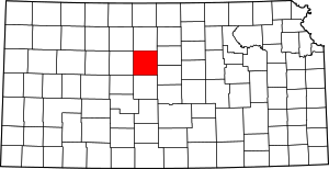 Map of Kansas highlighting Russell County | |
| Unincorporated communities | ||
| Ghost towns | ||
| Townships | ||
| Footnotes | ‡This populated place also has portions in an adjacent county or counties | |