Midland, Arkansas
Midland is a town in Sebastian County, Arkansas, United States. It is part of the Fort Smith, Arkansas-Oklahoma Metropolitan Statistical Area. The population was 325 at the 2010 census.
Midland, Arkansas | |
|---|---|
 Location of Midland in Sebastian County, Arkansas. | |
| Coordinates: 35°5′33″N 94°21′12″W | |
| Country | United States |
| State | Arkansas |
| County | Sebastian |
| Area | |
| • Total | 0.35 sq mi (0.91 km2) |
| • Land | 0.35 sq mi (0.90 km2) |
| • Water | 0.01 sq mi (0.01 km2) |
| Elevation | 545 ft (166 m) |
| Population (2010) | |
| • Total | 325 |
| • Estimate (2017)[2] | 334 |
| • Density | 965.32/sq mi (372.80/km2) |
| Time zone | UTC-6 (Central (CST)) |
| • Summer (DST) | UTC-5 (CDT) |
| ZIP code | 72945 |
| Area code(s) | 479 |
| FIPS code | 05-45500 |
| GNIS feature ID | 0072643 |
Geography
Midland is located at 35°5′33″N 94°21′12″W (35.092455, -94.353307).[3]
According to the United States Census Bureau, the town has a total area of 0.9 km² (0.3 mi²), of which 0.8 km² (0.3 mi²) is land and 0.1 km² (0.04 mi²) (8.82%) is water.
Demographics
| Historical population | |||
|---|---|---|---|
| Census | Pop. | %± | |
| 1910 | 639 | — | |
| 1920 | 787 | 23.2% | |
| 1930 | 373 | −52.6% | |
| 1940 | 560 | 50.1% | |
| 1950 | 356 | −36.4% | |
| 1960 | 261 | −26.7% | |
| 1970 | 294 | 12.6% | |
| 1980 | 286 | −2.7% | |
| 1990 | 220 | −23.1% | |
| 2000 | 253 | 15.0% | |
| 2010 | 325 | 28.5% | |
| Est. 2017 | 334 | [2] | 2.8% |
| U.S. Decennial Census[4] | |||
As of the census[5] of 2000, there were 253 people, 96 households, and 72 families residing in the town. The population density was 305.3/km² (795.7/mi²). There were 113 housing units at an average density of 136.3/km² (355.4/mi²). The racial makeup of the town was 96.44% White, 0.40% Black or African American, 1.19% Native American, and 1.98% from two or more races. 1.98% of the population were Hispanic or Latino of any race.
There were 96 households out of which 38.5% had children under the age of 18 living with them, 63.5% were married couples living together, 9.4% had a female householder with no husband present, and 24.0% were non-families. 20.8% of all households were made up of individuals and 14.6% had someone living alone who was 65 years of age or older. The average household size was 2.64 and the average family size was 3.08.
In the town, the population was spread out with 28.1% under the age of 18, 9.9% from 18 to 24, 25.3% from 25 to 44, 21.3% from 45 to 64, and 15.4% who were 65 years of age or older. The median age was 35 years. For every 100 females, there were 102.4 males. For every 100 females age 18 and over, there were 93.6 males.
The median income for a household in the town was $25,313, and the median income for a family was $28,500. Males had a median income of $24,688 versus $19,500 for females. The per capita income for the town was $13,552. About 13.2% of families and 14.1% of the population were below the poverty line, including 9.5% of those under the age of eighteen and 16.2% of those sixty five or over.
References
- "2017 U.S. Gazetteer Files". United States Census Bureau. Retrieved Aug 22, 2018.
- "Population and Housing Unit Estimates". Retrieved March 24, 2018.
- "US Gazetteer files: 2010, 2000, and 1990". United States Census Bureau. 2011-02-12. Retrieved 2011-04-23.
- "Census of Population and Housing". Census.gov. Retrieved June 4, 2015.
- "U.S. Census website". United States Census Bureau. Retrieved 2008-01-31.
Municipalities and communities of Sebastian County, Arkansas, United States | ||
|---|---|---|
| Cities | 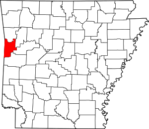 Map of Arkansas highlighting Sebastian County | |
| Towns | ||
| Unincorporated communities | ||
| Footnotes | ‡This populated place also has portions in an adjacent county or counties | |