Mexican Federal Highway 119
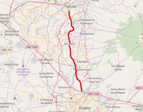
Federal Highway 119 (Carretera Federal 119) is a Federal Highway of Mexico.[3] Federal Highway 119 is split into two segments: the first segment travels from Tejocotal, Hidalgo in the north to Apizaco, Tlaxcala in the south. The second segment travels from Tlaxcala City in the north to Puebla City in the south.
| ||||
|---|---|---|---|---|
| Carretera Federal 119 | ||||
 | ||||
| Route information | ||||
| Maintained by Secretariat of Communications and Transportation | ||||
| Length | 146.37 km (90.95 mi) | |||
| North segment | ||||
| Length | 113.15 km[1] (70.31 mi) | |||
| North end | ||||
| South end | ||||
| South segment | ||||
| Length | 33.22 km[2] (20.64 mi) | |||
| North end | Tlaxcala City | |||
| South end | ||||
| Highway system | ||||
| Mexican Federal Highways List • Autopistas
| ||||

References
- "Datos Viales de Puebla" (PDF) (in Spanish). Dirección General de Servicios Técnicos, Secretaría de Comunicaciones y Transportes. 2011. p. 4. Archived from the original (PDF) on 2012-05-14. Retrieved 2012-03-04.
- "Datos Viales de Puebla" (PDF) (in Spanish). Dirección General de Servicios Técnicos, Secretaría de Comunicaciones y Transportes. 2011. p. 9. Archived from the original (PDF) on 2012-05-14. Retrieved 2012-03-04.
- "Mapa Nacional de Comunicaciones y Transportes" (PDF). Secretaría de Comunicaciones y Transportes de Mexico. Archived from the original (PDF) on January 26, 2009. Retrieved December 11, 2008.
| Highways |
|
|---|---|
| Toll roads | |
| Former highways |
|
| Unumbered Highways |
|
This article is issued from Wikipedia. The text is licensed under Creative Commons - Attribution - Sharealike. Additional terms may apply for the media files.