Metz, Missouri
Metz is a village in Vernon County, Missouri, United States. The population was 49 at the 2010 census, at which time it was a town.
Metz, Missouri | |
|---|---|
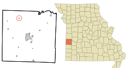 Location of Metz, Missouri | |
| Coordinates: 37°59′49″N 94°26′37″W | |
| Country | United States |
| State | Missouri |
| County | Vernon |
| Area | |
| • Total | 0.13 sq mi (0.34 km2) |
| • Land | 0.13 sq mi (0.34 km2) |
| • Water | 0 sq mi (0 km2) |
| Elevation | 787 ft (240 m) |
| Population | |
| • Total | 49 |
| • Estimate (2016)[3] | 48 |
| • Density | 380/sq mi (140/km2) |
| Time zone | UTC-6 (Central (CST)) |
| • Summer (DST) | UTC-5 (CDT) |
| ZIP code | 64765 |
| Area code(s) | 417 |
| FIPS code | 29-47612[4] |
| GNIS feature ID | 0729928[5] |
History
A post office called Metz has been in operation since 1870.[6] Metz was moved to its present site in the 19th century when railroad construction bypassed the original town site.[7] The village's name commemorates the Siege of Metz (1870).[8] An early variant name was "Pleasant Valley".[9]
Geography
Metz is located at 37°59′49″N 94°26′37″W (37.996913, -94.443746).[10]
According to the United States Census Bureau, the village has a total area of 0.13 square miles (0.34 km2), all land.[1]
Demographics
| Historical population | |||
|---|---|---|---|
| Census | Pop. | %± | |
| 1900 | 159 | — | |
| 1910 | 240 | 50.9% | |
| 1920 | 210 | −12.5% | |
| 1930 | 185 | −11.9% | |
| 1940 | 223 | 20.5% | |
| 1950 | 178 | −20.2% | |
| 1960 | 137 | −23.0% | |
| 1970 | 120 | −12.4% | |
| 1980 | 136 | 13.3% | |
| 1990 | 91 | −33.1% | |
| 2000 | 67 | −26.4% | |
| 2010 | 49 | −26.9% | |
| Est. 2016 | 48 | [3] | −2.0% |
| U.S. Decennial Census[11] | |||
As of 2000 the median income for a household in the town was $9,063, and the median income for a family was $18,000. Males had a median income of $18,750 versus $10,417 for females. The per capita income for the town was $6,940. There were 33.3% of families and 41.8% of the population living below the poverty line, including 44.4% of under eighteens and 41.7% of those over 64.
2010 census
As of the census[2] of 2010, there were 49 people, 22 households, and 15 families residing in the village. The population density was 376.9 inhabitants per square mile (145.5/km2). There were 31 housing units at an average density of 238.5 per square mile (92.1/km2). The racial makeup of the village was 93.9% White and 6.1% Native American.
There were 22 households of which 27.3% had children under the age of 18 living with them, 50.0% were married couples living together, 9.1% had a female householder with no husband present, 9.1% had a male householder with no wife present, and 31.8% were non-families. 31.8% of all households were made up of individuals and 9.1% had someone living alone who was 65 years of age or older. The average household size was 2.23 and the average family size was 2.80.
The median age in the village was 44.5 years. 22.4% of residents were under the age of 18; 14.3% were between the ages of 18 and 24; 14.2% were from 25 to 44; 32.6% were from 45 to 64; and 16.3% were 65 years of age or older. The gender makeup of the village was 55.1% male and 44.9% female.
References
- "US Gazetteer files 2010". United States Census Bureau. Archived from the original on 2012-01-25. Retrieved 2012-07-08.
- "U.S. Census website". United States Census Bureau. Retrieved 2012-07-08.
- "Population and Housing Unit Estimates". Retrieved June 9, 2017.
- "U.S. Census website". United States Census Bureau. Retrieved 2008-01-31.
- "US Board on Geographic Names". United States Geological Survey. 2007-10-25. Retrieved 2008-01-31.
- "Vernon County". Jim Forte Postal History. Retrieved 14 April 2015.
- "The Nevada Daily Mail". May 11, 1960. p. 8. Retrieved 3 May 2015.
- "Area towns approaching 100". The Nevada Daily Mail. Aug 14, 1970. p. 10. Retrieved 28 October 2015.
- "Vernon County Place Names, 1928–1945". The State Historical Society of Missouri. Archived from the original on June 24, 2016. Retrieved December 29, 2016.
- "US Gazetteer files: 2010, 2000, and 1990". United States Census Bureau. 2011-02-12. Retrieved 2011-04-23.
- "Census of Population and Housing". Census.gov. Retrieved June 4, 2015.
Municipalities and communities of Vernon County, Missouri, United States | ||
|---|---|---|
| Cities |  Map of Missouri highlighting Vernon County | |
| Villages | ||
| Townships | ||
| Unincorporated communities | ||
| Ghost towns | ||
| Footnotes | ‡This populated place also has portions in an adjacent county or counties | |
| Authority control |
|
|---|