McKenzie, Tennessee
McKenzie is a city at the tripoint of Carroll, Henry, and Weakley counties in Tennessee, United States. The population was 5,310 at the 2010 census.[5]
McKenzie, Tennessee | |
|---|---|
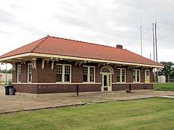 The McKenzie Depot, September 2014 | |
| Motto(s): This is your town... | |
 Location of McKenzie in Weakley County, Tennessee. | |
| Coordinates: 36°7′59″N 88°31′2″W | |
| Country | United States |
| State | Tennessee |
| Counties | Carroll, Weakley, Henry |
| Incorporated | 1869 |
| Government | |
| • Mayor | Jill Holland |
| • Vice Mayor | Gene Hale |
| Area | |
| • Total | 6.32 sq mi (16.37 km2) |
| • Land | 6.32 sq mi (16.37 km2) |
| • Water | 0.00 sq mi (0.00 km2) |
| Elevation | 495 ft (150 m) |
| Population (2010) | |
| • Total | 5,310 |
| • Estimate (2018)[2] | 5,480 |
| • Density | 867.09/sq mi (334.79/km2) |
| Time zone | UTC-6 (Central (CST)) |
| • Summer (DST) | UTC-5 (CDT) |
| ZIP code | 38201 |
| Area code(s) | 731 |
| FIPS code | 47-44940[3] |
| GNIS feature ID | 1326832[4] |
| Website | www |
It is home to Bethel University and the Tennessee College of Applied Technology at McKenzie.
Geography
McKenzie is located in northern Carroll County at 36°7′59″N 88°31′2″W (36.133189, -88.517189).[6] A small part of the city extends north into Henry County, and a smaller part extends west into Weakley County. U.S. Route 79 passes through the city southeast of the center, leading northeast 17 miles (27 km) to Paris and southwest 20 miles (32 km) to Milan. Tennessee State Route 22 runs through the east side of the city as a bypass, leading northwest 25 miles (40 km) to Martin and southeast 10 miles (16 km) to Huntingdon.
According to the United States Census Bureau, McKenzie has a total area of 6.3 square miles (16.2 km2), all land.[5]
Demographics
| Historical population | |||
|---|---|---|---|
| Census | Pop. | %± | |
| 1890 | 1,166 | — | |
| 1900 | 1,266 | 8.6% | |
| 1910 | 1,322 | 4.4% | |
| 1920 | 1,630 | 23.3% | |
| 1930 | 1,858 | 14.0% | |
| 1940 | 2,019 | 8.7% | |
| 1950 | 3,774 | 86.9% | |
| 1960 | 3,780 | 0.2% | |
| 1970 | 4,873 | 28.9% | |
| 1980 | 5,405 | 10.9% | |
| 1990 | 5,168 | −4.4% | |
| 2000 | 5,295 | 2.5% | |
| 2010 | 5,310 | 0.3% | |
| Est. 2018 | 5,480 | [2] | 3.2% |
| Sources:[7][8] | |||
At the 2000 census there were 5,295 people in 2,131 households, including 1,412 families, in the city. The population density was 957.9 people per square mile (369.7/km²). There were 2,382 housing units at an average density of 430.9 per square mile (166.3/km²). The racial makeup of the city was 82.80% White, 14.24% African American, 0.11% Native American, 0.34% Asian, 0.02% Pacific Islander, 0.79% from other races, and 1.70% from two or more races. Hispanic or Latino of any race were 2.15%.[3]
Of the 2,131 households 28.4% had children under the age of 18 living with them, 47.4% were married couples living together, 15.6% had a female householder with no husband present, and 33.7% were non-families. 29.8% of households were one person and 14.6% were one person aged 65 or older. The average household size was 2.31 and the average family size was 2.85.
The age distribution was 21.8% under the age of 18, 12.4% from 18 to 24, 24.2% from 25 to 44, 22.8% from 45 to 64, and 18.8% 65 or older. The median age was 38 years. For every 100 females, there were 88.7 males. For every 100 females age 18 and over, there were 85.7 males.
The median household income was $28,319 and the median family income was $34,322. Males had a median income of $26,038 versus $19,090 for females. The per capita income for the city was $18,723. About 10.4% of families and 13.4% of the population were below the poverty line, including 19.1% of those under age 18 and 9.9% of those age 65 or over.
Media
Radio
- WRQR-FM 105.5 "Today's Best Music with Ace & TJ in the Morning"
- WTPR-AM 710 "The Greatest Hits of All Time"
- WTPR-FM 101.7 "The Greatest Hits of All Time"
- WLLI AM 1390 FM 105.3 & 94.3 "The Mike Slater Show" 6am-9am
- WHDM 1440-AM 98.9-FM
Newspapers
- The McKenzie Banner
- Tennessee Magnet Publications
- Carroll County News-Leader
See also
- List of cities in Tennessee
References
- "2018 U.S. Gazetteer Files". United States Census Bureau. Retrieved February 23, 2020.
- "Population and Housing Unit Estimates". United States Census Bureau. June 27, 2019. Retrieved June 4, 2019.
- "U.S. Census website". United States Census Bureau. Retrieved 2008-01-31.
- "US Board on Geographic Names". United States Geological Survey. 2007-10-25. Retrieved 2008-01-31.
- "Geographic Identifiers: 2010 Census Summary File 1 (G001): McKenzie city, Tennessee". U.S. Census Bureau, American Factfinder. Archived from the original on February 13, 2020. Retrieved July 2, 2015.
- "US Gazetteer files: 2010, 2000, and 1990". United States Census Bureau. 2011-02-12. Retrieved 2011-04-23.
- "Census of Population and Housing: Decennial Censuses". United States Census Bureau. Retrieved 2012-03-04.
- "Incorporated Places and Minor Civil Divisions Datasets: Subcounty Resident Population Estimates: April 1, 2010 to July 1, 2012". Population Estimates. U.S. Census Bureau. Archived from the original on 11 June 2013. Retrieved 11 December 2013.
External links
| Wikimedia Commons has media related to McKenzie, Tennessee. |
Municipalities and communities of Carroll County, Tennessee, United States | ||
|---|---|---|
| City | ||
| Towns | ||
| Unincorporated communities | ||
| Footnotes | ‡This populated place also has portions in an adjacent county or counties | |
Municipalities and communities of Henry County, Tennessee, United States | ||
|---|---|---|
| Cities | Henry County map | |
| Towns | ||
| Unincorporated communities | ||
| Footnotes | ‡This populated place also has portions in an adjacent county or counties | |
Municipalities and communities of Weakley County, Tennessee, United States | ||
|---|---|---|
| Cities | Weakley County map | |
| Towns | ||
| Unincorporated communities | ||
| Footnotes | ‡This populated place also has portions in an adjacent county or counties | |