Mari Depression
The Mari Depression (Russian: Марийская низменность) is a depression in Gornomariysky District, Mari El, Russian Federation.
| Mari Depression | |
|---|---|
| Марийская низменность | |
 View of the area from the air | |
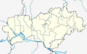 Location in Mari El, Russia | |
| Location | Mari El, Russia |
| Coordinates | 56°30′N 46°35′E |
| Part of | Volga Basin |
| Elevation | 50 meters (160 ft) to 100 meters (330 ft) |
| Area | 270,000 km2 (100,000 sq mi) |
Geography
The depression is located on the left side of the Volga, from the western borders of the Mari El to the Bolshaya Kokshaga River. The average height of the depression is between 50 meters (160 ft) and 100 meters (330 ft) and there are many small lakes and swamps.[1] The area is now partly flooded by the Cheboksary Reservoir.[2]
References
- Марийская низменность, Great Soviet Encyclopedia in 30 vols. / Ch. ed. A.M. Prokhorov . - 3rd ed. - M, 1969-1978.
- Nazarova, L. B.; Semenov, V. F.; Sabirov, R. M.; Efimov, I. Yu. (2004). "The State of Benthic Communities and Water Quality Evaluation in the Cheboksary Reservoir". Water Resources. 31 (3): 316–322. doi:10.1023/B:WARE.0000028702.74325.c5.
- (in Russian) БСЭ: Марийская низменность
This article is issued from Wikipedia. The text is licensed under Creative Commons - Attribution - Sharealike. Additional terms may apply for the media files.