Maniaiti / Benneydale
Maniaiti / Benneydale is a small town in the Waitomo District. It is situated on State Highway 30 approximately 35 km southeast of Te Kuiti.[1]
| Bennydale Maniaiti / Benneydale | |
| Country: | New Zealand |
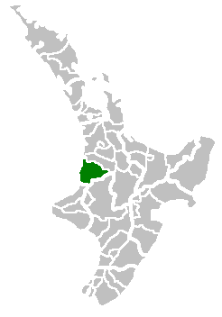 Waitomo District. | |
| Population: | 170 (2019) |
| Rural Area | |
|---|---|
| Extent: | |
| Territorial Authority | |
| Name: | Waitomo District Council |
| Website: | http://www.waitomo.govt.nz/ |
| Mayor: | John Robertson |
| Extent: | |
| Land Area: | 3,546.76 km2 (1,369 sq mi) |
| Regional Council | |
| Name: | Environment Waikato |
| Website: | http://www.ew.govt.nz/ |
History
Coal township
Coal was discovered in the area in 1931, and a mine was built at the town's present location. In 1940 the government bought the mine and created the township of Benneydale. Its name is a portmanteau of the undersecretary of mines at the time (Cecil Henry Benney) and the mine superintendent (Tom Dale). It was the only town in the King Country that does not have a Māori name.[1]
At its peak the town had a population of 2000 with a butchery, bakery and picture theatre.[1][2] There were jobs in the coal mine until the early 1990s, but like many other rural areas in New Zealand the town has slowly declined.[2] In 2019 the population was about 170.[3]
Modern history
Bush United is the towns local rugby union club, the clubhouse was built at Pureora in 1960 and was moved to Benneydale.[4]
Bennydale now mainly operates as a farm service town and it is the closest town to the Timber Trail in the Pureora Forest Park. The town has a police station, volunteer fire brigade, a garage, a corner store that sells hot food and basic groceries, a cafe with accommodation, and a primary school. There is also a meat works on the outskirts of town.
In 2018 the Maniapoto Māori Trust Board lodged an application to the New Zealand Geographic Board to change the name to Maniaiti, which means "a small slide, slip"[5] and is the name of a hill behind the township.[3] It was decided that it would have a dual name of Maniaiti / Benneydale.[5] There was substantial local opposition to the name change.[3]
Marae
Mangapeehi Marae is located near Benneydale. It is a meeting ground for the Maniapoto hapū of Matakore, Ngutu, Pare, Raukawa, Rereahu and Te Ihingarangi, and features the Rereahu meeting house.[6][7]
Te Miringa te Kakara, a local meeting house, is located one kilometre from Benneydale, between Benneydale and Tiroa[1]
Te Hape Marae and Te Kaha Tuatini meeting house is located east of Benneydale; it is a meeting place for the Rereahu hapū of Ngāti Te Rā and Ngāti Tuwhakahekeao.[6][7]
Education
Benneydale School is a co-educational state primary school,[8] with a roll of 31 as of March 2020.[9][10]
Notable people
- Keith Quinn, sports broadcaster[1]
References
- "Kia Ora: Benneydale". New Zealand Herald. 11 July 2014. ISSN 1170-0777. Retrieved 21 September 2016.
- "Rural exodus: Goodbye country ... small town NZ in decline as rush to cities grows". New Zealand Herald. 6 December 2012. ISSN 1170-0777. Retrieved 21 September 2016.
- "'Ngāti Benneydale': Town divided over name change". Stuff. Retrieved 18 November 2019.
- Editors Carolyn M. King, D. John Gaukrodger, Neville A. Ritchie. The Drama of Conservation: The History of Pureora Forest, New Zealand, p. 178. Springer Verlag, Berlin, and Department of Conservation, Hamilton.ISBN 978-0-478-15044-5.
- "Benneydale to have dual English and Māori name". Stuff. Retrieved 18 November 2019.
- "Te Kāhui Māngai directory". tkm.govt.nz. Te Puni Kōkiri.
- "Māori Maps". maorimaps.com. Te Potiki National Trust.
- "Benneydale School Ministry of Education School Profile". educationcounts.govt.nz. Ministry of Education.
- "New Zealand Schools Directory". New Zealand Ministry of Education. Retrieved 26 April 2020.
- "Benneydale School Education Review Office Report". ero.govt.nz. Education Review Office.