Mandohol Dam
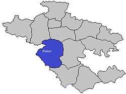
Mandohol Dam (Marathi: मांडोहोळ धरण), is an earth-fill dam on Mandohol River in Karjule Hareshwar village of Parner taluka in Ahmednagar district of state of Maharashtra in India.
| Mandohol Dam | |
|---|---|
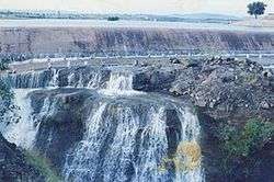 Fully filled Mandohol Dam | |
 Location of Mandohol Dam in Maharashtra | |
| Official name | Mandohol Dam |
| Location | Karjule Hareshwar, Parner India |
| Coordinates | 19°11′56″N 74°18′28″E |
| Construction began | 1977 |
| Opening date | 1984 |
| Construction cost | ₹362 lakh (US$510,000) |
| Owner(s) | Government of Maharashtra, India |
| Operator(s) | Command Area Development Authority (CADA), Ahmednagar |
| Dam and spillways | |
| Type of dam | Earth-fill (Earthen) |
| Impounds | Mandohol River |
| Height | 27.07 m (88.8 ft) |
| Length | 739.0 m (2,424.5 ft) |
| Dam volume | 426 km3 (102 cu mi) |
| Reservoir | |
| Creates | Mandohol Lake |
| Total capacity | 8,780 km3 (2,110 cu mi) |
| Catchment area | 142.45 km2 (55.00 sq mi) |
| Surface area | 199.51 km2 (77.03 sq mi) |
Construction
The dam is constructed by Command Area Development Authority (CADA), Ahmednagar. It was constructed between 1977 and 1983, and was opened for irrigation purpose in 1984.[1]
Specifications
The height of the dam above lowest foundation is 27.07 m (88.8 ft) while the length is 739.0 m (2,424.5 ft). The volume content is 426 km3 (102 cu mi) and gross storage capacity is 11,300 km3 (2,700 cu mi).[2]
Purpose
- Irrigation
- Drinking water for neatest villages
See also
- Dams in Maharashtra
References
- Mandohol Dam - Completed project by CADA Archived 2010-09-20 at the Wayback Machine
- Specifications of large dams in India Archived 2011-07-21 at the Wayback Machine
Ahmednagar district topics | ||
|---|---|---|
| History | 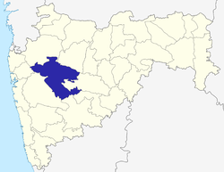 | |
| Geography | ||
| Talukas | ||
| Cities and towns | ||
| Monuments | ||
| Education |
| |
| Lok Sabha constituencies | ||
| Vidhan Sabha constituencies | ||
| Dams in District | ||
This article is issued from Wikipedia. The text is licensed under Creative Commons - Attribution - Sharealike. Additional terms may apply for the media files.