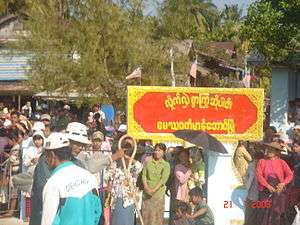
Manaung
Manaung (Burmese: မာန်အောင်မြို့) is a town in Rakhine State, Myanmar (Burma). The island it is on is also named Manaung.
Manaung မာန်အောင် | |
|---|---|
Town | |
 | |
 Manaung Location in Myanmar (Burma) | |
| Coordinates: 18°51′N 93°44′E | |
| Country | |
| Division | |
| District | Kyaukpyu District |
| Township | Manaung Township |
| Population (2005) | |
| • Religions | Buddhism |
| Time zone | UTC+6.30 (MST) |
Climate
| Climate data for Manaung (1981–2010) | |||||||||||||
|---|---|---|---|---|---|---|---|---|---|---|---|---|---|
| Month | Jan | Feb | Mar | Apr | May | Jun | Jul | Aug | Sep | Oct | Nov | Dec | Year |
| Average high °C (°F) | 28.9 (84.0) |
29.5 (85.1) |
31.5 (88.7) |
33.6 (92.5) |
33.1 (91.6) |
30.1 (86.2) |
29.5 (85.1) |
29.4 (84.9) |
30.5 (86.9) |
31.6 (88.9) |
30.8 (87.4) |
29.5 (85.1) |
30.7 (87.3) |
| Average low °C (°F) | 12.1 (53.8) |
13.1 (55.6) |
16.8 (62.2) |
19.1 (66.4) |
21.1 (70.0) |
21.1 (70.0) |
20.6 (69.1) |
20.8 (69.4) |
20.5 (68.9) |
19.7 (67.5) |
17.8 (64.0) |
14.1 (57.4) |
18.1 (64.6) |
| Average rainfall mm (inches) | 1.4 (0.06) |
4.1 (0.16) |
2.9 (0.11) |
20.7 (0.81) |
313.4 (12.34) |
1,070.1 (42.13) |
1,300 (51.18) |
1,086.9 (42.79) |
635.7 (25.03) |
275.3 (10.84) |
106.7 (4.20) |
11.4 (0.45) |
4,828.6 (190.10) |
| Source: Norwegian Meteorological Institute[1] | |||||||||||||
References
- "Myanmar Climate Report" (PDF). Norwegian Meteorological Institute. pp. 23–36. Archived from the original (PDF) on 8 October 2018. Retrieved 30 November 2018.
External links
Capital: Sittwe | ||
| Kyaukpyu District |  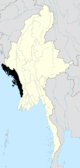 | |
| Maungdaw District | ||
| Sittwe District | ||
| Thandwe District |
| |
| Mrauk-U District | ||
| Main cities and towns | ||
This article is issued from Wikipedia. The text is licensed under Creative Commons - Attribution - Sharealike. Additional terms may apply for the media files.