Malabon, Oregon
Malabon (also Clear Lake) is a historical unincorporated community in Lane County, Oregon, United States.[1] The area is now a scattering of rural houses and farms northwest of Eugene, close to Mahlon Sweet Field.
Malabon | |
|---|---|
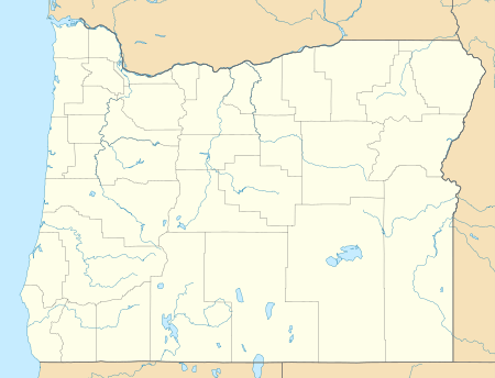 Malabon Location within the state of Oregon | |
| Coordinates: 44°06′03″N 123°14′17″W | |
| Country | United States |
| State | Oregon |
| County | Lane |
| Elevation | 377 ft (115 m) |
| Time zone | UTC-8 (Pacific (PST)) |
| • Summer (DST) | UTC-7 (PDT) |
| GNIS feature ID | 1166549[1] |
Clear Lake runs through the area. It is a widened stretch of Amazon Creek, a tributary of the Long Tom River.
The soils around Malabon define a series of soil types.[2]
Malabon Elementary School is some 3.5 miles (5.6 km) east-southeast of the historical community.[3]
The Oregon Historical Society has Southern Pacific Railroad timetables listing Malabon.[1]
References
- "Malabon (historical)". Geographic Names Information System. United States Geological Survey. Retrieved 2008-11-27.
- "Malabon Series". National Cooperative Soil Survey. U.S. Department of Agriculture. August 2006. Archived from the original on 2008-12-03. Retrieved 2008-11-27.
- "Bethel School District—Malabon". Archived from the original on 2008-09-15. Retrieved 2008-11-27.
Municipalities and communities of Lane County, Oregon, United States | ||
|---|---|---|
| Cities | 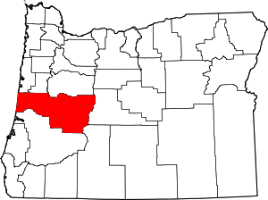 Lane County map | |
| Unincorporated communities |
| |
| Ghost towns | ||
| Indian reservation | ||
| Footnotes | ‡This populated place also has portions in an adjacent county or counties | |
This article is issued from Wikipedia. The text is licensed under Creative Commons - Attribution - Sharealike. Additional terms may apply for the media files.