Mad River (Ohio)
The Mad River (Shawnee: Hathennithiipi [4]) is a stream located in the west central part of the U.S. state of Ohio. It flows 66 miles (106 km)[5] from Logan County to downtown Dayton, where it meets the Great Miami River. The stream flows southwest from its source near Campbell Hill through West Liberty, along U.S. Route 68 west of Urbana, past Springfield (the point of confluence with Buck Creek), then along Ohio State Route 4 into Dayton. The stream's confluence with the Great Miami River is in Deeds Park.
| Mad River | |
|---|---|
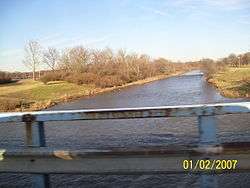 The Mad River flowing under Harshman Road in Riverside, Ohio | |
| Physical characteristics | |
| Source | |
| ⁃ location | ~ 2 mi (3.2 km) northeast of Bellefontaine |
| ⁃ elevation | ~ 1,450 ft (440 m)[1] |
| Mouth | |
⁃ location | Great Miami River at Dayton |
⁃ elevation | ~ 750 ft (230 m)[2] |
| Length | 66 miles (106 km) |
| Basin size | 657 sq mi (1,700 km2)[3] |
The Mad River was one of the Great Miami River tributaries that flooded during the Great Dayton Flood of 1913, resulting in the creation of the Miami Conservancy District.
The river derives its name from its mad, broken and rapid current.[6] Historically, the stream has also been known by the names Mad Creek and Tiber River, respectively, as well as by the Croatian name Fiume Mad (lit. "Mad River").[7]
The first road between Cincinnati and Dayton that opened up the "Mad River Country" to European settlement was the Mad River Road, cut in 1797. Today, a ski resort named Mad River Mountain is located near the stream's source.
Mad River is the largest coldwater fishery in Ohio. The Ohio Department of Natural Resources's Division of Wildlife periodically stocks Mad River with rainbow trout and brown trout.[8] The trout population suffers low reproduction rates due to sedimentation from channelization, extensive agricultural runoff, and diminishing habitat.
References
- U.S. Geological Survey. Rushsylvania quadrangle, Ohio. 1:24,000. 7.5 Minute Series. Washington D.C.: USGS, 1961.
- U.S. Geological Survey. Dayton North quadrangle, Ohio. 1:24,000. 7.5 Minute Series. Washington D.C.: USGS, 1996.
- "Map of Ohio watersheds". Archived from the original on 2007-03-11.
- "Shawnees Webpage". Shawnee's Reservation. 1997. Archived from the original on 2013-05-02. Retrieved 2013-04-26.
- U.S. Geological Survey. National Hydrography Dataset high-resolution flowline data. The National Map Archived 2012-04-05 at WebCite, accessed May 19, 2011
- Kilbourn, John (1833). The Ohio Gazetteer, or, a Topographical Dictionary. Scott and Wright. pp. 289. Retrieved 12 December 2013.
- U.S. Geological Survey Geographic Names Information System: Mad River
- "Ohio Department of Natural Resources". Rainbow/Brown Trout. 2012. Retrieved 2019-07-31.