Maco, Davao de Oro
Maco, officially the Municipality of Maco, is a 1st class municipality in the province of Davao de Oro, Philippines. According to the 2015 census, it has a population of 81,277 people.[3]
Maco | |
|---|---|
| Municipality of Maco | |
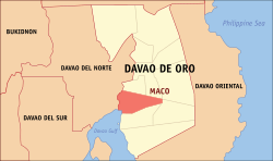 Map of Davao de Oro with Maco highlighted | |

| |
.svg.png) Maco Location within the Philippines | |
| Coordinates: 7°21′43″N 125°51′19″E | |
| Country | |
| Region | Davao Region |
| Province | Davao de Oro |
| District | 2nd District |
| Founded | June 17, 1967 |
| Barangays | 37 (see Barangays) |
| Government | |
| • Type | Sangguniang Bayan |
| • Mayor | Alvera Veronica R. Rimando-Arancon |
| • Vice Mayor | Arthur Carlos Voltaire R. Rimando |
| • Congressman | Ruwel Peter S. Gonzaga |
| • Electorate | 51,700 voters (2019) |
| Area | |
| • Total | 342.23 km2 (132.14 sq mi) |
| Elevation | 24.1 m (79.1 ft) |
| Population (2015 census)[3] | |
| • Total | 81,277 |
| • Density | 240/km2 (620/sq mi) |
| • Households | 18,666 |
| Economy | |
| • Income class | 1st municipal income class |
| • Poverty incidence | 23.27% (2015)[4] |
| • Revenue (₱) | 269,287,164.02 (2016) |
| Time zone | UTC+8 (PST) |
| ZIP code | 8806 |
| PSGC | |
| IDD : area code | +63 (0)87 |
| Climate type | tropical rainforest climate |
| Native languages | Davawenyo Cebuano Kalagan language Mansaka Tagalog Ata Manobo |
| Website | www |
It was formerly part of the Municipality of Mabini before becoming an independent municipality in June 17, 1967.[5]
Website: https://maco.gov.ph
Barangays
Maco is politically subdivided into 37 barangays. [2]
- Anibongan
- Anislagan
- Binuangan
- Bucana
- Calabcab
- Concepcion
- Dumlan
- Elizalde (Somil)
- Pangi (Gaudencio Antonio)
- Gubatan
- Hijo
- Kinuban
- Langgam
- Lapu-lapu
- Libay-libay
- Limbo
- Lumatab
- Magangit
- Malamodao
- Manipongol
- Mapaang
- Masara
- New Asturias
- Panibasan
- Panoraon
- Poblacion
- San Juan
- San Roque
- Sangab
- Taglawig
- Mainit
- New Barili
- New Leyte
- New Visayas
- Panangan
- Tagbaros
- Teresa
Climate
| Climate data for Maco | |||||||||||||
|---|---|---|---|---|---|---|---|---|---|---|---|---|---|
| Month | Jan | Feb | Mar | Apr | May | Jun | Jul | Aug | Sep | Oct | Nov | Dec | Year |
| Average high °C (°F) | 29 (84) |
30 (86) |
30 (86) |
31 (88) |
31 (88) |
30 (86) |
30 (86) |
30 (86) |
30 (86) |
30 (86) |
30 (86) |
30 (86) |
30 (86) |
| Average low °C (°F) | 22 (72) |
22 (72) |
22 (72) |
23 (73) |
24 (75) |
24 (75) |
24 (75) |
24 (75) |
24 (75) |
24 (75) |
23 (73) |
22 (72) |
23 (74) |
| Average precipitation mm (inches) | 98 (3.9) |
86 (3.4) |
91 (3.6) |
83 (3.3) |
133 (5.2) |
158 (6.2) |
111 (4.4) |
101 (4.0) |
94 (3.7) |
117 (4.6) |
131 (5.2) |
94 (3.7) |
1,297 (51.2) |
| Average rainy days | 16.4 | 14.3 | 16.3 | 18.5 | 25.3 | 25.0 | 23.8 | 21.9 | 20.8 | 24.4 | 24.3 | 18.7 | 249.7 |
| Source: Meteoblue [6] | |||||||||||||
Demographics
| Population census of Maco | ||
|---|---|---|
| Year | Pop. | ±% p.a. |
| 1970 | 29,693 | — |
| 1975 | 32,562 | +1.87% |
| 1980 | 41,017 | +4.72% |
| 1990 | 55,991 | +3.16% |
| 1995 | 58,609 | +0.86% |
| 2000 | 65,181 | +2.30% |
| 2007 | 70,906 | +1.17% |
| 2010 | 72,235 | +0.68% |
| 2015 | 81,277 | +2.27% |
| Source: Philippine Statistics Authority[3][7][8][9] | ||
In the 2015 census, the population of Maco, Davao de Oro, was 81,277 people,[3] with a density of 240 inhabitants per square kilometre or 620 inhabitants per square mile.
Festivals and events
- Fiesta ng Maco
- is celebrated every last Saturday of the month of June honoring "Inahan sa Kanunay'ng Panabang" (Mother of Perpetual Help).
See also
- List of renamed cities and municipalities in the Philippines
References
- "Municipality". Quezon City, Philippines: Department of the Interior and Local Government. Retrieved 31 May 2013.
- "Province: Compostela Valley". PSGC Interactive. Quezon City, Philippines: Philippine Statistics Authority. Retrieved 12 November 2016.
- Census of Population (2015). "Region XI (Davao Region)". Total Population by Province, City, Municipality and Barangay. PSA. Retrieved 20 June 2016.
- "PSA releases the 2015 Municipal and City Level Poverty Estimates". Quezon City, Philippines. Retrieved 12 October 2019.
- "Executive Order No. 128: Creating the Municipality of Maco in the Province of Davao" (PDF). Retrieved 21 April 2014.
- "Maco: Average Temperatures and Rainfall". Meteoblue. Retrieved 16 November 2019.
- Census of Population and Housing (2010). "Region XI (Davao Region)". Total Population by Province, City, Municipality and Barangay. NSO. Retrieved 29 June 2016.
- Censuses of Population (1903–2007). "Region XI (Davao Region)". Table 1. Population Enumerated in Various Censuses by Province/Highly Urbanized City: 1903 to 2007. NSO.
- "Province of Compostela Valley". Municipality Population Data. Local Water Utilities Administration Research Division. Retrieved 17 December 2016.
- "Events and Festivals: June". Philippine Department of Tourism. Archived from the original on 28 April 2014. Retrieved 21 April 2014.
External links
Places adjacent to Maco, Davao de Oro | ||||||||||
|---|---|---|---|---|---|---|---|---|---|---|
| ||||||||||
Nabunturan (capital) | |
| Municipalities | |
| Authority control |
|
|---|
This article is issued from Wikipedia. The text is licensed under Creative Commons - Attribution - Sharealike. Additional terms may apply for the media files.