Macarao National Park
The Macarao National Park[1] (Spanish: Parque nacional Macarao)[2] Is a protected area with the status of a national park located in the Macarao, San Pedro and Jarillo rivers, in the north of the South American country of Venezuela.[3][4] Its extension of 15,000 hectares covers part of the Capital District and Miranda State. The area was declared National Park in 1973.
| Macarao National Park Parque Nacional Macarao | |
|---|---|
IUCN category II (national park) | |
 | |
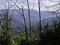
.jpg) Location | |
| Location | |
| Coordinates | 10°25′N 67°01′W |
| Area | 150 km2 (58 sq mi) |
| Established | December 5, 1973 |
It constitutes a zone of protection of hydrographic resources that contributes to satisfy the drinking water needs of the city of Caracas.
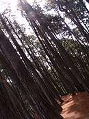
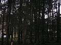
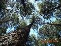
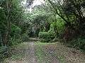
It is characterized by a mountainous relief that forms part of the Cordillera de la Costa, the highest point of which is the Alto de Ño León. It has facilities to facilitate sports, scientific and educational excursions.
Gallery
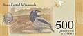 Venezuelan troupial with the Macarao National Park in the background, Venezuelan bolívar banknote
References
- (Venezuela), Instituto Nacional de Parques; (Venezuela), Fundación de Educación Ambiental (1983-01-01). Los Parques nacionales de Venezuela (in Spanish). Instituto Nacional de Parques.
- Boyla, Kerem; Estrada, Angélica; International, BirdLife (2017-03-16). Áreas importantes para la conservación de las aves en los Andes tropicales: sitios prioritarios para la conservación de la biodiversidad (in Spanish). BirdLife International. ISBN 9789978441961.
- Nweihed, Kaldone G. (1992-01-01). Frontera y límite en su marco mundial: una aproximación a la "fronterología" (in Spanish). Equinoccio. ISBN 9789802370641.
- Cunill, Pedro (1990-01-01). Venezuela: opciones geográficas (in Spanish). Fundación Eugenio Mendoza. ISBN 9789806017481.
This article is issued from Wikipedia. The text is licensed under Creative Commons - Attribution - Sharealike. Additional terms may apply for the media files.