Lujulo
Lujulo is a county in Yei River State, South Sudan. It is located at around 3°41′2.92″N 30°40′41″E, in the elevation of around 1195 metres.[2]
Lujulo | |
|---|---|
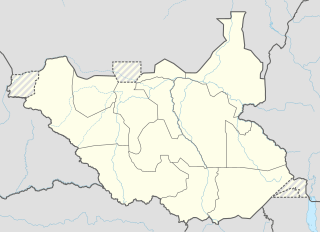 Lujulo Location in South Sudan | |
| Coordinates: 3°41′2.92″N 30°40′41″E | |
| Country | |
| State | Yei River State |
| County | Lujulo County |
| Government | |
| • commissioner | Mawa Joseph Okuba |
| Elevation | 3,920.6 ft (1,195 m) |
| Population (2008) | |
| • Total | 16,786[1] |
| Time zone | UTC+3 (South Sudan Standard Time) |
Climate
Lujulo has a Tropical savanna climate (Aw) with dry, warm winters and wet, cooler summers. Due to its elevation, the average temperatures are slightly cooler than many places with this climate.
| Climate data for Lujulo | |||||||||||||
|---|---|---|---|---|---|---|---|---|---|---|---|---|---|
| Month | Jan | Feb | Mar | Apr | May | Jun | Jul | Aug | Sep | Oct | Nov | Dec | Year |
| Average high °C (°F) | 32.2 (90.0) |
32.4 (90.3) |
31.9 (89.4) |
30.5 (86.9) |
29.5 (85.1) |
28.4 (83.1) |
27.2 (81.0) |
27.6 (81.7) |
28.3 (82.9) |
28.7 (83.7) |
29.8 (85.6) |
30.9 (87.6) |
29.8 (85.6) |
| Daily mean °C (°F) | 24.6 (76.3) |
25.2 (77.4) |
25.3 (77.5) |
24.4 (75.9) |
23.6 (74.5) |
23 (73) |
22.2 (72.0) |
22.2 (72.0) |
22.7 (72.9) |
22.8 (73.0) |
23.7 (74.7) |
23.7 (74.7) |
23.6 (74.5) |
| Average low °C (°F) | 17 (63) |
18.1 (64.6) |
18.8 (65.8) |
18.3 (64.9) |
17.8 (64.0) |
17.6 (63.7) |
17.2 (63.0) |
16.9 (62.4) |
17.1 (62.8) |
17 (63) |
17.6 (63.7) |
16.6 (61.9) |
17.5 (63.6) |
| Average precipitation mm (inches) | 16 (0.6) |
32 (1.3) |
93 (3.7) |
154 (6.1) |
176 (6.9) |
170 (6.7) |
181 (7.1) |
224 (8.8) |
188 (7.4) |
197 (7.8) |
88 (3.5) |
27 (1.1) |
1,546 (61) |
| Source: Climate-Data.org[3] | |||||||||||||
References
- "Elevation Finder". freemaptools.com. 2019-04-09. Retrieved 2020-06-16.
- "Climate: Lujulo". Climate-Data.org. Retrieved August 13, 2019.
This article is issued from Wikipedia. The text is licensed under Creative Commons - Attribution - Sharealike. Additional terms may apply for the media files.