Ludlow Parish, New Brunswick
Ludlow is a Canadian parish in Northumberland County, New Brunswick.[2]
Ludlow | |
|---|---|
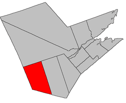 Location within Northumberland County, New Brunswick | |
| Coordinates: 46.49°N 66.35°W | |
| Country | |
| Province | |
| County | Northumberland |
| Established | 1814 |
| Area | |
| • Land | 1,016.66 km2 (392.53 sq mi) |
| Population (2011)[1] | |
| • Total | 1,543 |
| • Density | 1.5/km2 (4/sq mi) |
| • Pop 2006-2011 | |
| • Dwellings | 772 |
| Time zone | UTC-4 (AST) |
| • Summer (DST) | UTC-3 (ADT) |
Its population in the 2011 Census was 1,543. Statistics Canada did not report data for Ludlow Parish from the 2016 census.
Delineation
Ludlow Parish is defined in the Territorial Division Act[3] as being bounded:
- West and south by the County lines; north by Southesk Parish; and east by a line running north and south from the mouth of Big Hole Brook.
Communities
- Carrolls Crossing
- Ludlow
- McNamee
- Porter Cove
- Priceville
Demographics
PopulationPopulation trend[4]
|
LanguageMother tongue language (2006)[5]
|
See also
References
- 2011 Statistics Canada Census Profile: Ludlow Parish, New Brunswick
- New Brunswick Provincial Archives - Ludlow Parish
- "Territorial Division Act (R.S.N.B. 1973, c. T-3)". Government of New Brunswick website. Retrieved 23 August 2016.
- Statistics Canada: 1996, 2001, 2006 census
- 2006 Statistics Canada Community Profile: Ludlow Parish, New Brunswick
External links
Places adjacent to Ludlow Parish, New Brunswick | ||||||||||
|---|---|---|---|---|---|---|---|---|---|---|
| ||||||||||
| Subdivisions |
|
|---|---|
| Cities | |
| Counties | |
| |
This article is issued from Wikipedia. The text is licensed under Creative Commons - Attribution - Sharealike. Additional terms may apply for the media files.