Lucasville, Ohio
Lucasville is a census-designated place (CDP) in Scioto County, Ohio, United States. The population was 2,757 at the 2010 census.[3]
Lucasville, Ohio | |
|---|---|
 | |
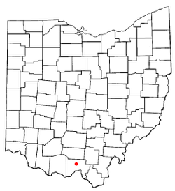 Location of Lucasville, Ohio | |
| Coordinates: 38°52′49″N 82°59′40″W | |
| Country | United States |
| State | Ohio |
| County | Scioto |
| Area | |
| • Total | 2.6 sq mi (6.6 km2) |
| • Land | 2.5 sq mi (6.5 km2) |
| • Water | 0.0 sq mi (0.1 km2) |
| Elevation | 548 ft (167 m) |
| Population (2010) | |
| • Total | 2,757 |
| • Density | 1,100/sq mi (420/km2) |
| Time zone | UTC-5 (Eastern (EST)) |
| • Summer (DST) | UTC-4 (EDT) |
| ZIP codes | 45648, 45699 |
| Area code(s) | 740 |
| FIPS code | 39-45304[2] |
| GNIS feature ID | 1061449[1] |
Lucasville is the location of the Scioto County Fairgrounds. The Southern Ohio Correctional Facility, Ohio's sole maximum security prison and the location of Ohio's death house where death row inmates are executed, is located just outside Lucasville.
Lucasville is served by the Portsmouth Public Library, as well as the Valley Local School District and Northwest Local School District.
History
Lucasville was laid out by Captain John Lucas (1788-1825) in 1819, and named for him.[4] A post office called Lucasville has been in operation since 1828.[5]
John Lucas was the brother of Robert Lucas, a War of 1812 hero, two-term governor of Ohio (1832-1836), and the first territorial governor of Iowa. John volunteered for service and commanded a regiment during the War of 1812. Upon the death of his father in 1814, John inherited much of his family's property in Scioto County, and it was on a portion of this land that he would establish the town of Lucasville on August 7, 1819. He and his wife, Mary Lucas, ran a tavern in Lucasville until his death in 1825. He is interred in Lucasville Cemetery.[6]
Geography
Lucasville is located at 38°52′49″N 82°59′40″W (38.880234, -82.994439).[7]
According to the United States Census Bureau, the CDP has a total area of 2.5 square miles (6.6 km²), of which 2.5 square miles (6.5 km²) is land and 0.04 square miles (0.1 km²), or 1.57%, is water.
Demographics
At the 2000 census there were 1,588 people, 589 households, and 448 families in the CDP. The population density was 631.4 people per square mile (243.3/km²). There were 672 housing units at an average density of 267.2/sq mi (103.0/km²). The racial makeup of the CDP was 97.10% White, 0.13% African American, 0.25% Native American, 0.25% Asian, 0.06% Pacific Islander, 0.06% from other races, and 2.14% from two or more races. Hispanic or Latino of any race were 0.31%.[2]
Of the 589 households 33.8% had children under the age of 18 living with them, 57.2% were married couples living together, 14.1% had a female householder with no husband present, and 23.8% were non-families. 21.2% of households were one person and 10.4% were one person aged 65 or older. The average household size was 2.70 and the average family size was 3.08.
The age distribution was 26.8% under the age of 18, 9.8% from 18 to 24, 26.6% from 25 to 44, 25.3% from 45 to 64, and 11.5% 65 or older. The median age was 37 years. For every 100 females, there were 90.6 males. For every 100 females age 18 and over, there were 87.4 males.
The median household income was $25,313 and the median family income was $37,443. Males had a median income of $30,125 versus $21,174 for females. The per capita income for the CDP was $13,569. About 6.8% of families and 8.5% of the population were below the poverty line, including 6.4% of those under age 18 and none of those age 65 or over.
Notable people
- Branch Rickey, baseball executive who signed Jackie Robinson; also credited with forming the farm leagues for Major League Baseball
- Roy Rogers, singer and cowboy actor
- Barry Sparks, professional musician/bass guitarist
- Ted Strickland, former member of the United States House of Representatives (1993–2006) and former Governor of Ohio (2007-2011)
- Gene Tenace, former Major League Baseball catcher and coach
References
- "US Board on Geographic Names". United States Geological Survey. 2007-10-25. Retrieved 2008-01-31.
- "U.S. Census website". United States Census Bureau. Retrieved 2008-01-31.
- "Profile of General Population and Housing Characteristics: 2010 Demographic Profile Data (DP-1): Lucasville CDP, Ohio". United States Census Bureau. Retrieved March 30, 2012.
- Evans, Nelson Wiley (1903). A History of Scioto County, Ohio: Together with a Pioneer Record of Southern Ohio. N. W. Evans. p. 406.
- "Scioto County". Jim Forte Postal History. Retrieved 2 January 2016.
- http://remarkableohio.org/picture.php?/7686/category/1305
- "US Gazetteer files: 2010, 2000, and 1990". United States Census Bureau. 2011-02-12. Retrieved 2011-04-23.
Municipalities and communities of Scioto County, Ohio, United States | ||
|---|---|---|
| City | 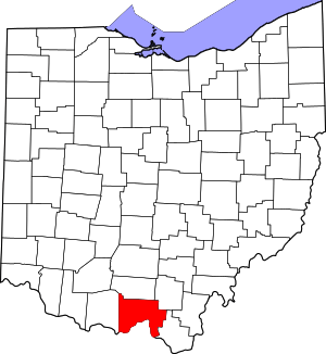 Map of Ohio highlighting Scioto County | |
| Villages | ||
| Townships | ||
| CDPs | ||
| Unincorporated communities | ||
| Footnotes | ‡This populated place also has portions in an adjacent county or counties | |
| Authority control |
|
|---|