Love Township, Vermilion County, Illinois
Love Township is a township in Vermilion County, Illinois, USA. As of the 2010 census, its population was 257 and it contained 105 housing units.[2]
Love Township | |
|---|---|
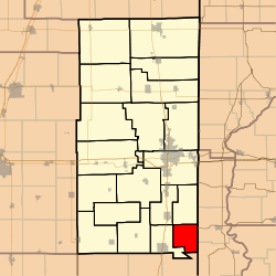 Location in Vermilion County | |
| Coordinates: 39°55′36″N 87°34′37″W | |
| Country | United States |
| State | Illinois |
| County | Vermilion |
| Created | 1902 |
| Area | |
| • Total | 20.38 sq mi (52.8 km2) |
| • Land | 20.37 sq mi (52.8 km2) |
| • Water | 0.01 sq mi (0.03 km2) 0.05% |
| Elevation | 659 ft (201 m) |
| Population (2010) | |
| • Estimate (2016)[1] | 248 |
| • Density | 12.6/sq mi (4.9/km2) |
| Time zone | UTC-6 (CST) |
| • Summer (DST) | UTC-5 (CDT) |
| FIPS code | 17-183-44953 |
History
Love Township was created in 1902. It was named for a Vermilion county judge named I. A. Love.[3]
Geography
According to the 2010 census, the township has a total area of 20.38 square miles (52.8 km2), of which 20.37 square miles (52.8 km2) (or 99.95%) is land and 0.01 square miles (0.026 km2) (or 0.05%) is water.[2] The stream of Yankee Branch runs through this township.
Extinct towns
- Bethel
- Humrick
Adjacent townships
- McKendree Township (north)
- Eugene Township, Vermillion County, Indiana (east)
- Vermillion Township, Vermillion County, Indiana (southeast)
- Prairie Township, Edgar County (south)
- Elwood Township (west)
- Georgetown Township (northwest)
Cemeteries
The township contains three cemeteries: Bethel, Whitlock and Yankee Point.
References
- "Population and Housing Unit Estimates". Retrieved June 9, 2017.
- "Population, Housing Units, Area, and Density: 2010 - County -- County Subdivision and Place -- 2010 Census Summary File 1". United States Census. Archived from the original on 2020-02-12. Retrieved 2013-05-28.
- Callary, Edmund (2009). Place Names of Illinois. Urbana: University of Illinois Press. p. 207. ISBN 978-0-252-03356-8.
- "Census of Population and Housing". Census.gov. Retrieved June 4, 2016.
External links
Municipalities and communities of Vermilion County, Illinois, United States | ||
|---|---|---|
| Cities | Map of Illinois highlighting Vermilion County | |
| Villages | ||
| Townships | ||
| CDP | ||
| Other unincorporated communities | ||
| Footnotes | ‡This populated place also has portions in an adjacent county or counties | |
This article is issued from Wikipedia. The text is licensed under Creative Commons - Attribution - Sharealike. Additional terms may apply for the media files.