Los Molinos, California
Los Molinos is a census-designated place (CDP) in Tehama County, California, United States. The population was 2,037 at the 2010 census, up from 1,952 at the 2000 census.
Los Molinos | |
|---|---|
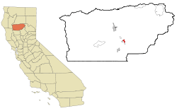 Location in Tehama County and the state of California | |
 Los Molinos Location in the United States | |
| Coordinates: 40°1′28″N 122°5′58″W | |
| Country | |
| State | |
| County | Tehama |
| Area | |
| • Total | 2.217 sq mi (5.743 km2) |
| • Land | 2.194 sq mi (5.683 km2) |
| • Water | 0.023 sq mi (0.061 km2) 1.06% |
| Elevation | 223 ft (68 m) |
| Population (2010) | |
| • Total | 2,037 |
| • Density | 920/sq mi (350/km2) |
| Time zone | UTC-8 (Pacific (PST)) |
| • Summer (DST) | UTC-7 (PDT) |
| ZIP code | 96055 |
| Area code(s) | 530 |
| FIPS code | 06-44140 |
| GNIS feature ID | 0277548 |
History
Los Molinos ("the mills" in Spanish) traces its history back to a railroad station which opened at the site in 1905.[2] A post office has been in operation at Los Molinos since 1905.[3]
Geography
Los Molinos is located at 40°1′28″N 122°5′58″W (40.024439, -122.099442).[4]
According to the United States Census Bureau, the CDP has a total area of 2.2 square miles (5.7 km2), of which, 2.2 square miles (5.7 km2) of it is land and 0.02 square miles (0.052 km2) of it (1.06%) is water.
Demographics
2010
At the 2010 census Los Molinos had a population of 2,037. The population density was 918.6 people per square mile (354.7/km²). The racial makeup of Los Molinos was 1,581 (77.6%) White, 0 (0.0%) African American, 39 (1.9%) Native American, 7 (0.3%) Asian, 2 (0.1%) Pacific Islander, 321 (15.8%) from other races, and 87 (4.3%) from two or more races. Hispanic or Latino of any race were 537 people (26.4%).[5]
The census reported that 2,004 people (98.4% of the population) lived in households, 32 (1.6%) lived in non-institutionalized group quarters, and 1 (0%) were institutionalized.
There were 786 households, 242 (30.8%) had children under the age of 18 living in them, 366 (46.6%) were opposite-sex married couples living together, 88 (11.2%) had a female householder with no husband present, 43 (5.5%) had a male householder with no wife present. There were 70 (8.9%) unmarried opposite-sex partnerships, and 1 (0.1%) same-sex married couples or partnerships. 232 households (29.5%) were one person and 120 (15.3%) had someone living alone who was 65 or older. The average household size was 2.55. There were 497 families (63.2% of households); the average family size was 3.18.
The age distribution was 483 people (23.7%) under the age of 18, 146 people (7.2%) aged 18 to 24, 473 people (23.2%) aged 25 to 44, 573 people (28.1%) aged 45 to 64, and 362 people (17.8%) who were 65 or older. The median age was 41.7 years. For every 100 females, there were 98.7 males. For every 100 females age 18 and over, there were 99.2 males.
There were 932 housing units at an average density of 420.3 per square mile, of the occupied units 487 (62.0%) were owner-occupied and 299 (38.0%) were rented.The homeowner vacancy rate was 3.7%; the rental vacancy rate was 17.6%. 1,225 people (60.1% of the population) lived in owner-occupied housing units and 779 people (38.2%) lived in rental housing units.
2000
At the 2000 census there were 1,952 people, 734 households, and 474 families in the CDP. The population density was 869.1 people per square mile (335.0/km²). There were 836 housing units at an average density of 372.2 per square mile (143.5/km²). The racial makeup of the CDP was 86.07% White, 0.31% African American, 1.69% Native American, 0.46% Asian, 0.05% Pacific Islander, 8.15% from other races, and 3.28% from two or more races. Hispanic or Latino of any race were 23.82%.[6]
Of the 734 households 30.9% had children under the age of 18 living with them, 47.3% were married couples living together, 12.4% had a female householder with no husband present, and 35.3% were non-families. 31.2% of households were one person and 15.1% were one person aged 65 or older. The average household size was 2.61 and the average family size was 3.28.
The age distribution was 28.8% under the age of 18, 8.1% from 18 to 24, 25.1% from 25 to 44, 21.1% from 45 to 64, and 16.9% 65 or older. The median age was 36 years. For every 100 females, there were 89.5 males. For every 100 females age 18 and over, there were 87.4 males.
The median household income was $26,691 and the median family income was $30,769. Males had a median income of $31,458 versus $20,769 for females. The per capita income for the CDP was $12,107. About 18.0% of families and 18.9% of the population were below the poverty line, including 25.0% of those under age 18 and 9.4% of those age 65 or over.
Politics
In the state legislature Los Molinos is in the 4th Senate District, represented by Republican Jim Nielsen, and in the 3rd Assembly District, represented by Republican James Gallagher.
Federally, Los Molinos is in California's 1st congressional district, represented by Republican Doug LaMalfa.[7]
Notable people
- Marv Grissom, Major League Baseball pitcher
- Leo Gorcey, Hollywood Actor, resident from 1956-1964
References
- U.S. Census Archived 2012-07-02 at the Wayback Machine
- "Place Names" (PDF). Tehama County Department of Education. p. 29. Archived from the original (PDF) on 8 May 2017. Retrieved 25 March 2018.
- "Post Offices". Jim Forte Postal History. Retrieved 26 March 2018.
- "US Gazetteer files: 2010, 2000, and 1990". United States Census Bureau. 2011-02-12. Retrieved 2011-04-23.
- "2010 Census Interactive Population Search: CA - Los Molinos CDP". U.S. Census Bureau. Archived from the original on July 15, 2014. Retrieved July 12, 2014.
- "U.S. Census website". United States Census Bureau. Retrieved 2008-01-31.
- "California's 1st Congressional District - Representatives & District Map". Civic Impulse, LLC. Retrieved March 1, 2013.
Municipalities and communities of Tehama County, California, United States | ||
|---|---|---|
| Cities | 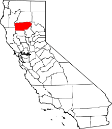 Tehama County map | |
| CDPs | ||
| Unincorporated communities | ||
| Footnotes | ‡This populated place also has portions in an adjacent county or counties | |